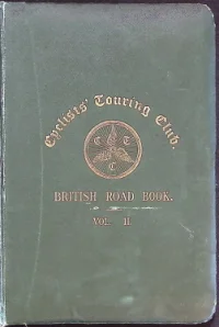
CTC British Road Book Vol. 2
Contents
- Explains how the volume's route descriptions were compiled from multiple, often conflicting, Chief Consul and member reports (averaging 9 miles per described length, with as many as nine drafts circulated locally for verification) before being finalised for the press. Notes the book follows Vol. I and was delayed by reliance on unpaid voluntary labour, covering 12,500 miles of road in detail.
- Sets out the area covered (South Midlands, Wales and East Anglia, bounded by the Thames/Bath road on the south and the Chester-Boston road on the north) and its division into Sections A-D radiating from London, plus the Forward/Reverse route format and mileage columns. Illustrates the steep-gradient arrow symbols with worked examples at Marlborough Hill and High Wycombe (Amersham Hill and Marlow Hill).
- Introduces Section A (South Wales), comprising routes within the radial lines formed by the London-to-Bath-and-Bristol road on the south and the London-to-Aberystwyth road on the north, illustrated by a small key map showing Bristol, Birkenhead/Liverpool, Southend and London.
- Describes the main Bath Road from London (Hyde Park Corner) through Hounslow, Maidenhead, Reading, Newbury, Hungerford and Marlborough to Bath and on to Bristol Bridge, noting Marlborough Hill's steep descent and the alternative Devizes route rejoining at Box.
- A short cross route from Hounslow (Trinity Church) via Cranford-bridge, Harlington-corner and Hillingdon to Uxbridge Market House, noted as better and shorter than the alternative via Southall.
- An alternative Hounslow-to-Uxbridge route via Norwood-green and Southall-green, joining the main Uxbridge Road at Southall before continuing to Uxbridge.
- Runs from Colnbrook (George Hotel) through West Drayton, Yiewsley, Uxbridge, Rickmansworth (crossing Scots Hill and Croxley-green) and Watford to St. Albans, ending with the long climb of Holywell Hill.
- A short link from Twyford (King's Arms Inn) via Wargrave to Henley, crossing Henley Bridge into the town at the Fountain.
- Runs from Newbury via Church Speen, Boxford, Welford, East and West Shefford, Eastbury and Lambourn, then over Blowing Stone Hill and Kingston Lisle to Faringdon.
- Connects Hungerford to Lambourn via Chilton Foliat and Soley, climbing Coppington Hill before a 1.5-mile descent into Lambourn (Market Cross).
- Proceeds from Lambourn via Upper Lambourn, Ashdown House and the steep Ashbury Hill descent to Ashbury, then over a canal swing-bridge into Shrivenham.
- Climbs Kingsbury Street and descends Port Hill out of Marlborough, then passes Ogbourne St Andrew, Ogbourne St George and Ogbourne Hill before reaching Swindon (Corn Exchange).
- Climbs out of Marlborough over Hackpen Hill (a very steep, winding descent) through Broad Hinton and Wootton Bassett, then via Purton and Cricklade to Cirencester.
- Runs from Wootton Bassett via Lyneham, Goatacre and Snow Hill through Hilmarton to Calne.
- Connects Chippenham to Wootton Bassett via Kington Langley, Sutton Benger, Christian Malford, Dauntsey Station and Lyneham.
- The most direct but hillier London-Bristol route, following the Bath Road (Route 1) to Chippenham then via Marshfield, Cold Ashton, Tog Hill and Kingswood to Bristol Bridge.
- A long route from London via Maidenhead, Henley, Nettlebed, Benson, Dorchester, Abingdon and Faringdon to Lechlade, Fairford, Cirencester and Birdlip Hill into Gloucester (The Cross).
- Runs from Abingdon (Town Hall) via Steventon and West Hendred to Wantage, crossing the green at Steventon before a rather steep ascent.
- Connects Faringdon to Burford via Radcot-bridge, Clanfield and Black Bourton, with Shilton passed on the left before the final steep descent into Burford.
- Runs from Cirencester via Jackaments Bottom and Whitchurch Hill (a sharp fall to the river) up Holloway Hill into Malmesbury, then via Corston to Chippenham.
- Follows the Tetbury road from Cirencester through Doughton, Weston Birt, Knockdown and Didmarton, joining Route 171 at Dunkirk for the final approach into Bath.
- An alternative London-Gloucester route via Maidenhead, Nettlebed, Wallingford, Sotwell and Brightwell to Didcot, Harwell and Wantage, rejoining the Dorchester route at Faringdon.
- A rough, hilly route from Wantage past Childrey, Sparsholt and Kingston Lisle, down the very steep Winslow Hill to Ashbury, then via Bishopstone, Hinton and Wanborough to Swindon.
- Runs from Reading via Purley and Pangbourne, up Streatley Hill through Blewbury and Upton to West Hagbourne, joining the road from London near Harwell before continuing to Wantage, Faringdon and Gloucester.
- The alternative, less direct Reading-Gloucester route via Hungerford, Chilton Foliat and Aldbourne, climbing to Liddington Hill before Swindon, Cirencester and Gloucester.
- The main Reading-Oxford road via Streatley, Moulsford and Wallingford, then Shillingford Hill and Dorchester before joining Route 26 into Oxford (Carfax).
- A shorter alternative to Oxford via Chazey-heath, Exlade-street and Woodcote, passing Ipsden and the White Horse Inn before Crowmarsh Gifford and Benson.
- Runs from Reading via Caversham Bridge and St Peter's Hill, then Chazey-heath and Goring-heath to Goring Station and across the toll bridge into Streatley.
- Follows the Bath Road to Maidenhead then via Henley, Nettlebed, Benson, Dorchester and Nuncham Courtenay through Sandford and Littlemore into Oxford (Carfax).
- The shortest Maidenhead-Oxford route despite a very steep ascent, via Bisham Hill, Great Marlow, Lane-end and Cadmore-end to Stokenchurch.
- An alternative to the main Dorchester road, via Cowley, Chislehampton, Stadhampton and Cuxham to Watlington, then the very steep Howe Hill and Pishill down into Henley.
- Runs from Oxford over Hincksey Hill through Abingdon, Steventon, Chilton and East Ilsley, down Gore Hill and past Chieveley and Donnington Hill into Newbury.
- Connects Oxford to Hungerford via Frilford, East Hanney and Wantage, over the very steep and unrideable Red House Hill to West Shefford and Hungerford Newtown.
- Runs from Oxford via Cumnor Hill, Besselsleigh, Faringdon, Shrivenham and Swindon, then Wroughton and Broad Hinton to Avebury and Beckhampton, joining Route 301 to Devizes.
- Runs from Swindon via King's Hill and Coped-hall (near Wootton Bassett), over Stoppers-hill to Brinkworth, then to Malmesbury (Market Cross).
- A long route from Oxford via Faringdon, Highworth, Cricklade, Charlton and Malmesbury, then Great Sherston, Luckington and Acton Turville to Tormarton, Downend and Bristol Bridge.
- Runs from Great Sherston through Badminton Park and Dunkirk, up to Hawkesbury Upton, across Inglestone Common to Wickwar and Tortworth-green, then via Falfield and Stone to Berkeley.
- Climbs steeply from Berkeley through North Nibley and Wotton-under-Edge, then via Kingswood and Hillsley to Hawkesbury Upton and Dunkirk, joining Route 171 into Bath.
- A short link from Thornbury via Upper Morton, Rockhampton and Lower Stone to Berkeley (Post Office).
- The archive's longest described route (249 miles), running from London via Uxbridge, High Wycombe, Stokenchurch and Oxford, then Witney, Northleach and Birdlip Hill into Gloucester, on through Ross, Monmouth, Abergavenny, Brecon, Llandovery and Carmarthen to Haverfordwest and Milford (Post Office).
- Runs from Beaconsfield via Holtspur, Wooburn-green and Bourne-end to Great Marlow, then Medmenham and Henley, before Shiplake and Caversham Bridge into Reading.
- Connects High Wycombe to Aylesbury via West Wycombe, Bradenham, Princes Risborough, Monks Risborough, Great Kimble and Stoke Mandeville.
- A short link from Princes Risborough via Longwick and Kingsey to Thame (County Buildings).
- Runs from Aylesbury via Hartwell, Stone (Asylum) and Scotsgrove Hill to Thame, then Tiddington and Wheatley before joining Route 37 into Oxford.
- Follows Route 41 to Thame then via Rycote Hill, Little Milton and Stadhampton to Newington and Warborough, crossing Shillingford Bridge into Wallingford.
- Runs from Oxford via Burford, Aldsworth and Bibury, then Arlington, Quarry Hill and Barnsley into Cirencester (Dyer St).
- Connects Witney to Faringdon via Cemetery Hill, Curbridge and Lew, then Bampton and Clanfield, with a final rise into Faringdon Market Place.
- Runs from Burford via Signet and Filkins to Little Faringdon, Lechlade and Inglesham, up to Highworth and Red Down Hill, then Stratton St Margaret into Swindon.
- Runs from Cirencester via Stratton, Baunton and North Cerney along the valley of the R. Churn, then Windlass Hill and Charlton Kings into Cheltenham (Plough Hotel).
- Runs from Cirencester via Frampton Mansell and the steep Cowcombe Hill into Chalford, Brimscombe and Stroud, then Stonehouse and Eastington to a Severn ferry crossing into Newnham.
- Crosses the Severn ferry from Newnham via New Inn and Arlingham, then Eastington, Frocester Hill, Nympsfield and Kingscote, via Weston Birt and Shipton Moyne to Malmesbury.
- Runs from Tetbury via Kingscote, Bowcott Hill and Whiteways Hill into Dursley, then Woodmancote and Taits Hill to Berkeley Road Station and on to Lydney Junction.
- Runs from Gloucester via Little Witcombe and the steep Crickley Hill, over Seven-springs and Chatcombe Pitch to Andoversford, then Naunton and Harford Bridge into Stow-on-the-Wold.
- The recommended Gloucester-Bath route via Tuffley and Horsepools Hill, down Pitchcombe Hill into Stroud, joining Route 171 for the remainder into Bath.
- Part I runs from Gloucester via Hempsted, Quedgeley and Standish into Stroud (Stonehouse route); Part II continues from Cainscross via Dudbridge, Lightpill and Woodchester into Nailsworth, joining Route 171 to Bath.
- Runs from Stroud via Butter-row and Minchinhampton Common to Minchinhampton, then Avening and Long Newton into Malmesbury (Market Cross).
- A rough, hilly direct link from Stroud via Cainscross and Dudbridge up the steep Selsley Hill, then Crawley Hill and Uley into Dursley.
- Runs from Stroud via Stonehouse and Eastington to Cambridge and Berkeley-heath into Berkeley, where cyclists take the train onward to Lydney Junction or Lydney Town.
- Climbs Lansdown Hill out of Bath via Wick and Doynton to Pucklechurch, Westerleigh Hill and Yate, then Wickwar, Wotton-under-Edge and North Nibley before Cambridge into Gloucester.
- A variant of Route 56 turning off at the top of Westerleigh Hill through Chipping Sodbury (Clock Tower) before rejoining the main line into Wickwar.
- An easier alternative to the Lansdown Hill route, via Kelston, Bitton, Oldland-common and Bridgeyate, through Siston into Pucklechurch (White Hart Inn).
- For South Wales roads: from Bath via Kelston and Bitton to Oldland-common and Bridgeyate, then via Webbsheath, Goose-green, Downend and Frenchay to Filton and Cribbs Causeway, ending at Pilning Station.
- Via Pucklechurch and Hullavington: from Bristol through Eastville, Fishponds and Mangotsfield to Pucklechurch, then via Hinton, The Gib and Grittleton through Hullavington and Corston to Malmesbury.
- From Bristol via Fishponds and Downend, past Nibley to Chipping Sodbury, with the return route noting Yate Station.
- The 'Upper road' via Birdlip across the Cotswolds: from Bristol through Winterbourne, Iron Acton, Cromhall, Charfield and Wotton-under-Edge, over Combe Hill to Nailsworth, Stroud and Painswick Slade, then Birdlip and down Leckhampton Hill into Cheltenham.
- From Bristol as far as Nailsworth (as Route 61), then via Minchinhampton and Frampton Mansell to Cirencester.
- Via Severn Tunnel: from Bristol through Clifton, Westbury-on-Trym and Cribbs Causeway to Pilning Station, thence by train through the Severn Tunnel to Severn Tunnel Junction, continuing via Magor, Llanmartin and Christchurch into Newport.
- Via Tockington and Latteridge to Iron Acton and Chipping Sodbury, up Old Sodbury Hill through Acton Turville and Burton to Castle Combe and on into Chippenham.
- Via Durdham Downs and down Stoke Hill through Stoke Bishop, then through Kingsweston Park and Shirehampton to Avonmouth.
- Part of the Land's End-to-John o' Groats road: from Bristol through Almondsbury, Berkeley, Gloucester, Tewkesbury, Worcester, Kidderminster and Bridgnorth, then Wellington, Whitchurch and Beeston Castle to Tarporley.
- A variant of the Route 66 Bristol-to-Tarporley road, branching off at Alveston to pass through Thornbury and Upper Morton before rejoining the main road at Stone.
- From Cirencester via Foss Cross, Fossbridge and Northleach to Bourton-on-the-Water, then Stow-on-the-Wold, Moreton-in-Marsh and Stretton-on-the-Fosse to Halford and Warwick.
- Via Woodstock: from Witney through Long Hanborough and Bladon to Woodstock, joining the Oxford and Banbury road at Sturdys Castle Inn on to Banbury.
- From Oxford via Kidlington and Deddington to Banbury, then Southam, Coventry, Nuneaton and Atherstone, through Twycross, Measham and Ashby-de-la-Zouch to Ticknall, Swarkestone and Derby.
- Via Weston-on-the-Green and Middleton Stoney to Brackley, then Silverstone and Towcester through Blisworth and Hunsbury Hill into Northampton.
- Via Bicester and Finmer to Buckingham, then Stony Stratford, Wolverton and Newport Pagnell through Chicheley and Bromham to Bedford.
- From Gloucester via Newnham and Blakeney to Chepstow, then Newport, Cardiff and Bridgend, over Tumble-down Dick Hill through Cowbridge and Neath to Swansea.
- Via Mitcheldean: from Gloucester via Lea Line to Mitcheldean, over Plump Hill through Nailbridge and Staunton into Monmouth.
- A shorter but much hillier variant between Huntley and Mitcheldean via Longhope Hill, rejoining the Route 73 road at the foot of Plump Hill; not recommended going west.
- Via Littledean and Coleford: through the Forest of Dean by Elton, Littledean, Ruspidge Hill and Cinderford-bridge, past Speech House Hotel and Cannop-bridge to Coleford and on to Monmouth.
- Via Purton and Etloe to Viney Hill, over Deadman's Cross to Parkend and Edenwall, and on into Coleford.
- Via Redbrook: through Whitecliff, Newland and Newland Station, down Redbrook Hill through Upper Redbrook and Redbrook into Monmouth.
- Via Flaxley and Mitcheldean: from Newnham via Broadoak and Elton to Flaxley and Gunns Mills, through Mitcheldean and Castle End to Ross.
- Via Littledean and Kerne Bridge: from Newnham through Elton, Littledean and Cinderford, past Ruardean to Kerne Bridge, then Goodrich, Marstow and Harewood-end to Hereford.
- Via Lydbrook Valley and Coleford: from Ross through Walford and Kerne Bridge into Lower and Upper Lydbrook, then Poolway and Coleford, over St Briavels and Tidenham Chase to Chepstow.
- Via English Bicknor: from Ross through Lower Lydbrook and Lydbrook Junction Station to English Bicknor, then Christchurch and Lower Berryhill into Coleford.
- The Wye Valley route: from Monmouth via Redbrook and Bigsweir Bridge to Llandogo, through Tintern and St Arvans to Chepstow.
- Via Bream and Blakeney: from Monmouth via Redbrook Hill, Newland and Clearwell to Trowgreen and Bream, then Parkend and Blakeney to Newnham.
- From Monmouth via Bream and Leech Pool, a near-continuous descent for most of the distance, into Lydney.
- Via Dixton and Ganarew Cross, over Ganarew Hill through Whitchurch and Marstow to Harewood-end and on to Hereford.
- Up Welsh St. past Piercefield Park to Crossway Toll House, then via Devauden-green and Star Pitch through Llansoy and over Hands Pitch to Raglan.
- Via Shire Newton and down Tyvree Pitch to Llangwm and Gwernesney, through Usk and over Horse and Jockey Pitch to Pontypool.
- Up Hardwick Hill via Pwll-Meyric and Park Wall Hill, past Portskewet to Caldicot and on to Severn Tunnel Junction Station.
- Via Malpas and Llantarnam to Croes-y-ceiliog and Pontypool Road Station, over Horse and Jockey Pitch through Pen-perlleni, Llanover and Llanelen into Abergavenny.
- Up Stow Hill via Cefn and Pontymister to Crosskeys and Cwm-Carn, then Newbridge to Crumlin.
- Up Stow Hill via Bassaleg and Machen to Bedwas and Caerphilly, over Nantgarw Hill through Upper Boat and Treforest into Pontypridd.
- Via Treforest, Tonteg and Church Village to Cross Inn and Llantrisant, then Llanharan, Tregroes and Coychurch into Bridgend.
- Over the hill above Crumlin to Newbridge and Pont-llan-fraith, via Tredegar Junction Station and Ystrad Mynach to Nelson and Quakersyard, joining the Cardiff road into Merthyr Tydfil.
- Via Pontmorlais and Dowlais to Princetown and Sirhowy, then Beaufort and Brynmawr, over Black Rock Pitch and Clydach Pitch through Gilwern and Llanfoist to Abergavenny.
- Via Pontmorlais and past Cyfarthfa ironworks, descending to Hirwain and continuing (as Route 106) to Swansea.
- Over Black Rock Pitch and Clydach Pitch to Gilwern, then over a bridge across the R. Usk into Crickhowell.
- Via Blaina and Abertillery, past the dangerous descents at Aber-beeg and through Llanhilleth into Crumlin.
- Via Tredegar: from Cardiff over Thornhill and Caerphilly Mountain to Llanbradach and Ystrad Mynach, then Maes-y-cwmmer, Bryn and Tredegar Junction Station, over Sirhowy to Abergavenny.
- Via Crickhowell and Llangrwyne, over Cwmdu to Pen-y-genffordd and Talgarth, then Bronllys, Dderw Pitch and Erwood to Builth.
- Via Llandovery, Llanwrda and Pumpsaint, over Lampeter Mountain to Llanybyther and Llandyssil, then Newcastle Emlyn, Cenarth and Llechryd to Cardigan.
- Via Talley, Ammanford and Pontardawe: from Lampeter via Cwmanne and Royal Oak Inn to Pumpsaint, then Talley and Llandilo, Ammanford, Glanamman and Garnant to Pontardawe and Swansea.
- Via Pontardawe, up and over Alltwen Hill through Rhos Killybebill and Bryncoch, then down Rhydding Hill into Neath.
- Via Tycross and Pen-y-waun to Llanedy and Pontardulais, then Llangennech and Halfway into Llanelly.
- Via Cwmanne, Pencarreg and Llanybyther, over Alltwallis Hill and past Bronwydd Arms Station into Carmarthen.
- Via the Railway Inn and Temple-bar down to Felinfach and Ystrad, then Cilcennin and Llanerch-Aeron into Aberaeron.
- Via Bettws-Bledrws and Llangybi to Tregaron, then Pontrhydfendigaid, Ystrad-Meurig and Pont Llanafan, over Trawscoed Bridge and Llanilar to Aberystwyth.
- Via Hirwain: from Cardiff via Tongwynlais and Nantgarw, past Pentre-bach and Cilfynydd to Navigation, then Mountain Ash and Aberdare, over Gadlys Hill and Pontwalby Hill to Glyn Neath and Swansea.
- Via Quakersyard and Perrot Hill to Merthyr Tydfil, then over Priory Hill through Brecon, Upper Chapel and Cwm-Owen to Builth, then Newbridge-on-Wye and Rhayader to Aberystwyth.
- Via Llandaff and Capel Llanilltern to Croesvaen, then a winding ascent into Llantrisant.
- From Cardiff via Grangetown and a toll-gate near the Penarth turn, then Eastbrook and Cadoxton, over Holton Hill into Barry.
- From Cardiff via Cogan, descending Windsor Terrace and Beach Rd. into Penarth.
- Via Porthkerry Park and Aberthaw to St Athan and St Mary Church, then a steep descent into Cowbridge.
- Via Fforest Fach and Pont Lliw to Pontardulais, then Cross Hands and Carmarthen, via Conwil and Llangeler to Newcastle Emlyn and Cardigan.
- Via Llanelly: from Swansea via Loughor and Llwynhendy to Llanelly, then Burryport, Pembrey and Kidwelly, over Llandyfaelog Hill into Carmarthen.
- From Swansea via Blackpill and Oystermouth, running alongside the tramway to Mumbles.
- Via St Clears, Llandowror and Red Roses to Llanteague-gate and Kilgetty, then Redberth and Sageston into Pembroke Dock.
- From the fork beyond Sageston, over Mutton Hill and down Hollyland Hill into Pembroke.
- Via St Clears, Red Roses and Llanteague-gate to Kilgetty Station and the Narberth road junction, then on into Tenby.
- Via The Ridgeway: from Tenby up Holloway Hill along the Ridgeway, over Hodgeston Hill through Lamphey to Pembroke.
- Via Gumfreston: from Tenby up Causeway Hill through Gumfreston, past Ivy Tower Park through Sageston and Milton into Pembroke.
- Via Jamestown and Penally: from Pembroke via Lamphey and Hodgeston to Jamestown, over Wind Hill through Lydstep and Penally into Tenby.
- Via Pembroke Dock, New Milford and Rosemarket: over Bush Hill through Pembroke Dock to the ferry at Hobbs Point, landing at New Milford and continuing via Neyland, Honeyborough and Thornham Hill to Rosemarket and Haverfordwest.
- Via Pembroke Ferry: down Ferry Lane to the ferry, crossing Milford Haven to Burton and Houghton, then via Sardis and Freystrop Cross to Merlins-bridge and Haverfordwest.
- From the New Milford landing stage via Neyland Hill and Honeyborough to Steynton and into Milford.
- Via Pelcomb Bridge and Keeston Hill to Roch and Midway, then Newgate Bridge and Solva to St Davids.
- Via Oxford and Cheltenham: via Andoversford and Dowdeswell Station to Charlton Kings and Cheltenham, then Coombehill and (joining Route 66) on to Worcester.
- Via the Promenade and Montpellier Rotunda, then Longlevens, into Gloucester.
- Via Maisemore and Hartpury to Staunton, over Round Bush Pitch and Haffield Pitch through Ledbury, then Stanley Hill, Bishops Frome and Munderfield-row to Bromyard.
- Via Newent: from Gloucester via Highnam-green and Highleadon to Newent, then Dymock, to Ledbury.
- Via Winchcomb: from Cheltenham via Prestbury and Southam, up Cleeve Hill to Winchcomb, then Greet and Sedgeberrow over Bengeworth Bridge into Evesham.
- Via Stow-on-the-Wold: via Chipping Norton, Churchill and Kingham to Stow-on-the-Wold, then Toddington and Teddington into Tewkesbury, continuing via Eastnor and Ledbury, Tarrington and Dormington to Hereford.
- Via Adlestrop and Cross Hands Inn along a ridge track past Great Rollright, over Otley Hill to Lower Tadmarton and Broughton into Banbury.
- Runs from Hereford via Willocks Bridge, Wormbridge, Pontrilas, Pandy and Llanfihangel to Abergavenny, then via Kemeys Bridge, Llangibby and Caerleon to Newport.
- Runs from Hereford via Clehonger, Cagebrook, Bredwardine, Middlewood and Pen-y-Park to Hay, then via Glasbury and Three Cocks toward Builth.
- Runs from Hereford via Moreton-on-Lugg, Wellington and Dinmore Hill to Leominster, then via Ludlow, Onibury, Stokesay and Church Stretton to Shrewsbury's Market Place.
- Runs from Builth via Cefn-y-bedd, Garth and Beulah to Llanwrtyd, then over the Sugar Loaf ridge and through Cynghordy to Llandovery's Market Hall.
- Runs from London via Wheatley, Chipping Norton and Tewkesbury to Upton-on-Severn, then via Hanley Castle and Hanley Swan to Great Malvern and Malvern Wells.
- A long route from London via Islip, Bletchington and Woodstock's Wootton Hill to Chipping Norton, then via Moreton-in-Marsh, Broadway and Worcester to Bromyard, Leominster, Kington, New Radnor and Rhayader before Llangurig and Aberystwyth's Clock Tower.
- A short hilly route from Moreton-in-the-Marsh via Bourton-on-the-Hill and Blockley, with the descent through Broad Campden and Westington into Chipping Campden.
- Runs from Moreton-in-the-Marsh via Blackwell and Armscott to Newbold, joining the road into Stratford-on-Avon at Clopton Bridge.
- Runs from Evesham via Pershore, Defford and Earls Croome to Upton-on-Severn, then via Little Malvern, Wynds Point and Chances Pitch down to Ledbury.
- Runs from Pershore via Eckington and Bredon to Aston Cross, passing Oxenton and Bishops Cleeve before entering Cheltenham by Pittville Street.
- Runs from Worcester via Powick, Callow-end and Rhydd to Upton-on-Severn, then via Longdon, Hartpury and Maisemore (crossing the Severn) into Gloucester.
- Runs from Worcester via Powick and Malvern Link to Great Malvern, over the Wyche to Colwall and Ledbury, then via Much Marcle and Coldborough Hill toward Ross and on to Newport via Route 130.
- Runs from Worcester via Bransford, Leigh Sinton and Storridge to Stiffords-bridge, then via Fromes Hill, Newtown and Shucknall-hill over Aylstone Hill into Hereford.
- Runs from London via Ross-on-Wye, Wilton and Harewood-end to Hereford, then via Bridge Sollers, Staunton-on-Wye and Eardisley to Kington, continuing to Aberystwyth by Route 135.
- Runs from Llangurig over the summit at Steddfa Gurig to Devil's Bridge, then via Hafod Upper and Lower Lodge, Pont-Rhyd-y-groes and Yspytty-Ystwyth to Ffair-rhos and Tregaron.
- Runs from Llangurig via Devil's Bridge and the Halfway House Inn to Capel Sion, then via Trefeccan and Bridge Street down into Aberystwyth.
- Runs from Aberystwyth via Rhyd-y-felin, Figure Four and Llanrhystyd to Aberaeron, then via Llanarth and New Inn toward Cardigan.
- Runs from Cardigan via Pen-y-bryn, Bridell and Rhoshill to Crymmych Arms, then via Efail-wen, Clynderwen, Narberth and Templeton to Tenby.
- Runs from Cardigan via Redstone Cross and Canaston Bridge to Cresselly, then via Carew and Milton into Pembroke Dock.
- Runs from Cardigan via Crossway and Temple Bar to Newport, then via Dinas, Fishguard and Croes-goch on toward St. Davids.
- Runs from Fishguard via Letterston and Ford to Trefgarn and Cutty Bridge, then over Prendergast Hill into Haverfordwest's Castle Square.
- Section divider explaining that Section B covers the North Wales routes lying in the sector bounded by the London-to-Aberystwyth road on the south and the London-to-Chester/Birkenhead/Liverpool road on the east.
- Runs from London via Edgware, Watford and Aylesbury to Bicester and Banbury, then via Warwick, Solihull and Acocks-green into Birmingham.
- Runs from Edgware via Stanmore and Harrow Weald to Pinner, then via Eastcote, Ruislip and Ickenham into Uxbridge.
- Runs from Edgware via Hendon and Finchley to Muswell Hill, descending Muswell Hill toward Tottenham's High Cross.
- Runs from Aylesbury via Wing and Leighton Buzzard to Woburn, then via Ridgmont, Lidlington and Marston Moretaine into Bedford.
- Runs from Banbury via Bloxham and South Newington to Chipping Norton, then via Shipton-under-Wychwood, Burford and Aldsworth into Cirencester.
- Runs from Banbury via Great Tew Avenue and Church/Road Enstone to Charlbury, then via Finstock and Hailey into Witney.
- Runs from Banbury via Broughton and Swalecliffe to Brailes, then via Shipston-on-Stour and Chipping Campden through Bretforton and Bengeworth into Evesham.
- Runs from Banbury via the fork near Upton House to Wellesbourne's Talbot Inn, then via Tiddington into Stratford-on-Avon.
- Runs from Banbury over Edge Hill to Kineton, then via Compton Verney and Wellesbourne to Barford and into Warwick.
- Runs from Banbury via Bishops Tachbrook and Tachbrook Mallory to Leamington, then via Chesford Bridge and Kenilworth into Coventry.
- Runs from Banbury via Grimsbury and Wardington to Chipping Warden, then via Byfield, Charwelton and Badby into Daventry.
- Runs from Shipston-on-Stour via Tredington and Cross Hands to Halford, then via Ettington and Wellesbourne Mountford into Warwick.
- Runs from Warwick via Stratford-on-Avon and Clifford Chambers to Mickleton, then via Broadway, Winchcomb and Cleeve Hill through Prestbury into Cheltenham.
- Runs from Warwick via Mickleton to Chipping Campden, then via Westington and Cross Hands to Stow-on-the-Wold and on into Burford.
- Runs from Warwick via Leek Wootton to Kenilworth, then via Rosemary Hill and Gibbet Hill into Coventry.
- Runs from Warwick via Emscote and Portobello Bridge to Milverton Station, then down Regent Street into Leamington.
- Runs from Warwick via Myton and Leamington to Ufton and Southam, then via Napton, Lower Shuckburgh, Staverton and Daventry through Weedon and Floore into Northampton.
- A short route from Southam via Kites Hardwick and over Toft Hill into Dunchurch.
- Runs from London via Oxford, Woodstock and Chipping Norton to Long Compton and Shipston, then via Stratford-on-Avon, Wootton Wawen and Hockley-heath into Birmingham.
- Runs from Birmingham via Kingsheath and Alcester to Studley and Evesham, then via Beckford and Teddington through Tewkesbury and Coombehill into Gloucester.
- Runs from Birmingham via Teddington to Cheltenham, then via Painswick, Stroud and Nailsworth through Cross Hands Inn and Cold Ashton down into Bath.
- Runs from Birmingham via Bournbrook and Selly Oak to Northfield and Lickey End, then via Bromsgrove, Droitwich and Fernhill-heath into Worcester.
- Runs from Birmingham via Northfield, Hopwood and Alvechurch to Redditch, then via Crabbs Cross and The Ridgeway through Dunnington Cross into Evesham.
- Runs from Birmingham via Halesowen and Stourbridge to Stewponey and Stourton Hill, then via Enville into Bridgnorth and on to Shrewsbury.
- Runs from Birmingham via Halesowen and Kidderminster to Bewdley, then via Clowes Top and Mamble to Tenbury and Leominster, continuing toward Aberystwyth.
- Runs from Birmingham via Leominster and Willersley to Hay and Glasbury, then via Felin-fach and Forge Hill into Brecon and on to Milford.
- Runs from London via Aylesbury, Whitchurch and Winslow to Buckingham, then via Westbury and Brackley through Farthinghoe and Middleton Cheney into Banbury.
- Runs from Buckingham via Tingewick and Finmer to Croughton and Aynho, then via Clifton and Deddington into Chipping Norton.
- Runs from Buckingham via Maidsmoreton and Akeley to Whittlebury Park, then through Whittlebury into Towcester.
- Runs from London via Chalfont St. Peter to Amersham, then via Great Missenden and Wendover into Aylesbury.
- Runs from London via Harlesden, Wembley and Sudbury to Harrow, then via Pinner and Batchworth-heath over Woodcock Hill into Rickmansworth.
- Runs from Rickmansworth via Chorleywood to Amersham, then via High Wycombe and Marlow Hill down into Great Marlow.
- Runs from Brentford via Hanwell and Greenford to Ruislip, then via Ruislip-common and Ducks Hill through Northwood into Rickmansworth.
- Runs from Hounslow via Heston and Norwood-green to Greenford, then via Harrow and Harrow Weald through Bushey-heath into Elstree.
- Runs from London via Kilburn and Willesden-green to Neasden, then via Kingsbury-green and Kenton into Pinner.
- Runs from Kew Bridge via Gunnersbury Park and Ealing Common to Hanger Hill, then via Alperton and Sudbury into Harrow.
- Runs from Harrow via Harrow Weald and Oxhey Lane to Grims Dyke, then via Watford-heath and New Bushey into Watford.
- The main-road itinerary from London via Barnet, St. Albans, Dunstable and Stony Stratford to Daventry and Coventry, then via Birmingham, Wolverhampton and Shrewsbury through Llangollen, Corwen, Bettws-y-Coed, Capel Curig, Bethesda and Bangor over the Menai Bridge to Holyhead.
- An alternative leg of the Holyhead road that branches at Queen's Head to pass through Oswestry and Gobowen before rejoining the main route.
- Runs from London via Edgware and Brockley Hill to Elstree, then via Radlett, Park-street and St. Stephens into St. Albans.
- Route from London along the Edgware Road and St Johns Wood Road through Kilburn, Golders Green and Finchley (Tally Ho Corner), joining the Great North Road, to Barnet Parish Church.
- Route from Barnet via Arkley, Barnet-gate and Highwood-hill to Edgware, then via Roe-green, Kingsbury-green, Preston, Wembley, Alperton and Hanger Hill to Brentford Town Hall.
- Route from Hammersmith Broadway via Shepherdsbush, Willesden, Neasden and Dollis Hill Lane to Hendon, then through Finchley to Barnet, joining the Great North Road at Tally Ho Corner.
- Route from St Albans (Peahen Inn) down Verulam Road past St Michael's Church to Leverstock-green and Boxmoor, continuing on to Tring.
- Route from St Albans via Sandridge, Wheathampstead Hill and Codicote to Hitchin, then via Henlow and Langford to Biggleswade.
- Route from St Albans via Hatfield (Red Lion), Cole-green and Hertingfordbury to Hertford, ending at the Shire Hall.
- Route from London (Mansion House) via the Holyhead Road to Hockliffe (White Horse Inn) then on to Leighton Buzzard Market Cross.
- Long route from London via Banbury, Wroxton and Sunrising Hill to Stratford-on-Avon and Alcester, then Bromsgrove, Kidderminster, Bridgnorth, Much Wenlock and Cressage into Shrewsbury Market Place.
- Route from Birmingham via the Holyhead Road, Albrighton, Tong, Newport and Hinstock to Whitchurch, then via Broxton and Handley to Chester.
- Alternative route from Birmingham via Hinstock, Market Drayton, Adderley and Audlem to Stapeley, joining the road from Coventry into Chester.
- Route from Birmingham via Smethwick, Oldbury and Tividale up Castle Hill into Dudley, then via Sedgley and Sedgley Bank to Wolverhampton, Queen Square.
- Route from Birmingham via Sutton Coldfield, Lichfield and Streethay to Burton-on-Trent (Queen's Hotel), then via Little Derby and Littleover to Derby Market Place.
- Route from Birmingham via Aston, Erdington, Sutton Coldfield and Bassetts Pole to Tamworth, then Measham, Ashby, Castle Donington and Long Eaton into Nottingham at St Peter's Church.
- Two named variant routes (Route A and Route B) through central Birmingham avoiding most of the tramway, both routed via Coleshill Street, Ashted Row/Prospect Row and rejoining the Gravelly-hill tramway terminus near Ashton Cross.
- Route from Birmingham via Shustoke, Furnace-end and Bentley-common over Wards Hill to Atherstone, ending at the Red Lion.
- Long route from Birmingham through Coleshill, Nuneaton, Hinckley and Leicester, then Thurmaston, Melton Mowbray and Croxton Kerrial to Grantham (Angel Inn).
- Route from Birmingham via Aston, Perry Bar and Walsall (The Bridges), then Bloxwich, Cannock and Penkridge, into Stafford Market Place.
- A variant of Route 205 leaving Birmingham's G.P.O. along Colmore Row and down Snow Hill into Summer Lane, rejoining the main Walsall road and tramway at Aston Six Ways.
- A variant of Route 205 which, on reaching Aston Six Ways from Walsall, descends Alma Street and Summer Lane to Snow Hill and Colmore Row instead of following the tramway.
- Route from Birmingham via Livery Street, Hockley Hill and Soho Hill through Handsworth and Hamstead Hill to Great Bar, joining the road to Walsall (The Bridge).
- Route from Birmingham via Gravelly-hill, Tyburn, Minworth and Curdworth to Marston and Hemlingford-green, noted as often impassable by flood, into Kingsbury.
- Long route from Birmingham via the Holyhead Road and Whitchurch to Bangor-on-Dee, Wrexham, Mold and Nannerch, then Bodfari and St Asaph into Rhyl.
- Route from Wolverhampton via Upper Penn and Wombourn to Himley, then via Stewponey and Broadwaters into Kidderminster at the Bull Ring.
- Route from Wolverhampton via Willenhall, Walsall and Aldridge to Little Aston, Canwell and Bassetts Pole, joining the Birmingham-to-Nottingham road (Route 202).
- Route from Dudley via Netherton, Oldhill and Haden Hill to Halesowen, then Romsley Hill and Catshill into Bromsgrove and on to Worcester (The Cross).
- Route from Dudley via Queen's Cross Hill and Kingswinford (Cross Inn), joining the Wolverhampton road near Stewponey, into Kidderminster Bull Ring.
- Route from Bromsgrove via Catshill and Fairfield to Bell-end, Clent and Hagley, ending at Stourbridge Town Clock.
- Route from Kidderminster via Hoobrook, Torton and Cutnall-green to Droitwich (Royal Hotel), then Hanbury, Feckenham and Ridgeway into Alcester (Globe Inn).
- Route from Kidderminster via Broadwaters and Stourbridge to Brierley-hill, Dudley, Wednesbury and Walsall, then Shelfield and Muckley-corner into Lichfield's Bird Street.
- Route from Kidderminster via Stourport and Great Witley to Stanford-bridge and Bromyard, then via Burleygate and Lugg Bridge into Hereford at All Saints' Church.
- Route from Worcester up Wheatsheaf Hill via Spetchley and Wyre Piddle into Evesham High Street, offered as a less-hilly alternative to the Pershore road.
- Route from Worcester via Spetchley, Upton Snodsbury and Flyford Flavell to Goomshill and Dunnington Cross, ending at Alcester's Globe Inn.
- Very long route from Worcester via Hartlebury and Mustow-green to Stourbridge, Wolverhampton and Penkridge, then Stafford, Aston and Meaford into Newcastle-under-Lyme.
- Route from Worcester along Foregate Street via Ombersley and Hartlebury-common to Stourport, then through Wribbenhall over Blackstone Hill into Bewdley.
- Very long route from Worcester via Holt-heath, Great Witley and Tenbury to Ludlow, Craven Arms and Bishops Castle, then Montgomery into Welshpool (The Cross).
- Long route from Worcester (as for Welshpool) via Kerry and Newtown to Talerddig, Llanbrynmair and Machynlleth, then via Pennal into Aberdovey.
- Route from Bromyard via Instone Bridge, Edvin Ralph and Collington to Kyre, ending at Tenbury's Swan Inn.
- Route from Leominster via Barons Cross, Kingsland and Mortimers Cross to Aymestrey and Wigmore, ending at Leintwardine Church.
- Route from Bridgnorth via Hermitage Hill, Worfield and Ashley to Trescott and Compton (Boat Hill), ending at Wolverhampton's Queen Square.
- Route from Bridgnorth via Three Ashes Bank and Morville to Monkhopton, Broadstone, Munslow and Diddlebury through Corve Dale into Ludlow.
- Route from Bridgnorth via Pedlars Rest and Craven Arms to Aston-on-Clun, Little Brampton and Purslow, ending at Clun's Town Hall.
- Route from Ludlow via Rocks-green and Middleton to Burwarton, Neenton and Rectory Bank, ending at Bridgnorth's Town Hall.
- Route from Ludlow via Angel Bank and the Clee Hills to Doddington and Hopton Wafers, then Cleobury Mortimer and Tern Brook Bank through Bewdley into Kidderminster's Bull Ring.
- Route from Cleobury Mortimer via Clowes Top and Abberley-common to Great Witley and Holt Fleet Bridge, ending at Droitwich via Ombersley.
- Route from Bridgnorth via Newton Bank, Stockton and Brockton to Shifnal, then Sheriff Hales and Woodcote Bank into Newport's Parish Church.
- Route from Bridgnorth via Cantern Bank, Nordley and Dunge Bank to Ironbridge, then Coalbrookdale and Jiggers Bank into Wellington's Cock Inn.
- Route from Bridgnorth via Ironbridge, Buildwas and Leighton Bank to Wroxeter and Atcham, ending at Shrewsbury Market Place.
- Long route from Shifnal via Madeley and Ironbridge to Much Wenlock, Longville Bank and Church Stretton, then Marshbrook and Plowden into Bishops Castle's Town Hall.
- Route from Bishops Castle via Lydham-heath and Norbury to The Bridges and Cothercot Hill, then through Castle Pulverbatch and Longden into Shrewsbury.
- Very long route from Shrewsbury via Hanwood and Pontesbury to Minsterley and Bishops Castle, then Clun, Knighton, Penybont and Llandrindod Wells into Builth.
- Route from Shrewsbury via Westbury and Chirbury to Montgomery and Abermule, then Newtown and Llanidloes to Llangurig, described as the easiest route to Newtown and Central Wales.
- Route from Shrewsbury via Middletown and Welshpool to Llanfair and Llangadfan, over the pass of Bwlch-y-fedwen, through Mallwyd and Dolgelley into Barmouth.
- Route from Shrewsbury via Llansantffraid and Llanfyllin along Lake Vyrnwy, crossing the Berwyn Mountains at the Pass of Rhiw Hirnant, into Bala.
- Route from Shrewsbury via Harmerhill, Middle and Ellesmere to Overton, ending at Wrexham's Wynnstay Arms Hotel.
- Route from Shrewsbury via Battlefield and Hadnall to Preston Brockhurst and Prees, ending at Whitchurch's Lord Hill Hotel.
- Route from Whitchurch via Redbrook and Hanmer to Overton, crossing Overton Bridge, and into Ruabon.
- Route from Shrewsbury via Oldheath and Roden to High Ercall (Cleveland Arms Inn), then Newport, Gnosall and Haughton into Stafford Market Place.
- Route from Newport via Forton and Woodseaves to Eccleshall and Norton-bridge, ending at Stone's High Street.
- Route from Newport via Church Aston and Lilleshall to Hadley and Wellington, continuing on to Shrewsbury Market Place.
- Route from Wellington via Shawbirch and Longdon to High Ercall and Wem, ending at Ellesmere's Town Hall via Welshampton.
- Very long route from London via Barnet, Coventry, Tamworth and Lichfield to Rugeley, Stone and Nantwich, then Tarporley and Chester, continuing to Birkenhead and by Woodside Ferry across to Liverpool.
- Route from Coventry via Stonebridge and Bacons-end to Castle Bromwich and Erdington, then Upper Stonnall and Churchbridge, joining Watling Street toward Shrewsbury.
- Route from Tamworth via Fazeley (White Lion), crossing Watling Street, into Coleshill's Green Man.
- Route from Nuneaton via Tuttle Hill and Mancetter into Atherstone (Red Lion Hotel), described as more picturesque but hillier than the Weddington/Watling Street alternative.
- Route from Lichfield via Weeford and Bassetts Pole to Coleshill, over Chattle Hill and Grimstock Hill to Stonebridge, then via Kenilworth Castle into Warwick Station.
- Route from Nantwich via Aston and Whitchurch to Tilstock and Wem, then Alderton and Harmerhill into Shrewsbury Station.
- Route from London via Barnet and Coventry to Rugeley, Stafford and Eccleshall, then Woore, into Chester, noted as 1.5 miles longer than the Stone route.
- Route from Stafford via Weston Bank to Weston-on-Trent (Ingestre Station), ending at Uttoxeter's Town Hall.
- Route from Chester via Ruabon and Chirk to Oswestry and Llanymynech, then Welshpool and Garthmyl into Newtown.
- The most direct route to Corwen, Bala and Central Wales, from Chester through Eaton Park via Pulford and Rosset to Marford and Wrexham, then via Ruabon and Llangollen, joining the Holyhead Road into Corwen.
- The main road from Wrexham runs via Rhosnesney and Llanypwll to Holt, crosses the Dee, then passes Farndon, Churton and Aldford to Boughton and into Chester.
- An alternative from Aldford enters Eaton Park, passes the Golden Gates of Eaton Hall and Eccleston Lodge Gates, and goes through Eccleston village and Handbridge into Chester.
- A third option from Aldford enters Eaton Park, passes the obelisk on Belgrave Drive and Memorial Lodge Gate near Eccleston-hill, and leaves the park at Overleigh Lodge to cross Grosvenor Bridge into Chester.
- The direct but hilly route from Wrexham goes via Adwy, Coed-poeth and Bwlch-gwyn over to Llandegla, then via Llanfair to Ruthin and on through Rhewl and Llanrhaiadr to Denbigh.
- Route from Wrexham passing Gwersyllt and Cefnybedd to Bridge-end and Hope, then via Pen-y-ffordd, Pen-y-mynydd and Dobshill into Hawarden.
- Route from Oswestry via Morda and Llynclys past Porth-y-waen quarries, then via Llansantfraid and Meifod to Heniarth Gate and on to Llanfair.
- From Llanfyllin the road climbs past Pont-Bren-y-ci and Mynydd-y-brith, drops steeply at 'The Walks' to Pont Pandy and Pont Llogel, then makes a tortuous ascent of Pren Croes Moor before descending to Llangadfan.
- From Llandysilio via Llanymynech, Maesbrook Green, Knockin and Shotatton Corner toward Ruyton, continuing (on the following page) via Baschurch, Middle, Yorton, Hawkstone Park and Hodnet to Market Drayton.
- From Newtown the road crosses Offa's Dyke beyond Knighton, descends Hares-green Pitch to Presteign, then goes via Kington and Lyonshall toward Hereford, ending at Kingsacre and All Saints' Church.
- A rough route over Kerry Hills from Newtown via Dolfor, Velindre, Beguildy and Knucklas to Knighton, then via Whitton, Beggars Bush and Hodders Pitch to Kinnerton and New Radnor.
- From Knighton via Brampton Bryan, Walford and Leintwardine, the road undulates on to Ludlow, entering by Corve Street and Bull Ring.
- From Newtown via Dolfor and over Clog Moor to Llandewy, then via Camnant Bridge, Llanbadarn-fynydd, Llananno and Llanbister toward Llandewy-ystradenny and on to Builth.
- A hilly route from Chester via Rossett and Cefnybedd to Bwlch-gwyn and Llandegla, joining the Holyhead Road near Corwen, then via Druid, Bala and Llanuwchllyn to Dolgelley and on to Barmouth.
- From Bala via Fron-goch and Capel Celyn over the summit level near Rhydyfin Inn, descending to Festiniog and then via Maentwrog, Tan-y-Bwlch and Penrhyn-deudraeth to the causeway at Minffordd and Portmadoc.
- A largely unrideable route over the Bwlch-y-Groes pass from Llanuwchllyn to Dinas Mawddwy and Mallwyd, continuing via Cemmaes Road, Machynlleth, Eglwysfach and Talybont to Aberystwyth.
- From Aberystwyth over Penglais Hill via Bowstreet and Borth to the Dovey Estuary ferry crossing to Aberdovey, then via Towyn, Abergynolwyn and Tal-y-llyn over the pass and via Cross Foxes to Dolgelley.
- From Dolgelley via Cross Foxes the road climbs to a gated summit, descends past Minffordd, then goes via Upper Corris and Corris, following the river and railway, into Machynlleth.
- A tedious route from Dolgelley via Llanelltyd and Ganllwyd to Trawsfynydd, then via Blaenau Festiniog and the Pass of Garddinan to Dolwyddelan and on to Bettws-y-Coed.
- From Dolgelley via Trawsfynydd and Maentwrog, past the Oakley Arms Hotel at Tan-y-Bwlch to Llanfrothen (Garreg), then through the Pass of Aberglaslyn via Pont Aberglaslyn to Beddgelert.
- From Festiniog descending steeply past Maentwrog and Talsarnau to Harlech.
- From Chester via Dolgelley and Penmaenpool to Arthog, continuing (on the following page) past Friog Promontory and Llwyngwril via Llanegryn, Bryn-crug and Towyn to Aberdovey.
- From Chester via Broughton toward Mold, Loggerheads and Llanferres over the Clwyddian Range to Ruthin, then via Clawddnewydd, Pont Bod-Renail and Llanfihangel Glyn Myfyr to Cerrig-y-Druidion and on to Bettws-y-Coed.
- From Chester via Blaconpoint and Sealand to a river crossing at Queensferry, then via Aston and Ewloe-green past Buckley Collieries and New Brighton into Mold.
- From Mold via Soughton and Northop to Flint.
- From Ruthin via Derwen and Gwyddelwern, joining the Holyhead Road near the Dee bridge, into Corwen.
- From Bettws-y-Coed over Waterloo Bridge via Llanrwst and Taly Cafn to Glan Conway, then along the causeway and over the suspension bridge into Conway.
- From Capel Curig via Pen-y-gwryd through the Vale of Gwynant past Llyn Dinas to Beddgelert, then through the Pass of Aberglaslyn via Tremadoc to Portmadoc.
- From Portmadoc via Tremadoc, Penmorfa and Dolbenmaen to Brynkir Station, then via Llanllyfni, Pen-y-groes, Groeslon and Llanwnda through Bontnewydd into Carnarvon.
- From Portmadoc via Criccieth and Llanystumdwy to Abererch and Pwllheli, then via Bodvean toward Nevin.
- From Nevin to Four Crosses, joining the road from Pwllheli, and on to Carnarvon.
- From Pwllheli via Four Crosses and Llanaelhaiarn to Clynog-fawr, then via Pont Llyfni, Llanwnda and Bontnewydd into Carnarvon.
- From Capel Curig via Pen-y-gwryd and Corphwysfa at the head of the Pass of Llanberis, descending through Old Llanberis to Llanberis, then via Cwm-y-Glo, Llanrug and Pont Rug into Carnarvon.
- Notes a ferry shortcut from near Alexandra Dock to Tal-y-Voel in Anglesey joining the Holyhead Road near Gaerwen, or the road route via Griffiths Crossing Station, Port Dinorwic and the Menai Suspension Bridge.
- From Carnarvon via Llanbeblig, Cae-athraw and Waen-fawr toward Bettws Garmon and Llyn Cwellyn, continuing via Beddgelert, the Pass of Aberglaslyn, Penrhyn-deudraeth, Pont Briwfod and Talsarnau to Harlech and on via Llanbedr and Llanaber to Barmouth.
- A footpath/cycle route crossing the estuary by Barmouth Bridge, past Barmouth Junction Station and along the railway embankment, then over Friog Promontory into Llwyngwril.
- From Chester via Eaton Park, Saltney and Broughton to Hawarden and Northop, continuing (on later pages) via Holywell, Rhuddlan, Abergele, Colwyn Bay and Conway to Bangor.
- From Holywell descending via Greenfield and Llannerch-y-mor to the steamer landing at Mostyn Quay.
- From Mostyn Quay via Penrallt and Newmarket toward Rhyl.
- From Colwyn Bay via Llandrillo-yn-Rhos and a toll-gate, skirting Llandudno Bay, into Llandudno.
- From Llandudno along The Promenade via Llanrhos and Tywyn, then over the causeway and suspension bridge into Conway.
- From Bangor via Glan Adda and Port Dinorwic to Griffiths Crossing Station and on into Carnarvon.
- From Bangor to Garth, crossing the Menai Strait by ferry, then via the landing stage toward Glyn-y-Garth into Beaumaris.
- From Bangor via Upper Bangor and the Menai Suspension Bridge to Menai-bridge village, then via Glyn-y-Garth into Beaumaris.
- From Chester following Route 290 to the Rock Inn, then via Rhuallt to St. Asaph and via Bodelwyddan and Abergele, rejoining Route 290 toward Bangor.
- From Chester following the Bangor road to Newmarket, then via Four Crosses toward Rhyl.
- From Rhyl via Foryd and Pensarn to Abergele, then via Llanfair Talhaiarn and Llangerniew to Llanrwst and on to Bettws-y-Coed.
- From Chester via Hawarden and a descent past the schools, then via Queensferry, Shotton and Connah's Quay into Flint.
- From Flint via Bagillt, Greenfield and Llannerch-y-mor to the Mostyn Quay steamer landing, then via Gronant and Prestatyn to Meliden and Dyserth and on to Rhuddlan.
- From Flint via Bagillt and Holywell, up Brynford Street to Brynford, then descending to Afonwen and via Caerwys and Bodfari to Denbigh.
- An alternative from Holywell via the Rock Inn junction and Caerwys down to Afonwen, rejoining Part I toward Denbigh.
- From Denbigh down Vale Street, via Trefnant, to St. Asaph.
- From Chester via Little Mollington and Hinderton to Neston, then via Parkgate, Gayton and Heswall over Grange Hill into West Kirby.
- From Parkgate via Gayton and Barnston to Woodchurch, then via Oxton Road and Grange Road, following the tramway through Hamilton Square, to Woodside Ferry, Birkenhead.
- From West Kirby via Saughall Massie to Upton and over Bidston Hill, descending past Birkenhead Park to Woodside Ferry, Birkenhead.
- From Birkenhead via Rockferry, Newferry and Bromborough to Eastham, then via Hooton and Ledsham Station to a ferry crossing of the Dee to Queensferry.
- From Birkenhead via Newferry and Bebington to Spital, then via Thornton Hough down a narrow sandy descent into Parkgate.
- From Birkenhead via Hamilton Street and Birkenhead Park to St. James's Church, Bidston, then via Moreton and Great Meols into Hoylake and on to West Kirby.
- From Birkenhead via Hamilton Square and Oxton Road to Woodchurch, then via Greasby and Frankby over Grange Hill into West Kirby.
- From Birkenhead via St. James's Church and Dock Station, crossing Wallasey Bridge, via Poulton and Wallasey village into New Brighton.
- From Birkenhead via Dock Station and Wallasey Bridge to Poulton, then via Liscard down Rowson Street into New Brighton.
- From New Brighton via Warren Drive and Grove Road to Wallasey, then (on the following page) via Leasowe Castle and Moreton into West Kirby.
- Section I, London to Newcastle-under-Lyme: from Barnet via Coventry to Stone, then via Meaford and Trentham into Newcastle-under-Lyme (continued to Manchester in Vol. III).
- From Coventry via Tamworth, then via Elford and Alrewas Station, joining the Birmingham road, into Derby.
- From Barnet via Coventry to Stone, then via Meaford, Trentham and Hanford into Trent Vale and Stoke-on-Trent.
- An alternative from Stone via Rough Close to Longton, then via Fenton into Stoke-on-Trent.
- From Uttoxeter via Bramshall and Field to Coton, then via Milwich and Little Stoke into Stone.
- From Barnet via Stony Stratford to Leicester, then via Markfield, Ashby-de-la-Zouch and Burton-on-Trent to Tutbury and Sudbury and on to Stoke-on-Trent.
- From Ashby-de-la-Zouch via Cole Orton and Grace Dieu Priory to Blackbrook Bridge and on into Loughborough.
- From Stoke-on-Trent via Newcastle-under-Lyme and Whitmore to Loggerheads, then via Market Drayton, Hodnet and Shawbury through Battlefield into Shrewsbury.
- From Stoke-on-Trent via Madeley and Woore to Audlem, then via Whitchurch, Bettisfield and Welshampton to Ellesmere and via Frankton and Whittington into Oswestry.
- From Barnet via Dunchurch to Rugby, then via Lutterworth and Blaby into Leicester.
- From Rugby via Harborough Magna and Withybrook to Hinckley, then via Nailstone and Ibstock to Swannington and via Tonge into Nottingham.
- From Daventry via Kilsby to a junction with Watling Street, then via High Cross and Smockington Hill into Atherstone.
- From Atherstone via Wilnecote and Fazeley to Muckley Corner, then via Gailey, Weston-under-Lizard and Oakengates through Ketley into Shrewsbury.
- From Barnet via Stony Stratford and Northampton to Leicester, then via Loughborough and Kegworth into Derby.
- From Barnet via Hockliffe and Woburn to Newport Pagnell, then via Stoke Goldington and Hackleton into Northampton.
- From Northampton via New Duston and Harlestone to Althorp Station, then via West Haddon and Crick through Hillmorton into Rugby.
- From Northampton via Broughton to Kettering, then via Geddington and Great Weldon to Duddington and Collyweston, on into Stamford.
- From Northampton via Wellingborough and Finedon to Thrapston, then via Oundle and Warmington to Elton and Alwalton, on into Peterborough.
- From Northampton via Kingsthorpe and Brixworth to Lamport and Maidwell, through Market Harborough, then via Kibworth and Great Glen into Leicester.
- From Leicester via Narborough to Sapcote and on into Hinckley.
- From Hinckley via Wolvey to Ansty, then via Walsgrave and Stoke into Coventry.
- From Lutterworth via Cross-in-Hand and Pailton to Stretton-under-Fosse, then via Brinklow and Binley through Gosford-green into Coventry.
- From Leicester via Thurnby to Billesdon, then via Tugby and East Norton to Uppingham, and via Morcott and Ketton on into Stamford (heading itself lost to OCR damage, reconstructed from the continuation on the next page).
- From Derby via Mickleover and Foston to Sudbury and Uttoxeter, then via Checkley, Longton and Stoke-on-Trent through Newcastle-under-Lyme and Nantwich into Chester.
- From Derby via Borrowash and Sandiacre to Nottingham, then via West Bridgford, Bingham and Bottesford to Sedgebrook and Barrowby, on into Grantham.
- Route from London (Mansion House) via St. Albans, Harpenden, Luton and Bedford, then through Higham Ferrers, Kettering and Market Harborough to Leicester (Clock Tower).
- Route from London via Welwyn, Codicote and Hitchin, then via Shefford to Bedford (Bunyan Statue).
- Route from Bedford via Ampthill, Toddington and Tring, through Chesham and Amersham, then via Beaconsfield and Farnham Royal to Windsor (Town Hall).
- Route from Bedford (Bunyan Statue) via Ravensden Hill, Bolnhurst, Keysoe and Pertenhall to Kimbolton (Church).
- Route from Higham Ferrers via Stanwick, Raunds and Ringstead to Thrapston Station.
- Route from Market Harborough via North and South Kilworth, Swinford and Rugby, then through Princethorpe and Cubbington/Lillington to Warwick (East Gate).
- Route from Market Harborough via Lubenham, Husbands Bosworth and Lutterworth, then over Watling Street at High Cross and down Smockington Hill to Atherstone.
- Route from Market Harborough via Dingley, Brampton Ash and Stoke Albany, then through Corby and Great Weldon to Oundle, continuing to Peterborough (Market Place).
- Route from Oundle via Warmington and Elton, crossing the bridge at Wansford, then via Thornhaugh to Stamford (All Saints' Church).
- Route from London via Barnet and Stony Stratford to Loughborough, then via Rempstone and Bunny Hill to Nottingham (St. Peter's Church).
- Route from London via Woburn, Newport Pagnell and Olney to Wellingborough and Kettering, then over Rockingham Hill through Uppingham, Oakham and Melton Mowbray to Nottingham.
- Route from Melton Mowbray via Asfordby and Shoby to Six-hills, then via Burton-on-the-Wolds to Loughborough (Market Place).
- Route from London via Hoddesdon and Hertford, then through Stevenage to Hitchin (Market Place).
- Short route from Hertford (Shire Hall) via Digswell Water to Welwyn (White Hart Inn).
- Route from Hertford via Ware, Much Hadham and Bishops Stortford, then through Dunmow, Braintree and Coggeshall to Colchester (Town Hall).
- First section (dist. 111 m.) of the Great North Road from London via Highgate, Barnet and Hatfield, then Stevenage, Baldock, Biggleswade, St. Neots and Alconbury-hill to Grantham (Angel Inn).
- Route from Barnet via Whetstone and Colney-hatch, over Muswell Hill through Hornsey and Westgreen to Tottenham (High Cross).
- Alternative route from Barnet via East Barnet, Cat Hill and Southgate, then through Palmersgreen and Woodgreen to Tottenham (High Cross).
- Route from Barnet via Edmonton and Chingford-hatch to Woodford-green and Wanstead, then via Manor-park and Eastham to the Free Ferry at Woolwich.
- Route from Hatfield via Woodfield and through New Park to Newgate-street and Goffs Oak, then via Cheshunt to Waltham Cross.
- A more direct alternative (dist. 8.5 m.) leaving the main London Road further on, via Leggatts and Cuffley, descending Cuffley Hill to rejoin the main route at Goffs Oak.
- Route from Baldock via Letchworth and Hitchin, over Offley Hill to Luton, then via Dunstable and Tring to Aylesbury.
- Route from Biggleswade via Broom and Stanford to Shefford, continuing to Fenny Stratford (Town Hall).
- Route from St. Neots via Great Paxton and Offord Cluney/Darcy, through Godmanchester, to Huntingdon (Town Hall).
- Recommended alternative (dist. 9 m.) from St. Neots across Island Common and Little Paxton, joining the Great North Road through Buckden and Brampton to Huntingdon.
- Route from Stamford via Empingham and Whitwell, over Barnsdale Hill, to Oakham.
- Route from Oakham via Burley and Cottesmore, through Greetham and Stretton, joining the Great North Road to Grantham (Angel Inn).
- Route from Stamford via Ryhall and Essendine to Bourne, then via Dunsby, Horbling and Bridgend through Donington to Boston (Market Place).
- Route from Stamford via Market Deeping to Spalding, then via Weston, Whaplode and Holbeach through Long Sutton to Lynn.
- Route from Stamford via Uffington and Tallington to Market Deeping and Deeping St. James, over Crowland's triangular bridge and through Thorney to Wisbech (Clarkson Memorial).
- Route from Grantham via Barkston, Honington and Ancaster to Sleaford, then via Heckington and Swineshead through Kirton Holme to Boston (Market Place).
- Route from Grantham up Somerby Hill via Coldharbour and Bridgend to Donington, then via Bicker and Swineshead Drayton through Kirton Holme to Boston.
- Route from Grantham via Donington and Quadring, through Gosberton, to Spalding (Market Place).
- Route from London via Royston, Arrington and Caxton, through Godmanchester and Huntingdon, joining the Great North Road at Alconbury-hill to Grantham.
- Section (dist. 116.75 m.) from London via Norman Cross to Peterborough, then via Market Deeping and Bourne through Folkingham and Aswarby to Sleaford (Market Place).
- Route from Huntingdon via Brampton and Buckden, through East and West Perry and Staughton-green, to Kimbolton and on to Northampton.
- Route from Huntingdon via Hartford, Old Hurst and Warboys to Ramsey, then via Forty Feet Bridge and Doddington through March, Upwell and Nordelph to Downham Market (Clock Tower).
- Route from Peterborough via Eye to Crowland's triangular bridge, then via Cowbit and St. Guthlac's Cross to Spalding (Market Place).
- Route from Spalding via Pinchbeck West and Twenty to Bourne, then via Edenham and Grimsthorpe through Corby, Bitchfield and Boothby Pagnell to Grantham.
- Route from Peterborough via Newark and Eye to Thorney, then via Guyhirn and Wisbech St. Mary to Wisbech, continuing via Walsoken and Tilney-cum-Islington to Lynn.
- Route from Sleaford via Heckington and Swineshead, through Wigtoft, Sutterton and Algarkirk to Fosdyke Bridge, then via Holbeach Clough, Fleet and Terrington to Lynn.
- Route from London via Norman Cross to Deeping St. James and Spalding, then via Surfleet and Gosberton through Sutterton and Kirton to Boston (Market Place).
- Route from Long Sutton via Tydd Gote to Wisbech (Clarkson Memorial), then via Elm, Emneth and Outwell through Nordelph to Downham Market (Clock Tower).
- Route from London via Biggleswade and Potton, through Gamlingay and Eltisley to St. Ives, then via Somersham to Wisbech (Clarkson Memorial).
- Route from London (Mansion House) via Ware and Royston to Cambridge, then via Ely and Littleport through Downham Market and Denver to Lynn.
- Route from London via Edgware Road and Regent's Park through Camden-town and Holloway Road, skirting Finsbury Park, to Tottenham (High Cross).
- Route from Ware via Wadesmill and Colliers-end through Standon, then via Little Hadham and its watersplash to Bishops Stortford (Corn Exchange).
- Route from Cambridge to St. Neots (the Cross), then via Eaton Socon, Wyboston and Great Barford to Bedford (Bunyan Statue).
- Alternative route from Cambridge via Barton and Lords Bridge to Arrington Bridge, then via Biggleswade, Moggerhanger and Willington through Cardington Cross to Bedford.
- Route from Cambridge over Madingley Hill and Caxton Gibbet to St. Neots, then via Kimbolton and Chelveston through Higham Ferrers and Wellingborough to Northampton (All Saints' Church).
- Route from Cambridge via Godmanchester and Huntingdon to Spaldwick and Bythorn, then via Thrapston and Twywell through Barton Seagrave to Kettering, continuing to Leicester.
- Direct route from Cambridge via Girton, Oakington and Longstanton, over Earith-bridge through Somersham and Chatteris to March, continuing via Guyhirn to Wisbech (Clarkson Memorial).
- Route from Cambridge via Pidley and Warboys to Bury and Ramsey, then via Whittlesey and the Dog-in-a-Doublet Bridge through Thorney to Crowland (Triangular Bridge).
- Route from Ely via Witchford and Sutton to Earith-bridge, through St. Ives and over Houghton Hill via Wyton and Hartford to Huntingdon (Town Hall).
- Route from Ely via Witchford, Sutton and Mepal to Chatteris and Doddington, then via March, Coates and Whittlesey through Stanground and Fletton to Peterborough (Market Place).
- Route from London via Moorgate and Islington to Camden-town and Chalkfarm, up to Hampstead, then via Golders-green and Brent Bridge to Hendon.
- Route from Hornsey via Crouchend and Highgate along Hampstead Lane, across Hampstead Heath by Jack Straw's Castle Inn, descending Northend Road to Hendon.
- Alternative approach from Hornsey via Middle Lane and Wolseley Road, up Shepherd's Hill Road and Jackson's Lane, to Highgate (Old Gate House Inn).
- Route from Hornsey via Hampstead Heath and West Heath Road through Childshill and Cricklewood, then via Kingsbury-green to Pinner (St. John's Church).
- Route from Hornsey via Hampstead and Cricklewood to Willesden-green, then via Stonebridge-park to Harrow.
- Route from London via Moorgate and Hoxton to Mildmay-park, through Finsbury-park and Woodgreen, then via Palmersgreen and Winchmore-hill over Bush-hill to Enfield.
- The most level route to Enfield, following Route 381 to Lower Edmonton then via Bush-hill to Enfield (Lloyd's Bank).
- Route from London via Camden-town and Kentish-town to Upper Holloway, then via Crouchend and Hornsey through Westgreen to Enfield.
- Route from Enfield up Lavender Hill via Botany Bay and Chase Farm Schools to Potters Bar.
- Route from Enfield via Forty-hill and Maiden's Bridge to Bulls Cross, then on to Waltham Cross; marks the end of Section C.
- Section divider introducing the East Anglia sector of routes, bounded by the London-to-Lynn road on the west and the London-to-Southend road on the south, with an accompanying locator map.
- Route 401. London to Norwich and Yarmouth (via Epping, Newmarket and Thetford). (opens in a new tab)Route from London via Epping, Loughton and Harlow to Bishops Stortford (Hockerill), then via Newmarket and Thetford through Attleborough and Wymondham to Norwich, continuing via Acle to Yarmouth (Town Hall).
- Route from Epping via North Weald and High Ongar, through Norton-heath and Cooksmill-green, then via Writtle to Chelmsford (The Conduit).
- Describes the road from London (Mansion House) via Stratford to Cambridge (Round Church), passing Stump Cross beyond Great Chesterford, Sawston, Stapleford, Great Shelford and Trumpington.
- Route from Cambridge through Newmarket, Kennett, Bury St. Edmunds, Ixworth, Stanton, Scole, Harleston, Bungay, Beccles and Gorleston to Yarmouth (Town Hall).
- Gives a main road (Part I) via Bungay and Beccles and a direct road (Part II) via Wortwell, Homersfield and Flixton, both converging at Worlingham before reaching Lowestoft (Railway Terminus).
- Road from Cambridge over the Gog Magog Hills through Linton, Horseheath, Haverhill, Ridgewell, Great Yeldham and Sible Hedingham to Colchester (Town Hall).
- Short connecting route from Sible Hedingham (Three Sugar Loaves Inn) through Swan-street, Gosfield and Bocking to Braintree.
- Road from Ely through Soham, Newmarket, Wickhambrook, Hawkedon and Long Melford, crossing at Bures, to Colchester.
- Road from Downham Market via Bexwell, Crimplesham, Stradsett and Fincham to Swaffham, joining the Lynn road near Swaffham Heath.
- Short route from Downham Market via Bexwell, Crimplesham and Wereham to Stoke Ferry church.
- Long route from Saffron Walden via Littlebury, Royston, Baldock, Shefford, Clophill, Ampthill and Woburn to Fenny Stratford.
- Short route via Little Walden and Hadstock, crossing a watersplash, to Linton.
- Route from London via Stratford, Woodford-bridge, Chigwell, Ongar, Passingford-bridge and Leaden Roding to Dunmow and on to Braintree.
- Route from Dunmow via Takeley, Hatfield Broadoak, Hatfield-heath and Churchgate-street to Harlow and Ware.
- Route from London to Tottenham (High Cross) then via Ferry-boat Lane and Higham-hill to Chingford.
- Route from London via Shoreditch, Hackney, Leabridge Road and Walthamstow, over Chingford Hill and down Mansfield Hill, to Waltham Abbey.
- Route from Waltham Cross via Waltham Abbey, Theydon Bois, Abridge, Romford, Upminster and Stifford, crossing the marshes at Gun Hill, to Tilbury pier for the Gravesend ferry.
- Route from London via Leyton, Baker's Arms Inn and Whips Cross to Woodford-green.
- Route via Chingford-hatch, Low-street, Ponders End, Enfield, Cat Hill, East Barnet and Elstree to Watford.
- Short route via Barking-side Road, over the R. Roding, to Wanstead and Snaresbrook, ending at Woodford-green.
- Route from the Tilbury ferry landing via Horndon-on-the-Hill, Langdon-hill, Laindon-common, Billericay and Stock to Chelmsford (The Conduit).
- Route via Chadwell St. Mary, the Cock Inn at Orsett and East Horndon to Herongate and Brentwood (The Monument).
- Route via Pilgrims-hatch, Bentley, Navestock-side, Abridge, Theydon Bois and Waltham Abbey to Waltham Cross.
- Route via Kelvedon-hatch, Ongar, Moreton, High Laver, Harlow and Roydon, over Cats Hill and Stanstead Abbots, to Ware.
- Route via Walthamstow, Wood Street Station, Whips Cross and Wanstead Flats to Ilford.
- Route via Walthamstow (Hagger Farm), Woodford-green and Snakes Lane down to Woodford-bridge, ending at Chigwell.
- Route crossing the Free Ferry from Woolwich to North Woolwich, then via Eastham, Westham, Stratford and Leyton (Bakers Arms Inn) to Waltham Abbey.
- Route via Eastham (Denmark Inn), Barking, Ilford and Barking-side, past Fulwell-hatch, to Chigwell.
- Route via Eastham and Barking (Bull Inn, East St.) to the main Romford road and on to Romford (Golden Lion Inn).
- Long route from London via Newmarket, Mildenhall, Brandon, Mundford, Swaffham, Fakenham and East Barsham to Wells (Norfolk).
- Route from Brandon via Weeting and Methwold to Stoke Ferry village.
- Route via Narborough, East Walton, Gayton, Grimston and Roydon to West Newton and Dersingham, continuing to Hunstanton.
- Route via Warham St. Mary, Binham, Field Dalling, Saxlingham and Letheringsett to Holt, then via Edgefield and Saxthorpe to Norwich.
- Old coach-road route via Drayton, Attlebridge, Lenwade, Bawdeswell, North Elmham, Brisley, Litcham and Gayton to Lynn.
- Route via Gaywood, South Wootton, Dersingham, Snettisham and Heacham to Hunstanton (Water Tower).
- Route via East Winch, West Bilney, Narborough, Swaffham, Necton and East Dereham to Norwich.
- Route via Narborough, West Acre and its two watersplashes into Castle Acre, then via West Lexham and East Lexham to Litcham.
- Long route via Shouldham, Stoke Ferry, Mundford, Thetford, Ixworth, Elmswell, Stowmarket and Claydon to Ipswich.
- Route via Hillington, Harpley, West and East Rudham, Sculthorpe and Fakenham, then Thursford, Sharrington and Letheringsett to Holt and Cromer.
- Route via Hillington, Flitcham, Great Bircham and Bircham Newton to Docking and Burnham Market.
- Short route via Castle Rising and West Newton to Sandringham Park, East Lodge.
- Coastal route via Old Hunstanton, Thornham, Brancaster, Burnham Deepdale, Burnham Market and Wells, then Blakeney, Cley-next-the-Sea, Salthouse and Sherringham, to Cromer.
- Route via North Creake and South Creake, past the Cranmer Park entrance, to Fakenham.
- A higher-ground alternative to the New Walsingham valley road, passing the Holkham Park entrance on its way to Fakenham.
- Route via Blakeney, Wiveton and Glandford, following the stream, to Letheringsett and Holt.
- Route via Thetford, Croxton, Tottington, Watton, Shipdham, East Dereham and Guist, then Briningham, Thornage and Holt, to Cromer.
- Short route from Thetford over Thetford Warren, with two steep descents and ascents, to Brandon.
- Route via Garboldisham, South Lopham and two watersplashes near Bressingham to Roydon and Scole.
- Route via Gressenhall-green, Litcham, Great and Little Massingham and West Newton, through Sandringham Park, to Dersingham and Hunstanton.
- Route via Gressenhall, East Bilney and Horningtoft (Hurdle Inn) to Fakenham.
- Route via Swanton Morley, Reepham and Cawston, past Woodrow Inn, to Aylsham.
- Route via Chelmsford, Little Waltham, Braintree, Halstead, Sudbury, Long Melford, Bury St. Edmunds and Thetford to Norwich.
- Route via Broomfield, Great Waltham, Ford-end, Dunmow, Thaxted and Wimbush to Saffron Walden.
- Route via Newton, Assington, Stoke-by-Nayland, Higham and Stratford St. Mary, then Dedham and Jupes Hill to Lawford, Mistley and on to Harwich.
- Route via Beyton, Woolpit, Haughley New-street, Stowmarket, Stonham Aspall and Pettaugh, then Ashfield and Earl Soham, to Framlingham.
- Main road via Bramford, Claydon, Earl Stonham, Stoke Ash and Scole, then Newton Flotman and Swainsthorpe, to Norwich, with a Part II detour through the town of Eye.
- Route via Myland, across the Stour valley to Nayland, then Honey Tye, Leavenheath and Assington, to Sudbury.
- Route via Higham and Shelley, then Layham, to Hadleigh.
- Route via Norwich, Horsham St. Faith, Hevingham and Marsham to Aylsham, then Ingworth, Erpingham and Roughton, to Cromer.
- Route via New Catton, Crostwick, Horstead and Coltishall, then Scottow and Westwick to North Walsham, and on via Antingham and Thorpe Market to Cromer.
- Route via Bawdeswell, Bintree, Twyford, Guist and Stibbard to Fakenham, then via Syderstone, Docking and Ringstead to Hunstanton.
- Route via Bawdeswell, Guist, Little Snoring and Great Snoring to New Walsingham and Wighton, ending at Wells.
- Route via Sprowston, Wroxham Bridge, Beeston St. Lawrence and Smallburgh Low-street, past Wayford Bridge, to Walcott-green and Happisburgh.
- Route via Northrepps, Southrepps and Trunch, then Knapton, Paston and Bacton, to Walcott and Happisburgh.
- The main London-to-Yarmouth road via Ilford, Romford, Brentwood, Chelmsford, Colchester and Ipswich, then Woodbridge, Wickham Market, Saxmundham and Yoxford to Lowestoft and Yarmouth (Town Hall).
- Route via Springfield, Boreham and Hatfield Peverel, then Langford and Heybridge, to Maldon.
- Route via Great Baddow, Rettendon, Battlesbridge and Rayleigh, then Thundersley and Hadleigh, to Southend (Royal Hotel).
- Route via Shrub-end, Stanway Hall, Heckfordbridge and Tiptree, then Great Totham, to Heybridge and Maldon.
- Route via Rumsell-green, Danbury Hill and Great Baddow, over Galleywood, to Margaretting and Ingatestone.
- Route via Latchingdon and Steeple, past the Queen's Head Inn, to Bradwell (Church).
- Route via Mundon and Latchingdon, then Lower and Upper Althorne and Ostend, to Burnham-on-Crouch.
- Route via Tillingham and Asheldham to Southminster and Burnham-on-Crouch, then over Creeksea Ferry via Great Stambridge and Rochford to Southend.
- Route via Elmstead, Little Bentley and Horsley-cross, then Wix-green, to Great Oakley.
- Route via East Hill, Greenstead and Clinker Hill to Elmstead, then Thorpe-le-Soken and Kirby, to Walton-on-Naze.
- Route from Colchester to Clacton-on-Sea, described as the most direct and picturesque option, running via the fork at the top of Clinker Hill, Wivenhoe Cross, Alresford, Thorrington and St. Osyth to the Royal Hotel, Clacton-on-Sea.
- Route from Clacton-on-Sea north through Magdalen-green and Great Clacton, then Little Clacton, Weeley and Tendring, to Manningtree.
- Route from Clacton-on-Sea via Great Holland and Kirby-cross to Kirby, where it joins the Colchester road (Route 474) into Walton-on-Naze.
- Route from Walton-on-Naze via Kirby, Beaumont, Great Oakley, Little Oakley and Ramsey Church through Upper and Lower Dovercourt to Harwich (G.E. Railway Pier).
- Route from Ipswich via Washbrook and Copdock towards Capel Station and on to Manningtree and Harwich; a footnote flags the shorter alternative via Wherstead and Tattingstone as a bad road.
- Long route from Ipswich via Hintlesham, Hadleigh, Boxford, Sudbury, Rodbridge, Foxearth, Pentlow, Cavendish and Clare, then Stoke-by-Clare, Baythorne-end, Steeple Bumpstead, Hempstead and Radwinter, to Saffron Walden.
- Route from Ipswich via Hadleigh, Monks Eleigh, Lavenham and Cockfield to Bradfield Combust and Sicklesmere, ending at Bury St. Edmunds.
- Route from Ipswich via Henley, Gosbeck, Crowfield Corner, Pettaugh and Winston-green to Debenham, then Rishangles and Eye to Hoxne, Brockdish and Harleston.
- Route from Ipswich down Bishops Hill and Fore St. through Trimley and Walton to Felixstowe Pier, crossing Harwich Harbour by steam ferry to Harwich.
- Route from Woodbridge via Martlesham, Martlesham Heath, Brightwell and Bucklesham to Trimley, joining Route 483 for Felixstowe and the Harwich ferry.
- Route from Woodbridge via Hasketon, Burgh, Clopton and Otley, then Helmingham and Winston, to Debenham.
- Route from Woodbridge via Melton and Eyke to Orford.
- Route from Orford via Tunstall and Snape Bridge to Sternfield and on to Saxmundham.
- Route from Wickham Market via Farnham, a watersplash and Snape to Aldeburgh Station and the town.
- Route from Aldeburgh via Aldeburgh Station, Leiston, Aldringham, Theberton and Middleton-green to Yoxford; noted as the more direct option over the preferable Friston/Saxmundham route.
- Route from Aldeburgh via Theberton and a watersplash to Westleton, skirting the green, then an excessively rough and sandy stretch to Dunwich.
- Route from Wickham Market via Hacheston, Parham and Framlingham, then Dennington and Fressingfield, crossing the River Waveney at Weybread to Harleston.
- Route from Framlingham via Badingham to Peasenhall and Sibton, ending at Yoxford.
- Route from Saxmundham via Sternfield and Friston to Aldeburgh.
- Route from Yoxford via Darsham Station and Westleton green to Dunwich, noted as recommended over a shorter but very rough alternative avoiding Darsham.
- Long route from Yoxford via Darsham, Bramfield and Halesworth, then Stone-street Spexhall, Bungay, Ditchingham, Hedenham, Woodton, Kirstead, Brooke and Poringland, through Framingham Earl, Arminghall and Bixley to Trowse and Norwich.
- Route from Halesworth via Holton and a watersplash to Brampton, then on to Beccles.
- Route from Blythburgh via Sotherton, Brampton and Shadingfield to Beccles, then Gillingham and Stockton to Loddon.
- Route from Lowestoft via Blundeston, Somerleyton, Herringfleet and St. Olaves, then Haddiscoe, Raveningham, Hales and Loddon, through Chedgrave and Thurton to Norwich (Guildhall, Market Place).
- Route from Yarmouth via Caister, Great and Little Ormesby, Potter Heigham and Catfield to Stalham, then Bacton and Paston to Mundesley, continuing via Trimmingham, Sidestrand and Overstrand to Cromer.
- Route from Yarmouth via Stalham, Wayford Bridge, Smallburgh Low Street, Dilham and Bengate to North Walsham, described as the shortest and easiest way to Cromer.
- Long route from Yarmouth via Potter Heigham, Ludham, Horning and Hoveton St. John, then Coltishall, Buxton, Aylsham Station and Aylsham, through Blickling, Itteringham and Matlask to Baconsthorpe, Hempstead-green, Holt and Cley-next-the-Sea (George Inn).
- Route from North Walsham via Whitehorse-common and Ridlington to Happisburgh, noted as very rough and shingly for the last five miles.
- Route from North Walsham via Felmingham and Banningham to Aylsham.
- Route from North Walsham via Swafield and Knapton-green to Mundesley.
- Route from Acle via Clippesby and Bastwick to Potter Heigham, then on to Stalham.
- Route continuing the main Yarmouth road (Route 465) to a turning near the 99th milestone, via Walberswick and the Walberswick Ferry over the River Blyth, to Southwold.
- Route from Southwold via Southwold Station and Potters Bridge to South Cove, ending at Wrentham.
- Route from Southwold via Reydon and Wangford to Blythford and Holton, ending at Halesworth; a footnote warns the direct road via Blythburgh, though shorter, is almost unrideable and recommends the longer Wangford route instead.
- Long route continuing from London (via Route 465) through Colchester, East Hill, Ardleigh and Lawford to Manningtree, then Mistley, Bradfield and Ramsey to Harwich, crossing by steam ferry to Felixstowe.
- Route from Manningtree via Horsleycross-street and Horsley-cross to Tendring, then Thorpe-green, joining Route 474 into Walton-on-Naze.
- Route from London (Mansion House) via Aldgate, Limehouse and Barking, then Rainham, Wennington, Aveley, Stifford, Baker-street, Orsett, Stanford-le-hope, Vange, Pitsea and Hadleigh, to Southend (Royal Hotel).
- Route from Southend via Rochford, Ashingdon and Fambridge Ferry over the River Crouch to Maldon, then Wickham Bishop and Witham to Braintree.
- Route from Southend via Southchurch and North Shoebury to Shoeburyness.
- Route from London via Brentwood, Shenfield and Hutton to Billericay, then Wickford and Rayleigh, to Southend.
- Route from Rayleigh via Hockley, Hawkwell and Canewdon to Creeksea Ferry over the River Crouch, ending at Burnham-on-Crouch.
- Alphabetical index of the place names cited throughout the road book, each entry giving the page number(s) on which it appears, running from Abberley-common through to Wrexham/Yoxford; prefaced by a note that places within a five-mile circle of London are omitted.