Road Book of the Ohio Division of the L.A.W.
Compiled by Arthur B. Howson1897699 chapters90 images
Contents
- The compiler explains that the road book was ordered by a resolution of the July 1895 meeting of the Ohio Division, L. A. W., and compiled from December 1895 onward. He blames gaps on members who sent fragmentary reports, and asks riders to send corrections to the Road Book Committee.
- Dated August 1897, the compiler notes that the growth of the Ohio Division forced a second edition; many corrections have been incorporated, fuller reports obtained from some counties, and several of the county maps re-engraved.
- Officers of the national League for 1897-98: President Isaac B. Potter of New York City, first vice-president A. Cressy Morrison of the Milwaukee Club, second vice-president C. Frank Kireker of Patterson, N. J., treasurer John W. Clendening of Covington, Ky., and secretary Abbot Bassett of 12 Pearl Street, Boston.
- Executive officers of the Ohio Division for 1896-97: chief consul Dr. Wm. D. Kempton of Cincinnati, vice-consul Arthur E. Chase of Toledo, and secretary-treasurer Willis C. Munro of Cincinnati, with eleven representatives at large from Chillicothe, Cincinnati, Toledo, Cleveland, Dayton, Fostoria, Steubenville, Canton, Oberlin and Columbus.
- The plan follows Dr. W. D. Kempton's 1892 Ohio road book: a coat-pocket format with a one-page map of every county plus a larger folding State map showing the through roads only. On the county maps main or through roads are drawn as double lines and cross roads as single lines.
- Because consuls and League hotels change from year to year and the road book cannot be reissued annually, the list of consuls and hotels and the Division by-laws are published in a separate annual pamphlet meant to be carried in the pocket of this book.
- Text of the Ohio act passed April 27, 1893 supplementing Section 6854 of the Revised Statutes, fining up to $100 or 60 days for wrongfully taking a bicycle, tricycle or tandem, and up to $50 or 30 days for defacing its number plate or maliciously puncturing or cutting its tire.
- Text of the act passed April 16, 1896 making it a misdemeanour, fined between $5 and $50, to place tacks, nails, iron, broken glass, bottles, briers or thorns on any street, road or public way where they might puncture a pneumatic tire; fines go to the local road or street fund.
- Text of the act of April 27, 1896 amending Section 4734 of the Revised Statutes, requiring township trustees to erect and maintain guide boards at road intersections showing the name, direction and distance of the places each road leads to, on petition of ten freeholder electors.
- Text of the act passed April 27, 1896 declaring bicycles to be baggage, requiring every railroad company operating in Ohio to carry one bicycle per passenger as baggage at the same charges and liabilities, with no obligation on the rider to crate or cover the machine.
- The Ohio Division offers $25 for evidence leading to the conviction of anyone stealing a bicycle from a member, with provisos excluding machines in storage or on sale and excluding cycle agents and dealers; signed by chief consul Dr. W. D. Kempton, vice consul Arthur E. Chase and secretary-treasurer Willis C. Munro, April 1, 1896.
- Adams County, area 488 square miles, population 26,093, with Manchester, Peebles and West Union its chief places. No county report reached the compiler, so Frank Smith's 1892 account is reprinted: marl pikes from Peebles to the Serpent Mound (7 miles) and to Sinking Springs and the old Sand Fort (9 miles), and a pike north from West Union through Fairfax to Hillsboro, 36 miles.
- Allen County, area 447 square miles, population 40,644, with Lima (15,981) and Delphos its largest towns. Information by F. E. Harmon of Lima: the main roads have stone foundations under good gravel and dry off quickly, while the clay dirt roads become very sticky in wet weather.
- The Wapakoneta road, a comparatively level gravel bed, passing through Cridersville, 6 miles, to Wapakoneta, 12 miles. Leave the public square south on Main street to the second street south of the river, then right three squares and left onto the straight road.
- The Ottawa road, generally in good condition with a gravel bed, through Cairo, 6 miles, and Columbus Grove, 13 miles, to Ottawa, 20 miles. Found by going north on Main street two squares above the Pittsburg, Ft. Wayne & Chicago Railroad, then left, right, and taking the right fork.
- The Delphos road, much the same as the others, reached by following the street next to the Pittsburg, Ft. Wayne & Chicago Railroad straight out; through Elida, 6 miles, then to Delphos, 15 miles.
- The Ada road, taken by leaving the public square east to the first street past the railroad, then left and straight ahead through Lafayette, 8 miles, to Ada in Hardin County, 16 miles.
- Eighty-five miles from Lima by the Ottawa road: fine pike through Cairo 6 miles, Columbus Grove 12, Ottawa 20, Leipsic 29, Belmore 37 1/2 to Deshler 42 miles, then good clay road to the Maumee River, along the south bank to Perrysburg 75 miles, and pike through Maumee into Toledo.
- Ashland County, area 437 square miles, population 22,223, with Ashland (3,500) and Loudonville its chief towns. Information by L. L. Garber: the surface is mostly rolling, level in the north and east and hilly in the southwest, with clay the prevailing soil and the principal road material, and no "best roads" in the county.
- North on Cottage street from Ashland to Savannah Lake and Savannah, 7 miles. A level clay bed and a good road in dry weather.
- North on Orange street from Ashland to Troy, 11 miles. Dirt road with some hills.
- North on Orange street to the Forks, then northeast to Nankin, 4 miles, and Sullivan, 13 miles; north to Wellington, 24 miles, and Oberlin, 33 miles, with the fork at Nankin leading to Polk, 5 miles. A good road of gravel and clay with some hills.
- Northeast on Cleveland avenue to West Salem, 11 miles of hilly clay road, thence through Lodi to Cleveland.
- East on Wooster avenue to Rowsburg, 9 miles, thence to Wooster, 23 miles. Dirt, gravel and sand, with many hills.
- South on Center street from Ashland; the first branch south leads to Perrysville, 15 miles, and a branch eastward to Jeromeville, 8 miles. The south fork runs to Haysville, 8 miles, McCoy, 13 miles, and Loudonville, 17 miles, over gravel and clay with occasional hills.
- South on Clermont avenue to the forks a mile south of town, then south through Mifflin, 6 miles, to Perrysville, 16 miles, and Newville, 21 miles, hilly but fair. The Mansfield branch runs southwest to Five Points, 5 miles, and west through Windsor, 8 miles, to Mansfield, 14 miles.
- Northwest on Sandusky street to Olivesburg, 6 miles, thence south to Mansfield, 16 miles. Fewer hills than the other Mansfield road, but less frequently travelled.
- The Haysville and Mifflin road runs from Wooster west through Haysville, 18 miles, and Mifflin, 24 miles, to Mansfield, 34 miles west. Clay bed and hilly.
- Westward from Loudonville to Perrysville, 6 miles, and Newville, 11 miles, passing Hemlock Falls and Butler. A good road through picturesque scenery.
- Ashtabula County, area 700 square miles, population 43,655, the largest county in the State, with Ashtabula (8,338), Conneaut and Geneva its chief towns. Information by Harry J. Hall; Ashtabula is the central starting point of the county.
- From the State line in the northeast corner west into Conneaut, then Amboy 5 miles, North Kingsville 8 miles, the Public Square in East Ashtabula 13 miles, over the high level bridge and out Prospect street to Saybrook, Geneva and the county line, 26 3/4 miles, part of the through route from Cleveland to Buffalo.
- Ten miles, with New Lyme at 24 miles; also Ashtabula to Rock Creek 16 miles, Austinburg 8 miles, Andover 25 miles, and Rock Creek to Orwell 10 miles. Going to Rock Creek, do not cross the railroad at Munson Hill but keep left.
- East of the State line the road is sandy; three miles east take the right fork into West Springfield, then the direct road through East Springfield, Girard and Fairview into Erie, 26 miles from Conneaut.
- Athens County, area 485 square miles, population 35,194, with Nelsonville (4,558) and Athens (2,620) its largest towns. Information by C. W. Murphy: the roads are very hilly but are being rapidly graded and piked, and the grounds of Ohio University and the Athens State Hospital afford splendid riding.
- On the Nelsonville road about five miles from Athens, a tract studded with Indian mounds, many of them in a fine state of preservation, and of interest to most tourists.
- Southeast via the River road through Canaansville, 6 miles, Guysville (Savannah P. O.), 12 miles, and Stewart, 14 miles, to Coolville, 30 miles. Good road and a pleasant ride.
- A pike running south via Jerseyville (Shade P. O.), 7 miles, to Pratt's Fork, 11 miles.
- To Albany (Lee P. O.) and on to Pomeroy in Meigs County, a good road, partly piked, and the best route to Pomeroy, via Hebbardsville, 7 miles, and Albany, 10 miles.
- Ten miles, about 5 miles of it piked. The road onward from Mineral to Albany is comparatively level and one of the best dirt roads in the county.
- Seven miles of good pike.
- Fourteen miles via Salina, piked part of the way, the balance dirt road which is fine in dry weather.
- Via Albany 10.1 miles, Bowlin's Mill 16, Prattsville 22.4, McArthur 28.6, Allensville 36.8, Radcliffsburg 41.5 and Londonderry 48.5 to Chillicothe, 60.6 miles. From Albany to Londonderry it is dirt road, ridable only from about June to October.
- The only route east in this part of the State, following the Hocking River 22 miles on a comparatively level road: pike on the north side, crossing at Stewart 14 miles and recrossing by covered bridge at Frost 19 miles, then the Cleveland telephone line to Little Hocking 29 miles, Belpre 36 and Marietta 48.5 miles.
- Auglaize County, area 398 square miles, population 28,100, with Wapakoneta (3,616) and St. Mary's (3,000) its chief towns. Information by William Kayser: most of the roads are gravel pikes with no steep grades, and better roads for wheeling will be hard to find.
- Two routes. The shorter leaves the postoffice east on Auglaize street, crosses the river bridge and passes Cridersville, 7 miles, to Lima, 13 miles; the second follows it 6 miles north, then east nearly 2 miles in sight of Cridersville and north 6 miles to Lima, 14 miles. Both roads are good.
- South on Willippie street from the postoffice, through Bodkin, 7 miles, on to Sidney, 20 miles. A good and level pike until it becomes hilly nearing Sidney.
- East from the postoffice and southeast 2 miles to the fork, then east through St. John's, 6 miles, New Hampshire, 13 miles, and Roundhead to Kenton, 34 miles. A good pike, but rolling and quite hilly after leaving Auglaize County.
- The Kenton route as far as New Hampshire, then pike south past the Lewistown reservoir at Lakeview and through Lewistown, 24 miles, to Bellefontaine, 32 miles.
- West on Auglaize street through Moulton to St. Mary's, 10 miles, then west along the Mercer County reservoir to Celina, 20 miles. A good, level pike.
- The Celina route as far as St. Mary's, then south through New Bremen and Minster to Berlin and southwest to Greenville, 45 miles. A good and level pike.
- Forty-eight miles by St. Mary's and the Van Wert road, which is piked to the county line. Better and shorter is to leave the Burnett House north on the Kossuth pike past Buckland, 5 miles, Kossuth, 10 miles, and Spencerville, 14 miles, straight on to Van Wert, 32 miles, all good pike.
- Belmont County, area 520 square miles, population 57,413, an eastern-tier county on the Ohio River with Bellaire (9,984) and Martin's Ferry its largest towns. Information by William C. Kunkle and John F. Crossland: the county is generally rough and hilly, all main roads are limestone pikes, and the National pike crosses it for 29 miles from Bridgeport through St. Clairsville to Fairview.
- Level road to Blaine, 5 miles, then Big Hill, a 1 1/4-mile climb and the longest grade on the pike between Wheeling and the Indiana State line; on through St. Clairsville 10 miles, East Richland 13, Great Western 14, Loydsville 15, Morristown 19, Hendrysburgh 26 and Fairview 29 miles, with two half-mile hills between Hendrysburgh and Morristown.
- North from St. Clairsville, a good pike 18 miles to Cadiz, county seat of Harrison County.
- Five miles of fairly good pike, not much used by wheelmen.
- National road west 4 1/2 miles, then right past the County Home to Bannock or Bruce, thence Uniontown 8 miles, Flushing 13 miles and Rock Hill 15 miles. One of the easiest graded pikes in the county and a nice run.
- Twenty-four miles through the villages of Colerain and Pleasant Grove, leaving the county 2 miles north of Pleasant Grove; a good graded pike all the way to Cadiz.
- Five and a half miles, intersecting the National road half a mile east of Hendrysburgh. A comparatively level road with only one hill, inside the corporate limits of Barnesville.
- Eight miles of good, gently rolling pike with a good road bed.
- Brown County, area 470 square miles, population 29,899, with Ripley (2,483) and Georgetown its chief towns. Information by F. L. C. Weisbrodt: the surface is generally rolling except for the very hilly Ohio River margin, and the whole county is connected by pikes that dry off very fast after rain; the Mound Builders' remains near Aberdeen are the only points of interest.
- South 10 miles to Ripley, then up the Ohio River 10 miles to Aberdeen, which is opposite Maysville, Kentucky.
- North to Wahlsburg 3 miles, New Hope 7, Mt. Oreb 12, Greenbush 15, Chasetown 22, Fayetteville 24 and St. Martins 28 miles, where the Ursuline Convent is a point of interest to many tourists.
- East 3 miles to the Day hill, then the pike to the left through Arnheim 9 miles and Brownstown 12 miles to Sardinia, 15 miles.
- One of the principal pikes radiating from Georgetown, running 8 miles south to Higginsport on the Ohio River.
- One of the principal pikes radiating from Georgetown, running 7 miles north-west to Hamersville.
- The Sardinia pike to the foot of Day hill, 3 1/2 miles, then through the covered bridge to Russellville, 7 miles, where four pikes lead off to Winchester 17 miles, Carlisle 10, South Fincastle 16, Fincastle 18, New Market 30 and Hillsboro 36 miles.
- Display heading opening Brown County's long-distance runs: the Aberdeen route through the northern part of the county to Columbus, and the Sardinia routes to Dayton and to Cincinnati.
- Aberdeen to Ripley 10 miles, Georgetown 20, Russellville 27, Fincastle 39, Hillsboro 56, Bainbridge 75, Bourneville 82, Chillicothe 94 and Columbus 142 miles; or from Georgetown take the pike to Mt. Oreb 32 miles, Fayetteville 44 and Blanchester in Clinton County, 56 miles.
- West to Mt. Oreb 6 miles, Fayetteville 18, St. Martins 21, West Bow 28, Midland City 30, Clarksville 41, Waynesville 53, Beavertown 68 and Dayton 72 miles. A good, fairly level pike affording the tourist much scenery.
- West to Mt. Oreb 6 miles, Williamsburg 13, Batavia 20, Boston 28 and Cincinnati 47 miles. This route is generally level.
- To Mt. Oreb 6 miles, Williamsburg 13, Batavia 20, Olive Branch 22, Mt. Carmel 29, Linwood 37 and Cincinnati 44 miles.
- Butler County, area 475 square miles, population 48,597, with Hamilton (17,565) and Middletown (7,681) its largest places. Information by W. J. Ehrnschwender: Hamilton is a pretty manufacturing city claiming 25,000 with its suburbs, and the county's roads are generally good pikes, rolling in character.
- Thirty-five miles and one of the finest trips in this part of the county, with only one hill, which can be avoided. From the St. Charles Hotel over the new truss bridge, across Two-Mile and Four-Mile Creeks through Overpeck 5 miles and Busenbark, then Trenton, Middletown, Post Town, Miamisburg (with one of the largest Indian mounds in the country), West Carrollton and Alexandersville.
- Twenty-five miles over the Carthage pike: from the St. Charles Hotel past Music Hall and along the electric car line through Lindenwald and Schenck's to Fuhrmandale 4 miles, over Jones Hill, on through Stockton, Springdale, Wyoming 15 miles, Carthage, Elmwood, Ivorydale, Chester Park and Cumminsville to Fountain Square.
- From the St. Charles Hotel west, crossing the Two-Mile, Four-Mile and White Eaton Creek bridges, on to Seven-Mile 6 miles, Collinsville 10, Somerville 14, Camden 20 and Eaton, 28 miles.
- West to the end of the city and along the electric car line through Edgewood, a two-mile grade and Haitzman's Hill, then down into Millville 5 miles, Bunker Hill 8 1/2, Reilly 12 1/2, Peoria, Ind. 17 1/2, and Brookville, Ind., 33 miles. A beautiful trip, but rather hilly.
- West from the St. Charles Hotel up a gradual grade, a fine mile-long coast and 4 miles of level pike into Darrtown 9 miles, then several good hills to Oxford 14 miles, College Corner 20, Cottage Grove 23, Lotus, Ind. 25, and Liberty, Ind., 28 miles.
- From the St. Charles Hotel east along the electric car line, over the C. H. & D. and P. C. C. & St. L. tracks and the canal, then up and down hill for 13 miles to a cross-road and on into Lebanon, 22 miles of very hilly road passing through no towns en route.
- East to the canal bridge, cross and take the first road right, keeping left past the angle, then straight through Tylersville 8 miles and Mauds 10 miles, turning left to Mason, 18 miles of very hilly road.
- Carroll County, area 401 square miles, population 17,566, with Carrollton, Minerva and Sherrodsville its chief towns. Information by C. H. Butler of Carrollton and H. S. Butler of Scio: the roads in the north are sandy but level, the rest are clay and furnish fair wheeling until late in the fall.
- Via Harrisburg, 6 miles, and Waynesburg, 12 miles from Canton.
- Twenty-eight miles, via Augusta, 9 miles, and Kensington, 15 1/2 miles.
- Via Harlem Springs, 6 miles, then Amsterdam, East Springfield and Richmond; the printed distance to Steubenville is left blank.
- Take the Steubenville road to within about a mile of Harlem Springs, then a road to the right through Kilgore, 12 miles, and Germano, 15 miles, to Cadiz, 28 miles.
- Via Dell Roy, 7 miles, and New Cumberland.
- Champaign County, area 447 square miles, population 25,980, with Urbana (7,872) the county seat and Mechanicsburg and St. Paris its other chief towns. Information by Albert Hupp and W. H. Reeser: the roads are nearly all good gravel roads in fine condition and afford splendid wheeling.
- Fourteen miles, taking the road running south through Bowlersville, 6 miles. The road forks just south of Urbana at the old fair grounds, the southwest branch being the best road to Dayton and in good condition.
- Directly west through Westville, 4 miles, and St. Paris, 11 miles; a little hilly at first, but from St. Paris on to Piqua, 28 miles, the road is in fine shape.
- Eighteen miles: the road leading north through town is level to West Liberty, and hilly beyond to Bellefontaine, but well covered with gravel about two years old.
- The best road for these places is the one leading from the northeast corner of town. The pike running east from Urbana forks half a mile out, the left branch going through Fountain Park 11 miles, Woodstock 16 miles and Milford Center, the right to Mutual 6 miles and Mechanicsburg 10 miles.
- Clarke County, area 393 square miles, population 52,277, dominated by Springfield (31,895). Map by W. L. Wood, information by C. W. Casper: the roads are all good gravel pikes, regravelled each Spring and Fall, over a somewhat rolling surface with no bad hills. All routes start from the north end of Fountain Square.
- East out High street to the end of the car line, then north one square and east on the celebrated National road through Harmony 5.9 miles, Vienna 10.5, Brighton 13, Sumerford, Lafayette and West Jefferson 28 miles into Columbus, 45 miles.
- East out High street, the Charleston pike, through Lisbon 10.6 miles and South Charleston 13.1 miles, then the London pike to London 9 miles and north 4 miles to strike the National pike; or from London by the West Jefferson pike.
- West on High street, following the road left a mile from the square and climbing the hill past a fine view of the Masonic Home, over and then under the C. C. C. & St. L. track to the table land; Eno 7.5 miles, Fairfield 14 miles, then no villages to Dayton, 24 miles. The safest road to Dayton.
- Heading printed "Springfeld". From the square one block north, west on Main street past the Masonic Home to the forks on top of the hill and a good coast; Midway 11.1 miles and no other town before Dayton, 24 miles. A valley pike, muddy after rain and very dusty in a long dry spell.
- West on High street, following the street car tracks southwest at the end of the paving; 9 miles brings Yellow Springs, then Goe's Station or Miami Powder Mills 13 miles, and on through Oldtown into Xenia, 19.5.
- One block east of the square, then north until the street becomes the Urbana pike, 14 good miles of excellent pike with no villages between and only one jonah, Donavin's Hill, 11 miles out.
- East one square from the starting point, then south; 9 miles brings you to Clifton, where the cliffs are worth a rest, with Cedarville 4 miles further on.
- One square north then west past the Masonic Home to the forks on top of the hill; take the right-hand fork through Donnelville, 7.3 miles, and Brant to the Dayton and Montgomery pike, then north to Troy. Several other routes are shown on the maps.
- Go to Urbana and take the Sidney pike, or go to Urbana, then to Bellefontaine, and thence across to Sidney.
- Go to Urbana, and then take the Piqua pike.
- One square north of the starting point, then east about a mile, turning left just before the C. C. C. & St. L. tracks and following the street car tracks out through the suburb of Lagonda to New Moorefield, 8 miles, and Mechanicsburg, about 18 miles.
- Clermont County, area 496 square miles, population 33,553, with New Richmond (2,379), Loveland and Milford its chief towns. Information by W. H. Baum of Batavia: the roads are hilly but generally in fair condition, the principal pikes being made of broken stone and gravel.
- From Cincinnati to New Richmond and thence Point Pleasant 5 miles, Moscow 7.7, Neville 11.2, Chilo 15.2, Rural 18.2, on to Higginsport 25 miles and Ripley 35 miles in Brown County, and thence north over a good pike to Hillsboro.
- From Withamsville to Amelia 4 miles, Bantam 10, Bethel 13, on to Georgetown in Brown County and Russellville 33 miles, West Union 51, Peebles 65, and by Locust Grove to the Serpent Mound in Adams County.
- A second cross-county line: Mt. Carmel to Batavia, 8.2 miles, and from Batavia to Williamsburg, 7.2 miles.
- Through Boston, 4.5 miles, to Goshen, 13.5 miles, Hill's Station (distance left blank) and Loveland, 17.6 miles.
- Clinton County: area 384 square miles, population 24,240, with Wilmington (3,079) the county seat. The roads are comparatively level with no hills the average rider cannot ride, and the main roads are piked and afford good wheeling; map corrected by J. P. Anderson of Martinsville and distances supplied by Miletus Garner of Wilmington.
- Melvin 6 miles, Reesville 8, Sabina 11, Jasper 16, Washington C. H. 22, New Holland 32 1/2, Williamsport 40 and Circleville 43 miles. A good, level pike throughout.
- New Antioch 6 miles, New Lexington 14, Leesburg 18 and Greenfield 29 miles; a better route to Greenfield is by way of Sabina, 11 miles, reaching Greenfield at the same 29 miles.
- Burtonville 4 miles, Morrisville 6, Martinsville 10 and Lynchburg 16 miles.
- Cuba 6 miles, Midland City 10 and Blanchester 16 miles.
- Sligo 6 miles, Clarksville 12, Fort Ancient 19 and Lebanon 24 miles.
- Oakland 7 miles and Harveysburg 11 miles.
- Lombarton 8 miles and Xenia 18 miles.
- Gurneyville 6 miles, Burlington 12, Spring Valley 18, Bellbrook 21 and Dayton 35 miles.
- Port William 8 miles and Jamestown 16 miles; a fine road.
- Snow Hill 9 miles, New Vienna 12 and Hillsboro 23 miles.
- Starbuckton 3 miles and Bloomington 12 miles.
- Viller's Chapel 6 miles and Blanchester 16 miles.
- Waynesville, 11 miles.
- Morrow 22 miles, Foster's 29 and Cincinnati 51 miles.
- Columbiana County: area 538 square miles, population 59,029, with East Liverpool (10,950), Salem (5,780) and Wellsville (5,247) the largest towns. None of the county's roads are macadamized; the southern part is very hilly while the northern roads are more level but sandy in places. Information by J. W. Clark of Lisbon.
- Cross the Canton bridge at the west end of Walnut street, passing through Hanover 10 miles and Kensington 12 1/2 miles to Carrollton, 28 miles.
- Out Walnut street over the Canton bridge through Guilford 6 miles, New Garden 10, New Alexander 14, New Chambersburg 17 and Moultrie 19 to Canton, 35 miles; a longer but much better road runs via Salem 11, Damascus 15 and Alliance 25 to Canton, 40 miles.
- The most direct road is via West Beaver 6 miles, Highlandtown 10 and New Salisbury 13 to Steubenville, 34 miles; the best road is via Wellsville, 15 miles, and then down the river road, 37 miles.
- The best road is through Columbiana; the road via Leetonia 7 miles, Washingtonville 9 and Canfield 18 is more direct but not so good.
- A rather hilly road passing through Elkton 4 miles, Clarkson 9 and Black Hawk 17 to Beaver, 28 miles, and on to Pittsburg, 55 miles.
- Coshocton County: area 550 square miles, population 26,703. The roads are clay on the hills and clay and sand in the valleys, with most hills ridable when the surface is good, and from May to September the surface becomes compact and smooth. Coshocton lies in the valley of the Walhonding where the Tuscarawas and the 'White Woman' unite to form the Muskingum; information by Edwin T. Lee. Distances below run from the Public Square, Coshocton.
- 32 miles via Adams' Mills and Dresden; the 16 miles to Dresden are mostly good level gravel with one ridable hill, but beyond Dresden it is very hilly. The Frazeysburg pike is 2 miles longer and a much better road.
- 42 miles, the same road as to Dresden and then via Frazeysburg and Hanover; this road is good.
- 28 miles via Plainfield: 6 miles of good hard hilly road to Bacon, 4 very poor to Linton Mills, 6 more very poor, then 8 miles of good clay road to Cambridge. Marietta is 92 1/2 miles by this route, mostly very fine riding.
- 38 miles via Warsaw 9 miles and Walhonding 18 miles; fine gravel road to Walhonding, fair with few hills to Millwood, and mostly good beyond.
- 28 miles via Keene 6 miles and Clark's 18 miles; fine gravel road to Canal Lewisville 2 1/2 miles, then hilly clay road, though most of the hills are ridable.
- 33 miles via West Lafayette 6 miles, Newcomerstown 16 and Port Washington 22. The road runs for miles over the famous 'White Eyes' Plain and is perhaps the most used thoroughfare in the county; mostly level gravel, with sandy places avoidable by the side path.
- 35 miles via West Lafayette, Orange 11 miles and Bakersville 15 miles; fine road to Orange, rather hilly to Phillipsburg and good beyond.
- Crawford County: area 393 square miles, population 31,927, with Galion (6,326) and Bucyrus (5,974) the largest towns. The county has few miles of pike but its roads are level and furnish good wheeling most of the summer, and Bucyrus has its principal streets paved with brick; the Marion road reaches a splendid pike to Marion 19 miles, Crestline is 12 and Galion 11 miles by the Columbus and Sandusky road, and Upper Sandusky is 16 miles via Osceola. Information by T. M. Drolesbaugh of Bucyrus.
- Cuyahoga County: area 480 square miles, population 309,970, including Cleveland with 261,353. Cleveland stands on a bluff overlooking Lake Erie and its broad well paved streets offer many attractions to the cyclist; county roads are as a rule fair, but all side paths in the vicinity of Cleveland are barred to cyclists by rigidly enforced local ordinances.
- From the Public Square out Superior street to the viaduct, Pearl street, Franklin avenue, Gordon avenue and Detroit street to Rocky River 8 miles, then Finney's Corners 9, Dover 14, Ridgeville 20 and Elyria 25 miles. Good grades, fair bottom in parts and fine side paths.
- Take the Elyria route to Rocky river, then keep straight ahead on the Lake road; very hilly clay for 7 miles, then sand but passably ridable to Avon, and very sandy on to Lorain, 26 miles.
- Superior street to the viaduct, then Pearl, Franklin, Gordon avenue and Lorain street to the second toll gate, turning south to Berea, 15 miles. A plank road with only fair surface but good grades.
- Ontario street to the Central viaduct, then Jennings, Holmdon, Scranton avenues and Pearl street to Brooklyn Village 3 1/2 miles, South Brooklyn 4 1/2, Parma 6 1/2, Albion 13 1/2, Strongsville 14 1/2 and Medina 25 miles. The 8 miles from Parma to Strongsville is a brick road; the roads near Medina are very hilly.
- Ontario street to Broadway and Independence street to the Ohio canal, then the tow path by Alexander's Mills, Boston and Peninsula to Akron; the grades are all toward Cleveland.
- Euclid avenue to Arlson avenue and Broadway, past the Northern Ohio Insane Asylum, then the State road to Bedford; a clay road, very hilly and unridable in wet weather.
- Euclid avenue to the Mayfield road, through South Euclid to Gates Mills 10 miles and on to Burton; a plank road from Cleveland to Gates Mills.
- Euclid avenue straight out to Collamer 6 miles, Euclid creek 10 miles and Wickliffe 12 1/2 miles; the plank road as far as Wickliffe is now in poor order but is being rapidly improved.
- Darke County: area 600 square miles, population 43,961, with Greenville (5,473) the county seat. The roads drawn in double lines on the county map are improved and graveled and as a rule furnish fine riding, the rest are fair to good, and there are no hills at all hard to ride. Distances from the City Hall, Greenville, include Hill Grove 10 miles, Rose Hill 15, Osgood 20, Burkettsville 17, Versailles 14, Arcanum 11, Gordon 17 and Tampico 13 miles. Information by Elliott M. Miller of Greenville.
- Defiance County: area 414 square miles, population 25,769, with Defiance (7,694) and Hicksville (2,141). Defiance is not in the line of ordinary tourist travel, most tourists going further north, and most of the roads are dirt or mud though the principal roads are partly piked. Information by William Daoust of Defiance.
- East to Independence, 4 miles, then northeast to Wauseon, 26 miles; a good gravel road.
- Southwest 18 miles following the Auglaize River; a good road. Detroit is 143 miles.
- The direct road follows the postal telegraph line to Hicksville, 20 miles, then via Maysville, Hall's Corner and Georgetown to Fort Wayne, 46 1/2 miles; about 20 miles of it is good gravel and the balance dirt with generally fair riding. A better route to Hicksville is via Farmer's Centre, Georgetown and Brunnersburg, 32 miles.
- Follow the postal telegraph line from Hicksville to Auburn, Ind., 18 miles of dirt road but all ridable, then on through Garrett and Kendalville to Chicago; a route sometimes taken by tourists riding from Chicago to Toledo.
- 19 3/4 miles of gravel and clay; good and fair.
- Delaware County: area 452 square miles, population 27,189, with Delaware (8,224) the county seat. The county is served by a network of pikes radiating from Delaware to Columbus, Marysville, Marion, Prospect, Sunbury and Mt. Vernon. Information by M. L. Wolfe of Delaware.
- The Columbus pike leads 25 miles south to Columbus, the first town reached being Worthington at 17 miles; a very good pike.
- The Marysville pike leads 16 miles west; a first-class gravel pike that passes through no towns between Delaware and Marysville.
- Marion lies 20 miles north on the Marion pike, passing Norton at 10 miles and Waldo at 12 miles, then 8 miles further to Marion; a very fine pike.
- By the Radnor and Prospect pike: Radnor 8 miles northwest on a good pike, then Prospect at 13 miles, from where Marion can be reached 10 miles further.
- The Sunbury pike runs 12 miles due east to Sunbury; a fair pike.
- Pass through Eden, 5 miles, to Mt. Vernon, 37 miles southeast of Delaware; the route is 5 miles of pike and the rest dirt roads.
- Erie County: area 260 square miles, population 35,462, with Sandusky (18,471) the chief town. The roads of the county are poor and sandy, there being few that are at all good for wheeling.
- 8 miles; a good road.
- 18 miles from Sandusky; sandy and poor.
- Leave via Hancock street, southeast to Milan 17 miles and Norwalk 21 miles; the road is fair but sandy.
- The best though longest route runs south over the Columbus pike to Bellevue, thence through Clyde to Fremont, 32 miles; a good road that can be ridden 12 to 24 hours after a rain. Another route is through Castalia, 8 miles, then a poor road to Fremont, 25 miles, macadam after leaving Castalia.
- East along the lake through Huron and Ceylon to Vermillion, then a good road to North Amherst, 7 miles, and a fine cinder path to Elyria, 7 miles farther.
- Fairfield County: area 474 square miles, population 33,939. The surface is diversified, the northern and northwestern portions fairly level and the southern and southeastern rather hilly, but the roads are generally very good. Lancaster, the county seat of about 9,000 inhabitants, has good paved streets, no ordinance objectionable to wheelmen, and always welcomes visiting bicyclists. Information by E. B. O. Smith.
- 31 miles: from City Hall west to Columbus street, north to Forest Rose Cemetery, left to Hooker's 4 1/2 miles, right to Carroll 9, then through Jefferson 14 to Canal Winchester 16 miles - the best route to Columbus. The Lithopolis pike is an alternative, leaving the first route at Hooker's for Rock Mills 7 1/2 miles, Greencastle 11 1/2, Lithopolis 14 1/2 and Canal Winchester 16 1/2 miles, the old stage coach road.
- 33 miles: from City Hall west to Columbus street and north past Forest Rose Cemetery to Dumontsville, 4 miles, very hilly with Slump's Hill a hard pull where the road is cut thirty feet through solid rock; then north to Baltimore 10 miles and on to Kirkersville, Licking County, 18 miles, where the National pike is struck.
- From City Hall north on Broadway to the Fair Grounds, east to Mt. Pleasant and north at the top of the hill, past the County Infirmary to Thurston and Millersport, 14 miles, at the end of Buckeye Lake and a great resort for fishermen. Partly piked, mostly level; Mt. Pleasant is a rocky hill 200 feet high with a view over almost the entire county.
- West on Main to the street-car stables, then north to Pleasantville 9 miles, New Salem 13 miles and on to Newark. The road is good, hard and smooth, slightly rolling with only one hard hill, and also goes by Buckeye Lake.
- East from City Hall on Main past the Children's Home, through Colfax, West Rushville 9 miles and East Rushville 10 miles, to Somerset in Perry County. Rolling and hard but rough and stony, with two long and very bad hills between East and West Rushville.
- East on Main to Maple street, then south on Maple past Deed's Mill to Sugar Grove, 9 miles; a rolling, sandy road little traveled by wheelmen.
- East on Main to Maple and south, crossing just before Deed's Mill and turning right; the road runs west of Sugar Grove to Millville 14 1/2 miles and on to Logan, 20 miles. A good, smooth, level road, cool and shady, and as far as Sugar Grove a favorite ride with Lancaster wheelmen, leading on to Stukey's Hill and Rhododendron Hill.
- From City Hall, south on Broadway across the railroad to the State Farm, 6 miles. The road is quite hilly and sandy, but a visit to the Boys' Industrial School repays one for the ride.
- South on the State Farm road 1/2 mile, then right to Hamburg 4 1/2 miles and on to Amanda 9 miles, with a turn one mile south of Hamburg for Clearport. Two and one-half miles south of Lancaster a left turn leads to Christmas Rock, or Riven Rock, a large hill of rock riven twenty to seventy-five feet deep and overgrown with ferns and laurel.
- West on Main to the railroad and take the left hand road through Delmont 4 1/2 miles to Amanda 10 miles, then west through Amanda and New Strausburg 10 1/2 miles to Circleville, 21 1/2 miles. Mostly rolling with several hard pulls, but hard and fairly smooth and a very enjoyable run.
- North on Broadway to the Fair Grounds and then west straight to the Camp Grounds, 2 miles; a level dirt road that is nice wheeling in good weather.
- Fayette County: area 398 square miles, population 22,309, with Washington C. H. (5,742) the county seat. The roads are fine gravel pikes usually in fine condition, with no hills and few up grades. Maps corrected and information furnished by Mr. Frank Kennedy and Mr. W. H. Hettesheimer of Washington C. H.
- Running north through Bloomingsburg 5 miles, Cook's Station, Madison Mills 9 miles, Mt. Sterling 15 miles and Columbus 40 miles.
- East to New Holland 10 1/2 miles, Williamsport 18 1/2 miles and Circleville 28 miles.
- Via New Holland 10 1/2 miles and Clarksburg 17 1/4 miles to Chillicothe, 33 1/2 miles. Chillicothe may also be reached by way of New Holland and Greenland, 21 1/2 miles, a very good pike.
- By way of Austin 15 miles and Frankfort 18 miles to Chillicothe, 30 1/2 miles. A long and steep hill is encountered just after leaving Frankfort, and from its top the road is mostly down grade to Chillicothe.
- The first pike on the left of the three which come together near the iron bridge at Washington C. H.; an excellent gravel pike with some fine coasts, and 14 miles to Greenfield.
- The second of the three pikes, considered the best wheel pike in the county, passing through Stanton 4 1/2 miles and Buena Vista 8 miles to Leesburg 11 miles and on to Hillsboro 26 miles.
- A continuation of the Columbus pike west, passing through Jasper 5 miles and Sabina 11 miles to Wilmington, 22 miles.
- A good gravel pike, somewhat rolling, leading to Jeffersonville, 11 miles.
- A fine road passing through Jamestown 30 miles to Xenia 40 miles and on to Dayton, 56 miles.
- Franklin County: area 524 square miles, population 124,087, including Columbus with 88,150. Information by W. J. Gulcher of Columbus.
- Passes through Franklin County due east and west, leaving Columbus east by way of Main street and west by way of Broad street. The eastern portion in this county is very bad and almost unridable; the western portion is fair to good over level country.
- Leave Columbus via South High street past Shadeville 10 miles, where the road is poor and rather hilly, then South Bloomfield 15 miles, Circleville 29, Chillicothe 49 and Portsmouth 97 miles. Good pike all the way, distances measured from the State House at Columbus.
- Leave Columbus via West Broad street and take the National road to West Jefferson, 14 miles, then south from the railroad crossing to London 25 miles, Xenia 55, Lebanon 78, Reading 98 and Cincinnati 108 miles. Another route runs via Grove City, Harrisburg, Mt. Sterling, Washington C. H., Wilmington, Clarksville, Morrow, Loveland and Milford, 119 miles.
- Out West Broad and on the National pike through West Jefferson 14 miles, Vienna 32, Harmony 35, to Springfield 42 miles, and on through Enon and Fairfield to Dayton, 68 miles from Columbus. A fine pike with few grades.
- Leave Columbus via North High street direct to Worthington, 9 miles of fair road; turn west 1 1/4 mile north of Worthington, cross the river and take the first road north, following the Olentangy River to Delaware, 24 miles. An elegant road and a delightful ride.
- Leave Columbus via East Main street to Alum Creek, 2 miles of pavement, turn south on the first road east of the creek, then direct to Canal Winchester 15 miles on fine roads, and on through Jefferson 17 miles to Carroll 22, Hooker's 26 1/2 and Lancaster 31 miles.
- Via North High street to Worthington 9 miles, then east to Blendon P. O. and north to Westerville 14 miles, and on through Gahanna, Centreburg 27 miles, Mt. Liberty 32 miles and Mt. Vernon 35 miles.
- Via North High street to Worthington, thence west to Dublin 15 miles, New California 24 miles and Marysville 33 miles on a level and very good road. A much prettier route leaves by West Broad street, crosses the Scioto at Sandusky street and follows the river road around Arlington and Grandview to Fishinger's Mill, about 5 miles, then crosses to Dublin.
- Via East Main street and the National road to Reynoldsburg 11 miles of rocky road and Hebron 25 miles of bad road, then north along the canal to Newark, 33 miles - a very bad road. Wheelmen prefer to follow Broad street with its 3 miles of asphalt, then about 4 miles of good road, turning south to the National road and east to Reynoldsburg.
- Leave via East Main street and follow the National road to Zanesville, 59 miles; a very bad road through hilly country.
- Fulton County: area 402 square miles, population 22,023, with Wauseon (2,060) the largest town. The county is improving its few miles of good roads and the pikes between Wauseon and Napoleon are all good; the through east-west route runs by Swanton, Delta, Wauseon and Archbold, following the long-distance telephone shown in dotted lines on the map. Information by A. J. Vernier of Archbold.
- The roads are very good nearly all the way.
- 10 1/2 miles; the road is gravel, with three or four miles of clay.
- Gallia County: area 441 square miles, population 27,005, with Gallipolis (4,498) the chief town and the map corrected by William Steenberger. No county description was received; the Ohio River road through Gallipolis is the best wheeling and connects at Crown City with the Ironton pike and in turn the Scioto County pike to Portsmouth, 35 miles Crown City to Ironton, while the interior roads are very hilly.
- Follows the Ohio River to Pomeroy, 20 miles, then takes the telephone line through Chester to Coolville, 40 miles; Parkersburg, 54 miles; and on to Marietta, 66 miles from Gallipolis.
- Geauga County: area 400 square miles, population 13,489, with Chardon (1,684) and Burton (736) the principal towns; information by A. M. Deming of Rootstown. Gently rolling clay land with fair dirt roads in dry weather, steep high hills along the Chagrin River valley, and an old highway through Chardon and Auburn Corners running 30 miles south to Ravenna and 10 miles north to Painesville; Chardon to Jefferson and to Cleveland are each 30 miles.
- Greene County: area 416 square miles, population 29,820, with Xenia (7,301) the county seat and largest city; information by J. E. Kelley and S. D. Kingsbury of Xenia. All the roads but one are gravel and kept in good condition, comparing favorably with any in the State, and all distances in the routes below are reckoned from Xenia.
- From the Xenia court-house north to Church street and east onto the pike bearing left, through Cedarville, 8 miles; Selma, 13; South Charleston, 18; London, 30; and Columbus, 52 miles. The Xenia-to-Selma pike is hilly and should be used only in wet weather; in fair weather take the perfectly level Federal pike east on Main street, turning left after 13 miles and running 3 miles into Selma.
- Turn to the right three miles out from Xenia; the road is good in fair weather but poor when wet as far as Jamestown, 10 miles, and good from Jamestown to Washington C. H., 30 miles.
- Due north from the court-house to Old Town, 3 miles; Goes Station, 5 miles; Yellow Springs, 10 miles; and Springfield, 20 miles. Roads always good, with only a few hills.
- Via the Dayton pike to Alpha, 5 miles, then the Shakertown pike through Shakertown to Dayton, 16 miles. The author warns riders always to take this road and not to believe farmers who direct them onto the Dayton pike from Alpha.
- West on Main street to West street, south eleven blocks, then the pike running south to Spring Valley, 6 miles; Mount Holly, 9 miles; Waynesville, 14 miles; and Lebanon, 24 miles. This pike is always in good condition.
- South from the court-house on the New Burlington pike to New Burlington, 8 miles; the road is always good and smooth, and is the one to take when riding to Hillsboro.
- South to the Little Miami Railroad depot, left on the macadamized Valley pike one mile, then right on the Xenia and Wilmington pike to Lumberton, 10 miles, and Wilmington, 20 miles; poor as far as Lumberton but good for the last ten miles. Visitors are urged to spin over the grounds of the Ohio Soldiers' and Sailors' Orphans' Home three-fourths of a mile from Xenia.
- West from the court-house to the foot of Main, then by the "Lower Bellbrook pike" direct to Bellbrook, 9 miles, where a bath in the magnetic springs repays the trip; the "Upper Pike" straight out Second street is the better road, good for five miles and good the last four in dry weather.
- Guernsey County: area 517 square miles, population 28,641, with Cambridge (4,631) the chief town and maps corrected by L. E. Carlisle. The only road much traveled by tourists is the National pike, limestone-bedded, hilly and just fair in summer, entering from Zanesville 26 miles west of Cambridge and running east through Washington and Fairview to St. Clairsville, 29 miles from Fairview.
- North from Cambridge through Linton Mills, 14 miles, and Painfield, and on to Coshocton, 28 miles.
- Northeast from Cambridge through Butler, Moorefield and Cassville to Cadiz; a poor and hilly road, with the intermediate distances left blank in the printed text.
- Hamilton County: area 400 square miles, population 374,573, of which Cincinnati (with the newly annexed Riverside, Westwood, Clifton, Avondale and Linwood) accounts for 306,000. Dr. Wm. D. Kempton of Cincinnati reports three distinct water sheds and hills often 300 feet high and one to five miles long, so that "anything less than half a mile long is not considered a hill"; the twenty-three numbered routes that follow all start from the Garfield monument at Eighth and Race streets.
- Out through Sedamsville, 3.6 miles; Anderson's Ferry, 6.8; Delhi, 11.1; Addyston, 13.7; North Bend, 15.9, where W. H. Harrison's tomb overlooks the railroad station; then Cleves, 16.7; Elizabethtown, 22.4; Lawrenceburg, Ind., 28.3; Aurora, 32.3; Rising Sun, 40.3; across the Ohio to Ghent, Carrollton and Milton, Ky.; Madison, Ind., 94.1; and by cinder path on the B. & O. S.-W. road-bed to Louisville, 145 miles, then Bardstown, 184; Glasgow, 252; Bowling Green, 280; and Nashville, Tenn., 344 miles. Very bad from Buffalo to Bear Wallow; Mammoth Cave lies sixteen miles west of Bear Wallow.
- South to Seventh, right to Freeman, then to the Price Hill Incline Plane, 2.3 miles, up the incline and along the street car tracks to the Harrison pike in Cheviot, 8.1 miles, joining Route 3. The usual way of avoiding Fairmount hill, level or slightly rolling and fair to good; a left turn beyond the second toll-gate leads to Kuehn's mill, built before Cincinnati was settled.
- North to the head of Race and out past Fairmount Woolen Mills, 3 miles, up the two-mile hill to Westwood, 6.5; Cheviot Seven-mile House, 7.8; Dent, 10.4; across the Big Miami at Miami, 15 miles, to Harrison; then New Trenton, Ind., 29; Brookville, 41; Connersville, 59; Rushville, 83; Indianapolis, 124; Terre Haute, 201; Vandalia, Ill., 308; and St. Louis, Mo., 384 miles. Good to Harrison and good from Marshall onward if dry, but very bad for five days after a rain; measured by B. G. Waldapfel and Chas. Finn Williams in 1895.
- Follows Route No. 3 to Spring Grove avenue, over Millcreek bridge, 4.2 miles, up the two-mile hill to Mt. Airy, 7.6; Groesbeck, 10; Bevis, 12.5; Dunlap, 15.4; across the Big Miami to Ross or Venice, 18 miles; then Millville, 24; McGonigle, 28.6; Oxford, 35; College Corner, 40; Liberty, 48; Connersville, 61; Rushville, 78; and Shelbyville, Ind., 100 miles. Side branches run by the Blue Rock pike to Harrison, 25 miles, and west from Ross through Okeana and Philanthropy to Brookville, Ind., 41 miles.
- Follows Route No. 4 to Millcreek bridge, 4.2 miles, then up a mile-long steep hill to College Hill, 6.8; past Clovernook, 8.9, home of the Carey sisters; Mt. Healthy, 9.8; Transit, 12; Pleasant Run, 15; Symmes Corner, 17.5; to Second and High streets, Hamilton, 22 miles. Good, but hilly for 12 miles.
- Follows Route No. 5 to Spring Grove avenue, past Spring Grove Cemetery and Chester Park, 6 miles; Carthage, 9; Hartwell, 10; Glendale toll-gate, 14; Springdale, 15.6; Hamilton, 25.4; Seven Mile, 31; Camden, 45; Eaton, 53; Richmond, Ind., 68; Cambridge City, 84; Knightstown, 102; Indianapolis, 133; Lafayette, 191; Kentland, 232; Kankakee, 273; then the railroad road-bed to Chicago, 312 miles.
- North to the head of Race, up the inclined plane and along the College Hill car tracks to Ludlow and Clifton avenues, 3 miles; down a steep hill to Chester Park, 5 miles; by the Winton road and Cedar avenue past North Bend Road, 9.8 miles, to the Colerain pike and Groesbeck, 12 miles, joining Route No. 4. This is the route usually taken to avoid Mt. Airy hill.
- East to Broadway and up the car tracks to Avondale, 2.5 miles; Reading, 10; Sharonville, 14; Westchester, 18; Jericho, 23; Monroe, 27; Blue Ball, 31; Franklin, 36; Miamisburg, 42; Dayton, 53.3; Springfield, 78; Urbana, 93; Bellefontaine, 109; Kenton, 132; Findlay, 160; Bowling Green, 182; and Toledo, 206 miles. Good to Dayton, very good to Dunkirk, passable only in dry weather to Bowling Green; the usual route to Dayton.
- Follows Route No. 8 to Sharonville, 14 miles, then up grade to Pisgah, 18; Mason, 22; Lebanon, 30 miles, with Fort Ancient 7 miles to the right. One arm runs straight on through Ridgeville, 37, and Centreville, 44, to Dayton, 54 miles, over easy grades and good surface; the other turns at Warren street for Waynesville, 40; Xenia, 53; Cedarville, 61; South Charlestown, 71; London, 83; and Columbus, 108 miles, rutty for the last ten.
- East to Broadway, up the cable slot through Eden Park to McMillan street and the loop, 4.6 miles; Norwood, 6.6; Pleasant Ridge, 8.6; Silverton, 10; Montgomery, 14; Sixteen-Mile Stand, 18; Twenty-Mile Stand, 21; Foster's, 23; Morrow, 31; then down and up a steep, dangerous hill to Fort Ancient, 37 miles. Very hilly to Foster's, good surface.
- Follows Route No. 10 to St. Francis de Sales Church, 3.8 miles, then the electric line to Hyde Park, 7 miles; Madisonville, 9.8; Madeira, 12.6; Allendale, 14; Remington, 16.5; and Loveland, 21.7 miles. Good roads and no steep grades.
- East to Sycamore and out by Pike and Pearl streets past the Pan Handle depot to Linwood, 7.4 miles; Red Bank, 9; Plainville, 11.6; Terrace Park, 15.4; over the Little Miami to Milford, 16; Goshen, 25; Blanchester, 38; Wilmington, 53; Sabina, 65; Washington C. H., 75; Mt. Sterling, 90; Grove City, 104; and Columbus, 112 miles. Granite to Linwood, nearly level or easy grades beyond, good past Red Bank.
- Follows Route No. 12 to Milford, 16 miles, then Perin's Mills, 21; Stone Lick, 24; up a mile-and-a-half hill to Owensville, 27; Marathon, 35; Fayetteville, 40; Allensburg, 49; Hillsboro, 58; Rainsborough, 69; Bainbridge, 78; Chillicothe, 97; Circleville, 118; and Columbus, 146 miles. Good the whole distance; the Rocky Fork caves at Paint are worth seeing.
- Follows Route No. 12 to Linwood, 7.4 miles, crosses the Union bridge over the Little Miami, 8.5, then Newtown, 11; up a very steep hill to Mt. Carmel, 15; Olive Branch, 20; Batavia, 22.6; Afton, 27; Williamsburg, 30; Mt. Oreb, 38; Sardinia, 44; Winchester, 54 miles; thence either north through Campbell's Mills, Fairfax and Belfast to Serpent Mound, 76 miles, or south through Cherry Fork and Wheat Ridge to Dunkinsville, 68 miles, and by Route No. 15 to Serpent Mound, 83 miles.
- Follows Route No. 12 to Eastern avenue and Carrel street, 6.1 miles, crosses the California bridge, 8 miles, and climbs to Fruit Hill, 12; Cherry Grove, 14; Withamsville, 16.5; Amelia, 20.5; Bantam, 26; Bethel, 30; Hamersville, 36; Georgetown, 43; Russellville, 49; West Union, 67; Peebles, 82; Locust Grove, 85 (four miles from Serpent Mound); Sinking Springs, 92; and Bainbridge, 107 miles, where it joins Route No. 13. Very hilly from Russellville to West Union.
- Follows Route 15 to the California bridge, then through California, 10 miles; Coney Island, 11; Palestine, 18; New Richmond, 23; Point Pleasant, 27, the birthplace of Gen. U. S. Grant; Moscow, 30; Chilo, 39; Higginsport, 49; Ripley, 59; Aberdeen opposite Maysville, Ky., 68; West Union, 87; and Mineral Springs, 110 miles. Level or short grades to Higginsport, fair only at the far end.
- Follows Route No. 12 to the Pan Handle depot, crosses the L. & N. bridge to Newport, Ky., and climbs a mile-and-a-half hill to Ft. Thomas, the military post overlooking Coney Island, 5.8 miles; then down a long steep hill to Brent, 7.3; Silver Grove, 8.4; Melbourne, 11.5; Ross, 13.4; to the end of the pike, 15.4 miles, where a ferry crosses to Palestine on Route No. 16. Level beyond Brent and good to fine throughout.
- East to Sycamore and over the Cantilever bridge to Newport, Ky., then up Monmouth street over two hills and level to Cold Springs, 9 miles; down and up again to Alexandria, 15 miles; and over a succession of hills to Persimmon Grove, 21 miles, beyond which there is nothing but bad dirt road. Fine to Alexandria, fair beyond.
- Follows Route No. 18 to Eleventh and Monmouth, then by Brighton over three small hills to a toll-gate and fork, 12.7 miles; up grade to Claryville, 18.5; rolling to Grant's Lick, 23; up a steep hill to Brayville, 27; down and across a ford to Butler, Ky., 33.6; and level to Falmouth, Ky., 45 miles. Fine to Claryville, fair to Butler, fine to Falmouth.
- South to Second and over the Suspension bridge to Covington, Ky., out by Madison street past Sanfordtown, 7 miles; up a hill to Independence, 14; level to Nicholson, 16.6; hilly to Fiskburg, 24; over three bridges on Grassy Creek, 30 miles; and by forks and toll-gates to Falmouth, 42 miles. The road is fine except for fifteen miles beyond Nicholson, which is fair to poor.
- Crosses the C. & O. bridge to Covington and climbs a two-mile hill, then Erlanger, 9 miles; Florence, 11; Walton, 21; Crittenden, 29; Williamstown, 40; Sadieville, 59; Georgetown, 78; Lexington, 90; Nicholasville, 102; High Bridge, 111; Danville, 127; Waynesburg, 149; Somerset, 170; Mill Springs, 188; and Monticello, 197 miles. Macadam to Waynesburg, dirt to Clio, macadam beyond; see the appendix for the Maysville, Lexington and Louisville route.
- Follows Route No. 20 to the Covington end of the bridge, then the car tracks through Ludlow, Ky., 3.6 miles; Bromley, 5; Constance, 10; up a very steep hill to Hebron, 13; Bullittsville, 15; Utsinger, 19; and Petersburg, 23 miles, opposite Lawrenceburg, Ind. Hilly from Constance and tolled; most riders instead take Route No. 1 to Anderson's and ferry to Constance.
- Follows Route No. 1 to Third and Main in Aurora, then five miles of slightly rolling macadam and a two-mile hill to Dillsboro, 43 miles; nine miles of dirt, sand and poor macadam to Elrod, 49; then to Versailles, 55; North Vernon, 76; and Seymour, Ind., 97 miles.
- A short note placing Batesville, Ind., about 27 miles northwest of Lawrenceburg on Route No. 1; the road is hilly, part macadam and part dirt.
- Hancock County: area 522 square miles, population 42,563, with Findlay (18,553) the county seat and Fostoria (7,070) next; information by Edson E. Marvin. Findlay is the center of the gas and oil region and worth a visit of several days for its sulphur artesian wells and the shooting of an oil well; the roads are poor in wet weather, though the commissioners have fined overloaded narrow-tire wagons, and all route distances are reckoned from Findlay.
- South over the Main street pavement onto a limestone and gravel pike with a small piece of clay: Arlington, 10 miles; Williamstown, 13; Dunkirk, 16; Kenton, 28; and Columbus, 90 miles.
- South six blocks from the court-house, right on Lima street following the street car line a mile out, then Rawson, 9 miles; Mt. Cory, 12; Bluffton, 16; Cairo, 20; and Lima, 32 miles.
- South two blocks and left on Sandusky street to the end of the car line, then over two bridges and a crossing road to Vanlue, 11 miles; Carey, 16; and Upper Sandusky, 28 miles; or follow the river instead to Mount Blanchard, 10 miles.
- West on the main cross street through the oil field to Benton Ridge, 9 miles; Pandora, 18; and Columbus Grove, 23 miles. This road is very sandy and the gravel pike via Ottawa is much preferred.
- East from the Marvin Opera-House along the car line over Tiffin avenue past the water-works pumping-station to a fork: the left fork gives Arcadia, 9 miles; Fostoria, 16; and Fremont, 40 miles; the right fork gives Tiffin, 28 miles.
- North to Findlay College and west on Howard street beside the river, past a brick church in the oil field, taking the right branch northwest to McComb, 10 miles; Dueville, 13; then straight on to Deshler, 20 miles, or by the telephone poles to Belmore, 22 miles, and Defiance; alternatively keep the river road to Gilboa, 14 miles; Ottawa, 23; and Columbus Grove, 30 miles.
- North on Main street through the oil and gas fields to Stuartsville, 5 miles, and Van Buren, 7 miles, then west and north into North Baltimore, 10 miles; or straight north to Walker, 10 miles, passing Oil Centre, 12; Cygnet, 14; Mermill, 17; Portage, 20; Bowling Green, 24; and Toledo, 45 miles.
- Hardin County: area 425 square miles, population 28,939, with Kenton (5,557) and Ada (2,079) the chief towns; information by W. H. Morrow of Ada. The county has many miles of good gravel pike, generally level, and is a good county for wheeling; Ada is the site of the Ohio Normal University with 1,000 to 1,400 students in attendance the year round.
- North on a good gravel pike to Dunkirk, 10 miles, then a good mud road to Findlay, 29 miles.
- Northeast on a good gravel pike, 12 miles.
- A good gravel pike runs east from Kenton to Marion, 23 miles.
- A good and level gravel pike runs southeast through Mt. Victory, 10 miles, to Marysville, 32 miles.
- A good pike through a rolling country to Belle Center, 12 miles, and Bellefontaine, 25 miles.
- A very good pike passing through Roundhead, 14 miles; New Hampshire, 21 miles; St. John's, 28 miles; to Wapakoneta, 34 miles.
- A sixteen-mile good pike from Kenton to Ada, the seat of the Ohio Normal University.
- Seventeen miles by either of two stone pikes, one north and the other south of the railroad; both are good.
- Leave Ada a mile to the north and turn west at the brick school house, seven miles to a gravel pike, south two miles to another gravel pike, then west to Lima, 7 1/2 miles. Country level.
- Twelve miles and level: 6 miles of stone pike and 6 miles of clay.
- Twenty-eight miles, 6 miles of stone pike and the remainder clay; a level and good road during summer time.
- South through Roundhead, 16 miles, and Huntsville, 21 miles, to Bellefontaine, 30 miles; a good gravel pike, the last six miles quite hilly.
- Harrison County: area 405 square miles, population 20,830, with Cadiz (1,716) the county seat; information by W. W. Potts of Cadiz. All the main roads center in Cadiz and leave from the public square at the court-house, and each is described below by the town it leads to.
- Leaves the public square easterly and follows the pike through Short Creek, 7 miles, and Harrisville, 11 miles, with two hills about three-quarters of a mile long going out and two shorter ones coming back; the grades are fair enough that wheelmen ride every hill, and the road is generally ridable from mid-March to late November.
- Leaves Cadiz southwesterly, bears left twice at the edge of town and follows the pike to New Athens, 7 miles; a quarter-mile below the town the left-hand road runs to St. Clairsville, 16 miles, and the straight road to Flushing, Belmont County, 12 miles. Hilly, and good from about the middle of May; the dirt road bearing right at the fork is the best way to Flushing.
- Leaves Cadiz the same way as the New Athens road but takes the right-hand fork, running through Cassville, 7 miles, and Moorefield, 12 miles, and crossing the C. L. & W. Ry. at Butler. Very hilly and not much of a wheel road; the Freeport road branches from it below Cassville.
- The best wheel road out of Cadiz: west past the railroad station and along the pike three miles out, then through Laceyville, 8 miles, and Tappan, 16 miles, crossing the P. C. C. & St. L. Ry. at Station 15 and going by Uhrichsville, 25 miles, or straight in to New Philadelphia. Nearly level but with three miles of sandy road, with a pathway alongside, before New Philadelphia; a branch six miles east of Laceyville reaches Deersville, 12 miles, and Tippecanoe, 18 miles, but is too hilly for pleasant cycling.
- Leaves Cadiz as the New Philadelphia road, bears right twice within a quarter-mile and drops down a very steep rocky hill three-quarters of a mile long, then branches before Jewett: left to Scio, 13 miles, and on to Carrollton, 28 miles; right to Jewett, 8 miles, Germano, 12 miles, and on to Carrollton. Apart from that one hill it is comparatively level and a very good road for cycling.
- Leaves Cadiz northeasterly through Hopedale, 7 miles, to Steubenville, 24 miles; rather too hilly for pleasant riding within this county, but it can be ridden.
- Leaves Cadiz as the Wheeling road, bearing left on the first hill beyond the public square and passing through Unionvale, 3 1/2 miles; very fair within Harrison County, being piked as far as Unionvale, and running on through Jefferson County to Wellsville, 24 miles.
- Leaves Cadiz over the Wheeling road and quits it at the three-mile post, bearing left on a level road to Adena, Jefferson County; beyond there are several piked hills about a mile each in length that can be ridden.
- Henry County: area 420 square miles, population 25,080, with Napoleon (2,764) and Holgate (1,134) the chief towns; information by Fred. J. Voigt of Holgate. The county lies in the northwestern part of the State, thirty miles east of the Indiana line and twenty miles south of the Michigan line, and with few exceptions its roads are level and good during the summer.
- North on the road east of the City Building ten miles to Napoleon over the best gravel, hard and smooth as a floor the year round, then west of the post-office and north into Wauseon, 22 miles; gravel and good apart from a few hills.
- Thirty-six miles: to Napoleon as above, then directly west on the road at the post-office to Bryan. Gravel for thirteen or fourteen miles northwest of Napoleon and good sand and clay road the rest of the way.
- Thirteen miles: west from the city one mile, then one mile north and west into Defiance. Gravel for about three-fourths its length with a good surface, and much used by local riders.
- South four miles to the ridge road, east eight or nine miles, then south three and a half miles to Leipsic. The road south from Holgate is good clay in summer and the ridge road good gravel with a few patches of mixed sand and clay.
- Directly east for five miles; the roads here are level, hard and fine.
- North on the gravel road six miles, then east through Grelton, 8 miles, and Weston, 10 miles, to Portage, north to Bowling Green, 31 miles, and on to Toledo, 53 miles. Some wheelmen go by Napoleon and the river instead, but that way is sandy and not in good condition.
- Nineteen and three-quarter miles of gravel and clay; good and fair.
- Fourteen and a quarter miles of sand and clay, fair; Grand Rapids to Waterville is 11 3/4 miles, somewhat hilly clay and fair, and Waterville to Toledo via Maumee 16 miles of clay and stone, fair and good.
- Highland County: area 527 square miles, population 29,048, with Hillsboro (3,620) and Greenfield (2,460) the chief towns; information by Julius C. Feible of Hillsboro. The county has some of the best made pikes in Ohio, mostly gravel, firm and smooth and good even after rain, so that despite hilly country cycling is a pleasure; fine pikes lead from Hillsboro to every adjoining county seat.
- North from Hillsboro to Careytown, 7 miles; Vienna, 12 miles; and on to Wilmington, 24 miles. Two miles could be saved by going direct from Hillsboro to Vienna, but the route given is the better one for wheelmen.
- North from Hillsboro to Samantha, 6 miles; Leesburg, 11 miles; and on to Washington C. H., 27 miles. The roads to Washington are fine, being level and smooth.
- Directly east to New Boston or Dallas, 6 miles; Rainsboro, 10; Paint P. O., 14; Bainbridge, 19; Bourneville, 26; and Chillicothe, 38 miles, a good pike all the way. Near Paint P. O. are the famous Highland County caves, visited by thousands every summer.
- Southeast to Marshall, 8 miles; Sinking Springs, 17 miles; and on to Waverly. A road of many steep grades, but the pikes are in good condition.
- South to Fairfax, 11 miles, and on south to West Union, 36 miles.
- The best route runs somewhat out of the direct course: southwest to Danville, 8 miles; Princeton, 11 miles; directly west to Chasetown, 20 miles; then south to Mt. Oreb, 25 miles, and Georgetown, 36 miles.
- West to Fairview, 6 miles; Allensburg, 9 miles; then north to Lynchburg, 12 miles. This is the best road around Hillsboro for wheeling.
- West to New Petersburg, 10 miles, then northeast to Greenfield, 18 miles.
- North to Samantha, 6 miles, and on to Lexington, 10 miles; the pike is very good.
- A favorite wheelmen's trip to the famous Serpent Mound in Adams County near the Highland County line: southeast to Berryville, 5 miles; Belfast, 12 miles; and on to Serpent Mound, 18 miles.
- Directly west to Dodsonville, 12 miles; Fayetteville, 18 miles; New Boston and Milford, 42 miles; then through Linwood, Hamilton County, to Cincinnati, 58 miles. The roads are fair for the whole distance.
- Hocking County: area 408 square miles, population 22,658, with Logan (3,119) and Laurelville (266) the only listed places. No fresh information was obtained, so the '92 road book is reprinted: from Logan the Nelsonville and Athens road runs east 24 miles by Haydenville and Nelsonville, and the Logan and Lancaster road west 20 miles by Enterprise, Millville and Sugar Grove, both largely gravel and level, while the north-south roads are too hilly and sandy for wheelmen. J. F. Martin of Circleville adds that Ewing, Isleboro, Cedar Falls, Ash Cave and the "Rock House" thirteen miles southwest are reachable but over very hilly roads.
- Holmes County: 436 square miles, population 21,139, with Millersburg (1,985) the county seat. No report reached the compiler; the high, numerous hills make the picturesque country nearly unridable, and the Cleveland-Zanesville-Marietta through route crosses it at its worst, very hilly, sandy and almost unridable north to Moreland, fourteen miles, and hilly clay south to Coshocton, twenty-eight miles.
- Huron County: 480 square miles, population 31,949, with Norwalk (7,195) the county seat. The roads are dirt and poor dirt at that, giving way to sand in places, but pleasant rides run from Norwalk to Milan and Sandusky (21 miles), Ashland (34), Mansfield (40) and through Clarksfield (11½) to Wellington (22); a side path runs five miles to Monroeville, with one to Wakeman, twelve miles, hoped for.
- Jackson County: 392 square miles, population 28,408, with Jackson (4,320), Wellston (4,337) and Coalton (1,459). The account is reprinted from the 1892 road book: the only wheeling roads are a few cindered miles out of the Court-house, 2½ to the County Infirmary, 4 to Buffalo Scull, 7 on the Portsmouth road, and all the rest are mud, rough and hilly, so that tourists seldom make a second trip.
- A mud road by way of Petrea, Berlin cross-roads and Wellston, known as the Athens National road.
- The alternative mud route to Hamden, by Whelton, Coalton, Glen Roy, Franklin Mines and Wellston.
- Mud road from Coalton to Byers Station, continuing by Raysville and Allensville.
- Mud road from Jackson to Chillicothe by way of Canter's Cave, Savageville and Richmond Dale.
- Mud road to Sharonville by Limerick and Hillsdale.
- By Beavertown: mud as far as Beavertown, then pike from there on to Waverly.
- By Cove Station and Whitman or Petersburg; the Jackson Furnace road is all mud but for one cindered mile out, Four Mile mud but for two, and Oak Hill mud from the County Infirmary, or reached by Keystone Station, Camba, Vaughn's Station and Cross Roads.
- The old Chillicothe and Gallipolis National road, running by Winchester, Vega, Centerville, Rio Grande, Harrisburg and Raccoon.
- By Vaughn's Settlement, Keystone Furnace and Willow Hollow.
- By McGhee's, Buckeye Furnace and Hank's Station; Ratcliffe Station is reached by Berlin cross-roads, Middletown ("the home of the Prohibitionists"), Coal Run and Hartley's Mills.
- Jefferson County: 435 square miles, population 39,415, with Steubenville (15,852) the county seat. The county has about 145 miles of good pike and is steadily building toward a complete system; riding is mostly very hilly but the scenery is beautiful and the coasting fine, and all routes below start from the court-house at Third and Market streets.
- West on Market street to Winterville, 5 miles, then the right fork to Richmond, 11½; Springfield, 16½; Amsterdam, 21, on the county border; and Canton, 59½. Piked from Steubenville to Springfield, very hilly but good riding with plenty of coasting.
- North a few blocks then the river road to Toronto, 10 miles, and Wellsville, 21; only fair, piked about five miles out, sandy on the low ground and clay or stony on the hillsides. Pittsburg can also be reached by the upper ferry and Holliday's Cove, Paris and Florence, about forty-five miles of dirt road with no pike.
- Out North Market street to the forks half a mile west of Wintersville, then the left-hand road to Bloomfield, 13 miles; Hopedale, 18; and Cadiz, 25. Very hilly, piked only two or three miles from the forks.
- South Third street down the river to Mingo, 3 miles; George's Run, 5; New Alexandria, 8½; Smithfield, 16; Mt. Pleasant, 21; and on to Wheeling, 12 miles further, by Bridgeport and Martin's Ferry. All pike and hilly, with many level stretches and much coasting.
- South Third street to Mingo, 3 miles, and Brilliant, 7; the pike ends two and a half miles below Brilliant and the railroad is best taken to Rush Run, after which the road is fair to Martin's Ferry, 23 miles, with pike from Portland to Bridgeport, 25. In summer it is better to cross at Brilliant to Wellsburg and ride the dirt road down the West Virginia side.
- Knox County: 527 square miles, population 27,600, with Mt. Vernon (6,027) the county seat, beautifully located, electric-lighted and paved with vitrified brick, its street cars running to the park containing the Magnetic Spring. All routes below leave the Public Square; Millwood has gas and oil wells and the well-known Millwood Caves.
- 38 miles southeast by High and Division streets to Coshocton avenue, through Monroe Mills, 6 miles; Howard, 9; Millwood, 12; Walhonding and Warsaw. A bad piece may be avoided by the creek road south at Monroe Mills; beyond Monroe Mills the road is fair with few grades.
- North from the Public Square through Belleville and Lexington, 29 miles, a gravel but hilly road; the best way is by Fredericktown, 7 miles, then Belleville, 17, with only two hills as far as Fredericktown.
- 40 miles northeast: east on High street, following the street car track to Hiawatha Park, then north through Amity, 8 miles, and Brownsville. Very hilly and not graveled.
- 25 miles south by Main street and the river, then through Hunt Station, 5 miles; Utica, 12; and Louisville. A little hilly to Utica, but nearly level and well graveled from there to Newark.
- 29 miles: west on High street to the old Delaware road through Sparta, 12 miles, and New Eden; or south on Main street to the Columbus road and Sunbury, then the National pike to Delaware, 38 miles.
- 45 miles southwest: south on Main street, across the river and right through Mt. Liberty, 12 miles; Centreburg, 18; Sunbury and Galena. A good road.
- 5 miles east by Main and Gambier streets on a straight road with two long steep hills but otherwise fine. Gambier is the seat of Kenyon College, Harcourt Place Seminary and Kenyon Military Academy.
- 18 miles east, going through Gambier at 5 miles; past Gambier the road is bad and very hilly.
- 12 miles southeast: south on Main street, across the river, then the road to the left. Very hilly.
- 24 miles west by High street and the Green Valley pike through Chesterville, 14 miles, the best road out of Mt. Vernon that far, but bad beyond except in summer.
- 7½ miles northwest by High and Sandusky streets to Spearman's Hill, then left and along the railroad. A good road; Fredericktown has three ancient mounds and a Shaker settlement four miles north.
- Lake County: 240 square miles, population 18,235, the smallest county in the State, with Painesville (4,755) the county seat and prettiest place. Points of interest include President Garfield's house at Mentor, the finest natural harbor on the lakes three miles north of Painesville, Little Mountain rising 700 feet above the lake, and the Kirtland Temple; the east-west roads are mostly gravel pike, the southern roads clay and impassable in spring and fall.
- From the park take Main street straight down hill and keep the road 10 miles to Madison, then 3 miles further to Unionville in Ashtabula County, 13 miles.
- West from the park out Mentor avenue 5 miles to Mentor, then to the Garfield homestead at 7 miles and Willoughby at 10; for Wickliffe and Cleveland take the left-hand fork one mile short of Willoughby and go out the main avenue on the north side of the park.
- From the park take Liberty street one mile, then the road down hill, and at the top of the hill across the valley take the left-hand road straight to Chardon, 11 miles.
- East on Main street two blocks, then out State street 3 miles to the left-hand fork and straight on into Trumbull County, passing over a corner of Geauga County.
- Through directions across Lake County: entering from the west, keep the main road to Wickliffe and Willoughby, turn east in the business part of the town to Painesville's five corners and hold Main street east to Unionville; entering from the east at Madison, ride 7 miles west to a white church, then right through Painesville and Mentor and by the left fork to Willoughby, Wickliffe and Cleveland.
- Lawrence County: 430 square miles, population 39,556, with Ironton (10,939) the chief town. In four years the county spent $275,000 building six main and four branch turnpikes, a system comparing favorably with any hill county in the State, all streams bridged, described road by road below from information by F. A. Dupuy and the engineer J. C. Thomas.
- The best road for wheelmen in the county: comparatively level gravel, joining the Scioto County pike eight miles below Ironton and following the Ohio bottoms and the Norfolk & Western through Hanging Rock, Ironton, Coal Grove and the "Narrows" past Sheridan and South Point to North Kenova, twelve miles, and the Symmes Creek bridge and Huntington ferry at twenty; the dirt continuation runs through Millersport to the Gallia line, thirty-five miles.
- Leaves No. 1 at Ice Creek bridge, three miles from Center street in Ironton; the first four miles limestone and beautiful, then gravel and limestone again, with "Get Away" (Russell Place) on Symmes Creek at fifteen miles the only town. It rejoins No. 1 at Bradrick but has several eight to ten per cent grades and is not a desirable road.
- Leaves No. 2 just above "Get Away" at the Symmes Creek bridge and connects with Branch Turnpike No. 3 below Willowwood, a gravel road, not hilly, following the Symmes valley for four miles.
- The hilliest and most traveled road in the county, leaving Ironton by Park avenue and the tunnel at the corporate line; built of limestone and furnace slag, it crosses four hills to Hecla Furnace (three miles), five more to the Branch No. 3 junction (eight miles) and another high hill to Marion on Symmes creek (fourteen miles), at a maximum eight per cent grade.
- Leaves No. 3 eight miles from Ironton and is the shortest line from Ironton to Millersport, twenty-eight miles against thirty-three by the river and Turnpike No. 1, but carries twelve hills, so wheelmen prefer No. 1; principally limestone and in fine condition.
- Leaves No. 3 at Hecla Furnace, three miles from Ironton, and runs fifteen miles through thinly settled furnace lands; hilly but good limestone, furnace slag and gravel at a maximum eight per cent grade, reaching the Gallia County line at Waterloo, twenty-two miles out, on the Ironton & Gallipolis road. Much used by wheelmen in spite of the hills.
- Leaves No. 4 at the top of a high hill fourteen miles from Ironton and runs to Arabia on Symmes Creek, twenty miles out, good gravel with no hills once off the one you start from.
- Leaves No. 4 at Etna school house, eight miles from Ironton, through Lawrence furnace (ten miles), Bartlett's Station (twelve), Center Station on the Ironton railroad (thirteen) and over High Hill to Mt. Vernon furnace (sixteen) and near Olive furnace. Good limestone and furnace slag with easy grades on its two hills, but little traveled.
- Leaves No. 1 just above Hanging Rock at the Sanitarium, crosses the Norfolk & Western and goes up Osborn Run beside the short railroad to the Newcastle mines, six miles from Ironton, then over the hill to Pine Grove furnaces (eight) and the county line at Porter Gap (fifteen) near Powellsville in Scioto County. Good limestone and furnace slag, one big hill, a beautiful ride.
- Licking County: 685 square miles, population 43,279, with Newark (14,270) the county seat and miles of well paved streets. The county roads are for the most part well packed gravel; Newark's sights are the Octagon, the Circle and the Old Fort at the Fair Grounds, all Mound Builders' work, the Octagon and Circle serving as the State camp grounds for the Ohio National Guards.
- From the Public Square by Fourth street to the Mt. Vernon pike, then via Vanata, 5 miles; St. Louisville, 9; Utica, 13; Hunt's, 18; to Mt. Vernon, 25 miles.
- East on Main street via Hanover, 9 miles; Frazeysburg, 17½; Dresden, 24; Adam's Mills, 29; Conesville, 33; Franklin Station, 35; to Coshocton, 39 miles. Turn right leaving Hanover and take the first road left after Boston Hill; a good road with few hills and a sandy strip between Hanover and Frazeysburg.
- West on Main, then south on Fifth to Jacksontown, 7 miles, quite hilly, and thence by the National road to Zanesville, 30 miles, good bottom but hilly. The dirt road five miles shorter is unridable most of the year.
- Take the Jacksontown route, then west on the National road through Hebron, 11 miles, and Etna, 20 miles, to Columbus, 35 miles.
- By Main, Fifth and Granville streets to Granville, 6 miles, then the Alexandria road west, left at the first fork on the Worthington road and the first left turn onto the Jersey road through Jersey, 18 miles, to Gahanna, 30 miles, and the Gahanna pike to Broadway, Columbus, 2½ miles from the Capitol.
- Logan County: 448 square miles, population 31,467, with Bellefontaine (6,873) the county seat, one of the best piked counties in Ohio, with over 600 miles of free turnpike, principally good gravel. The country is just rolling enough to make riding enjoyable, Bellefontaine lying within 1½ miles of the highest point between the Alleghanies and the Mississippi; the hills at West Liberty and Zanesfield should not be coasted.
- South on Main street to West Liberty, 8 miles, with easy climbs and long coasts, then on to Urbana, 18 miles, and Springfield, 32 miles. Castle Park lies three miles east of West Liberty.
- East on Chillicothe street and Eastern avenue to Zanesfield, 5 miles (beware Zanesfield hill), then East Liberty, 12 miles, with one long hill to climb, and on by Middleburg, Marysville, 22 miles; Delaware, 38; and Columbus, 56 miles.
- Out Sandusky avenue to New Jerusalem, 7 miles, and West Mansfield, 12 miles.
- To Harper, 5 miles; Rushsylvania, 9; Big Springs, 12; Marion, 42; and Galion, 60 miles, and so on northeast.
- North on Main street to Northwood, 9 miles; Belle Center, 12; Kenton, 24; and Tiffin, 52 miles; northwest from Belle Center it is 35 miles to Lima.
- Out Garfield avenue and the Huntsville pike to Huntsville, 5 miles; west to Lewiston, 9; northwest to Lake Ridge and Bulkhead, 12; Bloom Center and Lake View, 14; and Wapakoneta. North from Huntsville it is 10 miles to Richland and 12 to Belle Center.
- West on the Sidney pike to Logansville, 9 miles, and Sidney, 24 miles, a good road in Logan County, but hilly in Shelby.
- South on Main street one mile, then southwest on the Carlisle pike to Twin Lakes, 3½ miles; west from there to Degraff, 10 miles, and Quincy, 13; or straight ahead at Twin Lakes to Spring Hills, 10 miles.
- Lorain County: 530 square miles, population 40,295, with Elyria (5,631), Oberlin (4,376) and Lorain (4,863). The clay roads ride well when dry and are almost impassable when wet, but numerous cinder paths are a joy to wheelmen, a good one from Oberlin to Elyria, 9 miles, and on to Cleveland, 34, and a splendid one to North Amherst, 7 miles, near one of the largest stone quarries in the United States.
- Out West Lorain street to Kipton, 5 miles, roads fair; on to Wakeman, 10 miles, and Norwalk, 24 miles, roads good.
- Distances from Elyria: Lorain, 9 miles; Oberlin, 9 miles; Grafton, 8 miles; Amherst, 8 miles; Cleveland, 25 miles.
- Distances from Oberlin: Wellington, 9 miles; Norwalk, 24 miles.
- Lucas County: 430 square miles, population 102,296, with Toledo (81,434, claiming 140,000) the chief point of interest. The county is largely sandy but stone roads are the rule and nearly equal to asphalt when dry; Toledo's own paving is mostly asphalt with stretches of fire brick, cobble-stone, cedar block and macadam, and its standing as a "bicycle town" has kept up a lively interest in good roads.
- Out Collingwood avenue and Cherry street through West Toledo to Vienna, 11 miles, clay and gravel; Monroe, 21, clay and sand with a side path; Trenton, 40, clay; Wyandotte, 50, loam; and Detroit, 60 miles.
- By Monroe street and Collingwood avenue to Sylvania, 10½ miles, good pike; Riga, 15; Blissfield, 22; Palmyra, 25, good gravel; and Adrian, 32 miles, clay and good. At Sylvania turn north and follow the telegraph line into Blissfield.
- Via Maumee, 10 miles; Waterville, 17, sandy; Grand Rapids, 28; Napoleon, 44; Defiance, 51, gravel; and Bryan, 65 miles. In dry weather cross at Maumee to Perrysburg and take the east-side road, recrossing at Grand Rapids to follow the canal into Napoleon.
- Out Woodville street to Milbury, 8 miles; Oak Harbor, 19 miles; and Port Clinton, 27 miles.
- Out Broadway to Maumee, 10 miles; Perrysburg, 11; Bowling Green, 23½; Van Buren, 40; and Findlay, 48½ miles, with this route continuing to Fostoria.
- Toledo to Maumee, 9¾ miles; Perrysburg, 10½; Lime City, 15¼; Stony Ridge, 18¾; Woodville, 27½; Hessville, 34½; and Fremont, 42¾ miles, stone throughout, good at either end and fair between.
- Out Woodville street to Milbury, 8 miles; Genoa, 11; Elmore, 12; and Fremont, 34 miles, 10 miles shorter than the Perrysburg route but not as good.
- Madison County: 465 square miles, population 20,057, with London (3,313) the county seat. The National pike crosses east to west a little north of the county's center, ridable the year round from West Jefferson through Lafayette, 8 miles, Somerford, 12, and Markley Hill to Brighton, 16, and the rest of the roads are level and nearly all graveled, with no hill that cannot be ridden. Keep off the sidewalks in London.
- From the Public Square east on High street to Jefferson, 10 miles, then east on the National pike to Columbus, 25 miles.
- East High street three blocks, left on Elm street and straight ahead to Marysville, 27 miles; for Plain City turn right at the first road for Lafayette, 4 miles; Gillivan, 5; and Plain City, 12 miles.
- North Main street, then left at the first street past the park to Plattsburg, 10 miles, and Springfield, 21; or keep straight ahead to Somerford, 4 miles, and take the National pike 18 miles into Springfield, 22 in all.
- Out West High street ¾ mile to the fork, then straight ahead 12 miles to Charleston.
- Out West High street to the left fork, then Walnut Run, 4 miles; Midway, 11; and on to Washington C. H., 27 miles. Turn right at Midway for South Solon.
- To Walnut Run, 4 miles, then a block left and right again, keeping the right fork a mile further on for Danville, 11 miles; the left-hand fork reaches Chenoweth Corners, 12 miles.
- Out South Main street, turning left after the railroad for Lilly Chapel, 10 miles; straight out and along the left fork two miles from town for California, 7 miles; and the right fork at three miles out for Mt. Sterling, 14 miles from London.
- Mahoning County: 422 square miles, population 55,979, with Youngstown (33,220) the county seat, a busy city with many miles of fine paved streets, hospitable wheelmen and Glenwood, three miles of picturesque valley reckoned by many the finest park in the State. The county is quite hilly but rides finely in summer; the State roads cross at Canfield, the geographical center.
- Northeast by Wick avenue, one mile of brick pavement, then three miles of macadam to Sueder's Corners, where the roads diverge: north to Church Hill, 2 miles; northeast to Brookfield, 7 miles; east to Hubbard, 7½ miles, all good dirt road.
- West by Federal street to Spring Common, ½ mile from the Square, then Mahoning avenue to Austintown, 5 miles; from Spring Common it is 4½ miles northwest to Gerard on good dirt road (keep off the sidewalks), or north by Belmont avenue past the Fair Grounds to Church Hill, 4 miles, a beautiful ride.
- East on Federal street, ¾ mile of asphalt, then Wilson avenue to Hazleton, 2½ miles of dirt road, east 3½ miles to Coitsville and northeast 3½ more to New Bedford, an old-fashioned village of 300 whose inn, the Truly Rural, keeps the most hospitable boniface in this part of the country.
- Southeast from the Public Square by Federal street and Poland avenue, then a good cinder road five miles to Poland village, an educational center, and seven more on a level fine road to New Middletown, then by good road to Sub Rosa and southwest to Springfield, whose spring water is used in distilling whisky.
- Marion County: area 416 square miles, population 24,727, with Marion (8,827), Prospect, Caledonia, Larue, Green Camp and Waldo as its principal towns. Its roads are good stone and gravel pikes, generally level.
- Eighteen miles from Marion through Brush Ridge; piked one-half of the way, the balance good dirt road.
- Eighteen miles from Marion over a fair stone and gravel pike.
- Eighteen miles through Claridon, Denmark and Edison; a good pike so far as it runs in Marion County.
- South through Waldo, 9 miles, and Norton, 10 miles, to Delaware, 20 miles, and Columbus, 45 miles, on a good gravel and stone pike that is slightly hilly in parts. An alternative runs south via Prospect, 10 miles, then 4 miles east to Waldo and 11 miles on to Delaware.
- Southwest over a good gravel pike to Green Camp, 6 miles, and Richwood, 16 miles, thence by Marysville to Urbana, 45 miles.
- An all-gravel road through Green Camp, Essex, West Mansfield and East Liberty to Bellefontaine, 44 miles; the last ten miles carry some high hills.
- Northwest through Big Island and Cochran to Kenton, 26 miles, a good gravel pike smooth in all seasons; an alternative runs via Green Camp, 6 miles, and Larue, 16 miles, reaching Kenton at 29 miles.
- The shortest way is south on the Green Camp pike a few miles, then 10 miles west to Larue, a good smooth gravel road throughout.
- A good smooth gravel road runs south 10 miles to Prospect, a little town of 200 that is quite a summer resort.
- A good gravel road of 28 miles; Prospect south to Radnor is 5 miles and Delaware 6 miles further over a fair road.
- Six miles west to Richmond, then 6 miles south to Magnetic Springs, then 1 mile south and 11 miles east to Delaware; described as a very pretty ride.
- Medina County: area 420 square miles, population 21,742, with Medina (2,073), Wadsworth, Seville, Lodi, Liverpool and Western Star. The clay road-beds are very good in summer but impassable for a wheel in winter and spring; roads west of Medina are level, those east hilly with rises of about fifty feet.
- The old Smith road east from the Union House avoids the fatiguing hills a mile east of Medina at a cost of only a quarter mile; go directly east 15 miles, then take the right fork to Akron, 20 miles.
- Take the pike running north from the American House straight into Cleveland, 25 miles; a good rolling road, planked to the city beyond the first ten miles.
- West 1 mile from the American House, then the diagonal road 3 miles to Mallet Creek and due west through Litchfield and Penfield in Lorain County to Wellington, 19 miles; a good, mostly level dirt road.
- The better route follows the old pike south 9 miles to Seville, then west and southwest 3 miles to Creston and on to Wooster; the alternative Harrisville road runs southwesterly 5 miles to Whittlesey then due south to Wooster, 25 miles, passing west of Leroy and Canaan and hilly for 2 miles south of Whittlesey.
- Harrisville road to a point 1.5 miles south of Whittlesey, then the right diagonal 6 miles to Lodi and 6 miles more to West Salem, 12 miles, in Wayne County; Ashland lies fourteen miles further, 31 miles from Medina.
- Go as to Wellington as far as Mallet Creek, then north and west to Grafton in Lorain County and 8 miles west to Elyria, 24 miles; clay road with easy grades.
- Chippewa Lake, a summer resort, lies 6 miles south and west of Medina over easy grades and good clay, and 5 miles north and west of Seville by an easy road.
- Meigs County: area 415 square miles, population 29,813, with Pomeroy (4,726) and Middleport (3,211). No report was received, so the roads are described from the 1892 road book: three roads out of Middleport are passable for wheelmen, and most tourists cross the hilly county by train.
- A continuation of Mill street from Middleport, running 6 miles to Rutland then branching toward Wilkesville and Harrisonville, and on from Rutland through Albany and Athens; dirt road-bed, indifferent and very hilly.
- From Middleport through Pomeroy, 2 miles, then Minersville, Syracuse and Racine; dirt road-bed in fair condition with no large hills.
- Mercer County: area 460 square miles, population 27,220, with Celina (2,702), Fort Recovery, Shane's Crossing, Coldwater and Mendon. About 400 miles of good graveled pikes radiate from Celina over very level country, and the town stands on the Mercer County Reservoir, well stocked with black bass.
- East from the City Hall to St. Marys, 10 miles, straight on to Wapakoneta, 20 miles, then north to Lima, 33 miles; a good, level graveled pike the whole distance.
- North on Main street by a straight road into Van Wert, 22 miles; the first eight miles is good pike, the balance a much-travelled dirt road, very level and good in dry weather.
- Northwest to Rockford, 11 miles; Willshire, 19 miles; Decatur, 28 miles; Ft. Wayne, 49 miles. All gravel pike except nine miles between Willshire and Decatur and two between Decatur and Ft. Wayne.
- South over the Reservoir bank pike and on by North Star, 16 miles; Devlin, 18 miles; Brock, 22 miles; Navada, 26 miles; Beamsville, 28 miles; Pikeville, 30 miles; Greenville, 35 miles, good graveled pike over level country.
- South from the City Hall by a zigzag of turns to Coldwater, 7.5 miles, then west and south to Fort Recovery, 19.5 miles, and west again to Portland, 30.5 miles.
- East to St. Marys, 10 miles; south to New Bremen, 17 miles; then east and north to McCartyville, 26 miles, and Sidney, 35 miles; good pike.
- Miami County: area 396 square miles, population 39,754, with Piqua (9,090), Troy (4,494), Covington, Tippecanoe City, Bradford and West Milton. Information by W. H. Telford of Troy; the gravel roads are good and generally level, free, with no unridable hills and the streams bridged.
- Choice of three routes: the shortest goes east from Public Square to Union street and almost straight to Dayton, 18 miles; the second crosses Bradford bridge through Charleston, 9.6 miles; the third and most picturesque runs west by Horseshoe Bend, Ludlow and Ludlow Falls, then south through Milton to Dayton.
- East on Main street across Bradford bridge, bearing left at a fork; at about seventeen miles bear right, with Springfield five miles ahead.
- West from Public Square over the canal, right at the corner church, then through Pleasant Hill, 8.2 miles, to Greenville, 25 miles.
- Two roads to Piqua, 8 miles, that east of the river usually being in best condition while the other follows the electric railway; Piqua to Sidney is a further 12 miles. Riders are warned to keep off the sidewalks in Piqua.
- Monroe County: area 468 square miles, population 25,175, with Woodsfield (1,031), Clarington, Beallsville, Calais, Graysville, Jerusalem and Miltonsburg. No report was received; the county is very hilly, with probably no roads fit for wheeling.
- Montgomery County in southwestern Ohio: area 480 square miles, population 100,852, with Dayton (57,978), Miamisburg, Germantown, Brookville and Vandalia. Map corrected by Fred. J. Cellarius and information by John A. Hiller, C. E.; the principal roads are turnpikes radiating from Dayton, all well kept and fairly level.
- Turnpike running northwestward from North Main street, Dayton, to Harrisburg, 9 miles; Union, 11; West Milton, 16; Ludlow Falls, 18; Pleasant Hill, 22; Covington, 26 miles. The grades are rolling.
- Runs northwardly from Keowee street in North Dayton to Chambersburg, 7 miles; Vandalia, 9 miles; Troy, 20 miles, and is hilly between Chambersburg and Vandalia.
- Runs northwardly from Valley street to Tippecanoe, 16 miles; Troy, 20 miles; Piqua, 28 miles, with occasional hills of no great height or grade.
- Runs northeastward from Valley street to Osborn, 10 miles, and Springfield, 24 miles; nearly level with a good surface, forming the desirable road from Columbus and eastern points to Dayton, Richmond and Indianapolis.
- Runs eastwardly from East Third street to Fairfield, 12 miles, and Springfield, 24 miles; the southern fork of the National road from Springfield through Dayton to Richmond, smooth but slightly rolling.
- Runs southeastward from Dayton to Xenia, 13 miles; a hilly but well-kept pike.
- Runs southward from Main street to Centerville, 10 miles, and Lebanon, 24 miles, whence a smooth, slightly rolling road continues to Cincinnati, 54 miles.
- Leads southwestward from South Main street to Alexanderville, 6 miles; Carrollton, 7; Miamisburg, 10; Franklin, 16 miles, where it forks left through Monroe, Sharon and Reading to Cincinnati, 53 miles, or right through Middletown, Hamilton and Carthage, 65 miles. Hilly for the first four miles in Montgomery County.
- Leads directly west from Third street past the Soldiers' Home, 1 mile, to New Lebanon, 10; Johnsville, 12; West Alexandria, 18; Eaton, 24; Richmond, 40; Indianapolis, 110 miles, a continuation of the south fork of the National road, which it rejoins at Richmond.
- Morgan County: area 400 square miles, population 19,143, with McConnelsville (1,771), Malta and Stockport. No report was received and the roads are very rough and hilly, though the road up the right bank of the Muskingum River to Zanesville, 17 miles, is a good dirt road with easy grades and a beautiful ride.
- Morrow County: area 432 square miles, population 18,120, with Mt. Gilead (1,329), Cardington, Edison, Marengo, Chesterville and Sparta. The compiler could obtain no information from the county's only League member; Mt. Gilead to Mansfield via Lexington is 24 miles, and to Mt. Vernon via Chesterville also 24 miles.
- Muskingum County: area 651 square miles, population 51,210, with Zanesville (21,009), Dresden, New Concord, Roseville and Taylorsville. Information by Chas. T. Fortune; Zanesville is a great wheel town with good repair shops, and its chief wheeling roads are the National pike east and west, the Maysville pike, and the River road down the Muskingum.
- Leaves Zanesville by Main street and Greenwood avenue, where the brick pavement ends and macadam begins; hilly but ridable to Norwich, 12 miles, with easier grades on to New Concord, 16 miles, and Cambridge, 26 miles.
- Crosses the Y bridge and runs out West Main street; two steep hills at Mt. Sterling, 8 miles, should be walked, then through Hopewell, Gratiot, Brownsville, Linville and Jacksontown, 22 miles, to a level road on to Columbus, 54 miles, though sandy and rutty beyond Hebron.
- South on Sixth street over the bridge and out Putnam avenue past the street-car barn; in bad repair but rolling and good to White Cottage, 7 miles, rough and hilly to Fultonham, 10 miles, and rough with three steep hills to Somerset, 21 miles, improving thereafter toward Lancaster.
- The west-side road is the better as far as Taylorsville, 10 miles, and Duncan's Falls, beyond which it becomes almost unridable sand and the rough east-side road is preferable; it passes Gaysport, 14 miles, Eaglesport, 20 miles, and McConnelsville, 26 miles, with Malta across the river.
- The east bank is good only to Gilbert Station, 7 miles, and unridable on to Dresden, 16 miles, because of hills and sand; the west side is no better, being mostly unridable.
- Take the Frazeysburg road rather than the unridable Dresden road: cross the Fifth-street viaduct and keep left at the forks, four miles of macadam then good dirt with ridable hills, to Frazeysburg, 18 miles, with a connection to Dresden, 18 miles, and a good gravel road on to Coshocton, 15 miles further, by Adam's Mills and Roscoe.
- The shortest is the Newark dirt road, 26 miles, but one of the worst in the county and to be avoided; the National pike route via Mt. Sterling is by far the best in dry weather, and returning from Newark it is better to go via Jacksontown, where the grade favours the rider.
- South on Sixth and east on Marietta street to the end of the brick pavement, then right; a dirt road good in summer but mostly very hilly, through Chandlersville, 10 miles; High Hill, 15; Zeno, 18; Young Hickory, 21 miles, beyond which it can hardly be ridden. The Muskingum River road is the better way to Marietta, and a dirt road runs from High Hill to Cumberland, 26 miles.
- Noble County: area 415 square miles, population 20,753, with Caldwell (1,248), Summerfield, Sarahsville, Batesville (Williamsburg), Mount Ephraim, Dexter and Middleburg. Information by H. B. Coen of Mt. Ephraim; the dirt roads are well cared for and give good riding from May to December, though they are generally hilly, and the routes below all start from Mt. Ephraim.
- To Washington in Guernsey County via Senecaville, 7 miles, and Gore City, 11 miles, reaching Washington at 17 miles; a good road, hilly after leaving Senecaville.
- Via Chaseville, 5 miles; Hartford, 8 miles; Byrsville, 14 miles; to Cambridge, 20 miles, a fine road with only two or three hills, Cambridge standing on the National pike.
- Take the route to Cambridge, then follow the National road to Zanesville, about 44 miles.
- Via Fredericksdale, 4 miles; Sarahsville, 6; Olive, 12; Caldwell, 13 miles, then either by Sharon, Olive Green and Reinersville or the better route via Keiths, reaching McConnelsville at 40 miles; a good road, hilly beyond Caldwell.
- Via Freedom, 3 miles; Steamtown, 5; East Union, 10; Carlisle, 13; Harriettsville and Lower Salem, 35; Warner, 36; Pinchtown, 47; Marietta, 49 miles, a fine road with only two or three hills. Returning, the route from Warner via Dexter City to Caldwell has less upgrade.
- Go to Washington or Quaker City and follow the National road.
- Via Freedom, 3 miles, and Batesville, 9 miles, to Quaker City, 14 miles.
- Ottawa County: area 311 square miles, population 21,974, with Port Clinton (2,049), Oak Harbor, Elmore, Genoa, Catawba Island, Put-in-Bay and Rocky Ridge. Information by Roy F. Darling of Elmore; the black loam soil packs compact and solid in dry weather, making fairly good cycling, and few pikes exist outside Danbury township.
- Cross the Portage river and follow the road to Oak Harbor, 12 miles, up the river about 5 miles, over the big iron bridge and on through Elmore, 20 miles; Woodville, 24; Pemberville, 30; Bowling Green, 40 miles.
- Follow the Bowling Green road to Oak Harbor, turn right before the iron bridge and go a quarter mile north, then northwest until striking the road running due west and the Toledo or State road, recognisable by its telegraph line, into Toledo, 29.5 miles.
- Take the main road due southwest to Fremont, 16 miles.
- Take the road between the L. S. & M. S. Railroad tracks, with a bridge a mile long over Sandusky Bay to cross, or take the train over.
- Taken from the '92 Road Book: the direct road to Port Clinton, then the State road piked all the way to Gypsum, the cross-road to the Harbor Bridge, and the Lake Shore or East road to the village of Catawba Island, 24 miles from Fremont, a great summer resort with boats for Cleveland, Detroit, Toledo, Put-in-Bay, Sandusky and Kelly's Island.
- The same route as to the Harbor Bridge, then turn right to Lakeside, 26 miles from Fremont; Harbor Bridge to Lakeside is about 6 miles and to Marblehead about 7.
- Paulding County: area 414 square miles, population 25,932, with Paulding (1,879), Antwerp, Payne, Scott, Latty, Melrose, Oakwood and Cecil. Information by E. P. Copeland; the level dirt roads are not ridable until after May 1, and distances from Paulding run to Defiance and Hicksville 18 miles, Antwerp and Payne 11, Cecil 7, Scott 8, Van Wert 18, Grove Hill and Melrose 14, Oakwood 15.
- Perry County, 402 square miles and 31,151 people, is hilly in the south; apart from the Zanesville and Maysville pike the roads are clay, compact and smooth from May to October, winding round the hills through narrow valleys. New Lexington is the county seat and the starting point for all routes given.
- Northwest from New Lexington on Main street to Somerset, 9 miles, and Thornville, 18 miles, reaching Newark at 27 miles.
- Follows the Newark route as far as Somerset, then west on the pike to Lancaster, 26 miles.
- North on Water street through Rehobath, Saltillo and Fultonham, then east on the pike to Zanesville, 26 miles. An alternative by Mill street and the Bear Run road runs via McLuney, Crooksville and Roseville, 27 miles, but the first is the better route.
- Take the Somerset route, then 2 1/2 miles along the Thornville road turn left to New Salem, 10 miles, and continue via Thurston, Baltimore, Basil, Pickerington and Brice to Columbus, 56 miles.
- South on Water street past the cemetery to Anderson's Station, 3 miles, Middletown, 9 miles, and Maxville, 12 miles, reaching Logan at 18 miles.
- Pickaway County, 501 square miles and 26,959 people, has generally fair roads, the more important pikes being gravel and giving very good but dusty riding in dry weather. Circleville, population 6,556, is the county seat, and information was supplied by W. H. Shell of that town.
- North from the Court House on Court street through South Bloomfield, 9 miles, and Shadesville, 19 miles, to Columbus, 28 miles.
- The River road south from the Court House gives very good riding with only one long hill, reaching Chillicothe in 20 miles by way of Hopetown. Wheelmen generally prefer the Kingston road east from the Court House, a good level run through Kingston, Kinnikinnick and Hopetown, 21 miles.
- North one block and east on Main three blocks, bearing left to Amanda, 12 miles, and Lancaster, 21 miles. The pike is rather hilly and two miles near the county line are very rough but ridable.
- West on Main and the Lancaster and Washington pike to New Holland, 10 miles, and on to Washington C. H., 21 miles; a generally good road.
- North out Court street 2 miles, then bearing right over a level pike to Nebraska, 7 miles, and Winchester, 18 miles, where the Columbus and Groveport pike carries on to Columbus.
- North out Court street 3/4 mile, then right over a rather hilly gravel road to East Ringgold, 7 miles, and Royalton, 16 miles.
- East on Franklin street over the railroad and right at the fork to Adelphi, 15 miles; the famous Ash Cave lies 15 miles southeast of Adelphi and the Rock House 9 miles east, both worth a visit.
- Pike County, 436 square miles and 17,482 people, is very hilly, but the roads follow the courses of the streams and there are a number of good pikes. Piketon and Waverly are the principal towns; information by James H. Moore of Chillicothe.
- The Chillicothe and Portsmouth pike is the only route through the county likely to be used by tourists, a good gravel pike throughout. From Waverly the east-side road runs through Piketon, Wakefield, 12 miles, and Lucasville, 19 miles, to Portsmouth, 32 miles; the west-side road through Jasper, 7 miles, crossing to Lucasville at 20 miles, is the better of the two.
- A good pike runs through Given and Dove to Beaver, but from Beaver on to Jackson the road is a hilly mud road.
- Runs with beautiful scenery from Waverly through Dailyville, 5 miles, Idaho, 10 1/4 miles, Latham, 16 1/2 miles, Byington, 19 miles, Sinking Springs, 25 miles, and Marshall, 34 miles, to Hillsboro, 42 miles; the long steep hills between Waverly and Idaho can be avoided by going down to Jasper.
- Portage County, 480 square miles and 27,868 people, has clay and clay-and-gravel roads, sandy and somewhat hilly in the southwest, with moderate grades and good bridges at all stream crossings. Ravenna and Kent are the principal towns; information by H. M. Deming of Rootstown.
- Cleveland avenue from Ravenna to Streetsboro, 8 miles, Twinsburg, 15 miles, and Cleveland, 35 miles, hilly to the county line. Some prefer the Brady Lake road west from Ravenna, following the C. & P. R. R. to Hudson and thence by Twinsburg or Macedonia to Bedford or Cleveland.
- West from Ravenna to Kent, 6 miles, and Cuyahoga Falls, 13 miles.
- Southwest from Ravenna to Tallmadge, 12 miles, and Akron, 17 miles.
- North from the Court House to Mantua Station, 9 miles, and Chardon, 30 miles.
- East from the Court House to the watering-trough, then north and northeast to Freedom, 8 miles, east half a mile to Dukesburg and northeast to Garrettsville, 12 1/2 miles; from Freedom a road runs directly north to Hiram, 5 miles, and on to Troy and Burton.
- One block east of the Court House to Rootstown, 4 miles, Randolph, 9 miles, New Baltimore, 12 miles, Alliance, 20 miles, and Canton, 26 miles; Canton can also be reached by the right-hand road through Hartville, which has one big sandy hill.
- Preble County, 432 square miles and 23,421 people, has all good free gravel pikes, well graded, level and quick to dry after rain. Eaton is the principal town; information by Spencer C. Hunt of Eaton with A. L. Reid, county surveyor. Tourists heading east by the National pike leave the Richmond and Eaton pike near Neil Station, Ind., passing Gettysburg and Euphemia.
- Passes nine miles north of Eaton and ten miles north of Dayton.
- Twelve miles to Manchester and 25 miles on to Greenville; said to be the finest road in the State.
- Eight miles to Camden, 14 miles to Somerville and 29 miles to Hamilton.
- Sixteen miles over a fair gravel pike with few hills.
- Six miles to West Alexandria and 24 miles on to Dayton.
- Putnam County, 480 square miles and 30,188 people, is entirely level; the eastern roads are all piked and afford fine riding, while the western are mud, very sticky after rain but good in dry weather. Ottawa is the county seat; information by Dr. A. C. Matthias of Gilboa.
- From the Court House at Ottawa east on Main street to Gilboa, 7 miles, then due east to Findlay, 23 miles; a good gravel pike all the way.
- West on Main to the second iron bridge, left along the pike to Columbus Grove, 7 miles, then by Main and Second streets on stone pike to Lima, 12 miles further and 19 miles from Ottawa.
- East on Main past the Catholic church and over several railroad crossings to a gravel pike into Leipsic, 7 miles, then north to the telegraph line and along it to Defiance, 35 miles from Ottawa; clay and gravel pike, good in dry weather.
- First street west of the Court House, left across the river on the iron bridge, then the gravel pike angling left, 6 miles.
- Left on the street farthest east and north 4 1/4 miles to the ridge, on to McComb, 12 miles, over gravel road; alternatively follow the Findlay road east to the cross-roads a mile beyond the brick church and turn left, also 12 miles.
- Cross the iron bridge from Main street, south 4 1/2 miles to the ridge, left one mile then right to Bluffton, 16 miles.
- Main street east to Pandora, 6 miles, and by Benton Ridge to Findlay, 25 miles; gravel and stone pike with some sand.
- Main street west, taking the road angling left through Vaughnsville; a sandy road with no pike.
- Twenty-two miles in all: cross the iron bridge through Glandorf, whose Catholic cathedral is worth seeing, then the road angling left, 9 miles; gravel pike.
- Cross the creek on the iron bridge and follow the road angling left, 8 miles of gravel pike.
- Five miles of gravel pike.
- Richland County, 487 square miles and 38,072 people, has dirt and clay roads that go very heavy in wet weather but dry off rapidly; the eastern and southern parts are very hilly. Mansfield, population 13,473, is the hub, and the State road crosses the county east to west. Information by Ralph J. Harris and L. P. Bennett of Mansfield.
- East to Mifflin, 9 miles, then by Jeromeville and Reedsburg on to Wooster, 34 miles.
- Printed with the town's name mis-set as "Mansfeld". West to Ontario, 6 miles, Galion, 16 miles, and on to Marion, 40 miles; the first three miles are hilly and the balance good. A more direct road runs southwest to Marion in 36 miles but is hillier.
- Southwest through Lexington, 7 miles, to Mt. Gilead, 24 miles, and Delaware, 51 miles. A good gravel road crosses the south of the county from Johnsville by Belleville and Independence to Newville and Perryville; just west of Perryville is a long steep hill unsafe for coasting.
- Ross County, 658 square miles and 39,454 people, is the garden spot of the Scioto Valley with 2,000 miles of road, the principal ones good gravel pikes with easy grades ridable from early spring to December. Chillicothe, population 11,288, is the second oldest town in the State and a former capital; four Ohio governors lie in its cemetery and Mound Builder works abound in the county.
- East on Main to Bridge street, over the Scioto iron bridge to Hopetown, 3 3/4 miles, then left on the River road to Circleville, 19 miles. The usual return route continues straight through Kinnikinnick and Kingstown to Circleville Court-house at 21 miles, then on to Columbus.
- South on Paint street over Paint Creek through Massieville, 5 miles, and Alma, 12 miles, to Waverly, 16 miles, and Portsmouth, 48 miles. A good pike except the "Divide", a 1 1/4-mile pull 9 1/4 miles out repaid by a 1 3/4-mile coast.
- West on Main then out the Cincinnati and Milford pike to Slate Mills, 4 3/4 miles, Bourneville, 12 5/8 miles, Bainbridge, 19 miles, and Hillsboro, 38 miles; a very enjoyable ride up the rich valley of Paint Creek.
- Reached by a good road from Bainbridge, 12 miles.
- Best reached by the Lower Twin road, which leads off to the right about a mile east of Bourneville: South Salem 22 miles, Lyndon 23 miles and Greenfield 27 miles over a good road.
- Leads right a quarter mile beyond Slate Mills and passes through Lattaville, 13 miles, to Greenfield, 23 miles; a good but hilly pike, the easier route to Greenfield being by Bourneville or Bainbridge.
- West on Main, north on High and out the Frankfort pike, keeping left at the fork 3 1/2 miles out, to Frankfort, 13 miles, and through Austin to Washington C. H., 30 1/2 miles. Bray's Hill, twelve miles from Chillicothe, is long, steep and smooth and demands full control of the wheel.
- Follows the Frankfort route to the forks 3 1/2 miles out then takes the right fork; a long hill tests the rider before a delightful run to Greenland, 12 1/2 miles from Chillicothe, New Holland, 23 3/8 miles, and Washington C. H., 33 3/4 miles.
- West on Main, north on High to Marfield's Mill, 2 miles, right over the canal and north, recrossing the canal, to Clarksburg, 16 1/4 miles, New Holland, 23 1/2 miles, and Washington, 33 1/2 miles; a good pike and the favourite route to Washington C. H.
- The old road out the Kingston pike to Kinnikinnick, 6 miles, then right by Hallsville, 12 miles, to Adelphi, 20 miles, is good but hilly. The newly completed Mooresville and Charleston pike, east on Main over the river bridge past Mt. Carmel Church, Mooresville, Tucson and Charleston, reaches Adelphi at 21 miles and is much easier.
- Sandusky County, 418 square miles and 30,617 people, centres on Fremont at the head of navigation on the Sandusky River, with Clyde, Bellevue, Green Spring, Gibsonburg and Lindsey the other principal towns. Information by E. Stanley Thomas of Fremont.
- The county seat and principal city, at the head of navigation on the Sandusky River, served by the L. S. & M. S., W. & L. E. and L. E. & W., the two latter carrying wheels free. Six miles of paved streets, mostly fire-brick; sidewalk riding needs a licence and number but no bell or lantern is required, and the Fremont Cycling and Athletic Club welcomes wheelmen at its Croghan street rooms.
- Fort Stephenson Park marks Colonel Croghan's 1813 victory over the British and Indians and holds the cannon "Betsey Croghan" beside the Soldiers' Monument, with Birchard Library on the same grounds. A brick-paved ride out Birchard avenue to Diamond Park and Buckland avenue reaches Spiegel Grove, the late President Hayes's residence, whose driveway is always open.
- Introduces the Fremont route list, all starting from the intersection of Front street and the Western Reserve and Maumee turnpike. The county's chief piked roads are that turnpike, the State road northeast to Sandusky and the Greensburg pike west to Millersville; the southern townships are sandy and the rest mainly clay, with stretches of macadam throughout.
- The main east-west tourist route, used by all relay riders between Chicago and New York, running from Bellevue through Clyde, Fremont, Hessville and Woodville to Perrysburg on the Maumee, 46 miles in all. The 8 miles from Fremont west to Hessville, macadam topped with gravel, are among the finest riding in the State.
- Foot-path and macadam for six miles then clay; good in summer and autumn once worn down, but impassable after rain or thunder-storms and best kept away from in unsettled weather.
- Macadam for the greater part of the distance, with only two or three miles of dirt.
- The west route is macadam for seven miles then dirt to the county line; the east route has three miles of macadam, then dirt and rather sandy going.
- A pleasant summer resort on the Nickel Plate and the Sandusky Division of the C. C. C. & I., with the Oak Wood Sanitarium and a large sulphur spring known to the Indian tribes for its medicinal qualities; one of the roads to it follows the old Indian trail. Roads in the vicinity are more or less sandy and in places unridable, but never for long.
- Six miles of fine gravel road; the other roads out of Green Spring are mostly clay or sand but good in the season.
- Two routes from Fremont: the 10-mile road east on the pike 3 1/2 miles over Green Creek then south, with about two miles of sand near the railroad crossing; and the 13-mile road south on Front street and Tiffin street to Ballville, 2 miles, then south to the county line, level and with little sand.
- West on the pike a quarter mile beyond the Thompson-Houston Carbon Company plant, then north direct to town, turning west half a mile near the county line; macadam for eight miles, balance dirt and no good unless dry.
- With Lake-Side at 28 miles, Catawba Island at 22 and the Lake Erie islands beyond. North under the Lake Erie and Western Railroad bridge, side-path by the Fair Grounds for 2 miles, then northeast; macadam seven miles and clay the rest. At the Mud Creek draw-bridge, 8 1/2 miles out, the DeMar's Point Hunting and Fishing Club serves meals for 25 to 35 cents.
- Three routes are available: the county road north to Venice, good only in fine weather; the State road through Castalia, macadam for most of the distance; and a 32-mile route east through Clyde and Bellevue then north on the Columbus pike, the longest but much the best, ridable twelve to twenty-four hours after rain.
- Two routes: by the Greensburg pike to Millersville, Helena and the township-line roads, taking the rider through part of the gas and oil regions; or west on the pike to Hessville and then southwest by township-line roads, with no sand but rocky in places.
- West on the pike, turning north on either the third or fourth road from Hessville; dirt road after leaving the pike, the third road a little sandy but ridable.
- Scioto County, 613 square miles and about 35,000 people, borders the Ohio River and has gravel pikes good most of the year. The Gallipolis road runs beneath overhanging sandstone cliffs in sight of the Kentucky hills, the Portsmouth and Buena Vista turnpike reaches the State's greatest stone quarries at 19 miles, and the Chillicothe turnpike runs north up the fertile Scioto Valley. Portsmouth, population 12,394, holds the world's largest fire-brick factory.
- An old run: up the Ohio River turnpike to a point three miles past Sciotoville, over the divide to the B. & O. S. W. railroad at Wait's Station, and thence to Jackson C. H.
- Either the east or the west side of the Scioto River may be taken, and riders can change from one pike to the other at Lucasville.
- Seneca County, 544 square miles and 40,865 people, has mostly clay roads that make very good cycling in the dry season. Tiffin, population 10,801, and Fostoria, 7,070, are joined by a good gravel-ridge road through Bascom, the village made famous by Petroleum V. Nasby. Information by Richard Atkins of Tiffin.
- Leave by North Washington street and follow Sandusky street through to Fremont, 18 miles; road fair.
- Leave by East Market street and take the Portland road through Lowell, turning east 4 1/2 miles northeast of Lowell, then northeast to Bellevue, 24 miles, and Norwalk, 36 miles.
- Leave by South Washington street through Melmore, 8 miles, to Bucyrus, 28 miles.
- Leave by Sandusky street, which leads direct to Upper Sandusky, 21 miles.
- Leave by Clay street west to Hopewell Centre, take the first road right and recross the B. & O. R. R. to Fostoria, then by Van Buren to Findlay, 31 miles; not the most direct road but the best.
- Shelby County, 420 square miles and 24,707 people, is traversed by good pikes in every direction, some as fine as any in the State. Sidney, the county seat with 4,850 people, lies on the C. H. & D. and C. C. C. & St. L. railroads and has about five hundred wheelmen, thirty-five of them L. A. W. members forming the Valley City Cycle Club, No. 612. Information by D. E. Combs, local consul. All routes start from the Court-house Square.
- South on Main street past Graceland Cemetery, over the Miami River and up Sulphur Spring hill, a third of a mile long and fairly steep but always in good condition, then straight south 6 miles to the county line and by the long-distance telephone line to Piqua.
- Take Route No. 1 three miles south, then east to Plattsville, south past the school-house to Tile Kiln and right two miles to Ballou, continuing south and east by the old cemetery to the brick school-house and the Piqua and Urbana pike, with St. Paris and Urbana lying east and Fletcher and Piqua west.
- East from the south side of the Court-house Square over East River bridge and Orbison hill, through Pasco to the end of the pike at 7 1/2 miles, then by the telephone line to Pemberton and Quincy, and north over the river past Riverside Park to DeGraff; rolling but the pike is always good.
- Take Route No. 3 to the first street after the river bridge, north under the Big Four railroad bridge and on 3 miles to Port Jefferson; east from there past the State canal dam for Jackson Centre and Maplewood, on east 4 miles then north for Bloom Centre, and direct north out of Port Jefferson 7 miles for Montra.
- North on Ohio avenue on the west side of the Court-house Square, following the telephone line with no turn; after 5 miles the road is level and in fine condition. This is the route used by all touring wheelmen going north or south.
- Take route No. 5 to the first road west beyond the tile factory, then north on the St. Mary's pike through McCartysville, right one mile for Kettlersville, or left and 3 miles of pike to New Bremen, whence the pike runs north to St. Mary's, 8 miles.
- West on Poplar street past the Florentine Hotel, the L. A. W. house, over the railroad and up Hardin hill, then straight west through Hardin and Oran and half a mile south of Wynant (Newport) for Versailles and Union City; Loramie (Berlin) lies 4 miles north through Wynant, with Minster 3 miles beyond.
- Take route No. 7 to Oran, then left 2 miles; for Houston turn right just after crossing the Big Four track, 1 mile, with Mt. Jefferson a mile south and Russia west out of Houston.
- South on Ohio avenue, second street below the Court-house, right under the C. H. & D. railroad bridge and up the hill past the Fair Grounds, taking the left fork past the County Infirmary to Lockington. Piqua can also be reached this way, though route No. 1 is much better.
- Take route No. 1 to 4 1/2 miles south, then turn right where an old church stands on the left.
- Stark County: area 560 square miles, population 84,170, with Canton (26,189), Massillon (10,002) and Alliance (7,607) its chief towns. Map corrected by W. G. Saxton of Canton, road report by Primus Phillippi.
- Heads the series of Stark County runs radiating from Canton, covering Akron, Ravenna, New Philadelphia, Uhrichsville, Zoar, Alliance, Salem, Massillon, Congress Lake, Wooster and Orrville.
- Out North Cleveland avenue to New Berlin, 5 miles; Greentown, 9; Uniontown, 12; White Grocery, 19; Akron, 23. Fair roads two-thirds of the way, the balance sandy but ridable.
- Out North Market street two miles to a fork, taking the right fork to Middlebranch, 9 miles; New Baltimore, 17; Randolph, 22; Rootstown, 27; Ravenna, 32. Roads fairly good.
- Out South Market and Navarre streets to Richville, 6 miles; Navarre, 10; Justus, 14; Beach City, 18; Sugar Creek Falls, 20; Strasburgh, 23; Canal Dover, 28; New Philadelphia, 31. Rather hilly for half the distance.
- Follows the New Philadelphia route, then 10 miles further to Uhrichsville, with side-path for six miles and the balance hilly but good.
- Out South Market street to North Industry, 4 miles; Sparta via the Narrows, 9; Sandyville, 12; Zoar, 15. Fairly good road, the last three miles hilly; Zoar is a summer resort and home of the "Zoar" Society.
- Out Third and Mahoning streets east to Louisville, 7 miles; Harrisburg (now Barryville), 12; Five Points, 16; Alliance, 20. Three other routes exist but this is the best and ridable nearly all year.
- Takes the Alliance route on to Beloit, 30 miles; then south to the State road, 1 mile, and east through Damascus to Salem, 33 miles.
- Out West Tuscarawas street and the State road; a good road throughout.
- Out West Tuscarawas street 1½ miles, thence north half a mile and west half a mile to the lake.
- Out North Market street to Cairo, 7 miles; Hartville, 5½ miles further; Congress Lake, 1½ miles beyond. Good gravel road, a little hilly.
- Out West Tuscarawas street and State road to Massillon, 6¼ miles; right fork to West Brookfield, 10; East Greenville, 13; Dalton, 17; Honeytown, 27; Wooster, 32. Good for two-thirds, the balance hilly and all better after rain.
- Follows the Wooster route to Dalton, then west to a school-house, north to a church, west to the second road and north into Orrville. Road fair.
- Out North Cleveland avenue by New Berlin, Greentown, Uniontown and Springfield Lake, then north to Talmadge, Stow Corners, Hudson, Bedford and Newburgh into Cleveland. Road not very good, hilly and sandy but ridable; the best of three Canton-Cleveland routes.
- State road west to Mansfield, then Marion, Marysville, Mechanicsburg, Springfield, Dayton and Hamilton into Cincinnati. Canton to Mansfield is hilly and sandy (train advised); Marion to Cincinnati is pike all the way and very good.
- Takes the Cleveland route, then out Euclid avenue by Wickliffe, Willoughby, Mentor, Painesville, Geneva, Ashtabula, Conneaut, Erie, Pa., Westfield, N. Y., Dunkirk and Buffalo to Tonawanda and Niagara Falls. Roads east of Painsville are good all the way.
- Take the Akron route, 23 miles; out West Market street to Medina, 22 miles; Wellington, 21; Norwalk, 22; Sandusky, 17. Dirt road from Akron but fairly good in dry weather.
- Via Uhrichsville and Dennison, following the street railway track, then New Philadelphia road station, Franklin, Cadiz, Mt. Pleasant, Colerain and Bridgeport. Warns of a steep grade nearly three miles long with sharp turns going into Bridgeport.
- Summit County: area 391 square miles, population 54,089, with Akron 27,601. Roads are sand and clay and very hilly; Akron sits on the highest level of the Ohio Canal with twenty-one locks, and is probably the greatest tire-manufacturing town in the country.
- Leaves Akron on North Howard street over the big sand hill following the electric railway, then by the Exchange Hotel to Cuyahoga Falls, 4½ miles, past High Bridge Glens, Old Maid's Kitchen and Big Falls, on by Stow Corners, Silver Lake, Darrowville, Hudson (12 miles) and Twinsburg to Bedford. Usually good in summer.
- North on Howard street to the top of the north hill, then east through Talmadge Centre, 5 miles, to Youngstown, about 50 miles.
- East Exchange street to Market, then through old Middlebury (now East Akron) to White Grocery, 3 miles; right-hand road through Springfield, 5¼ miles; Uniontown, 11; Greentown, 13; New Berlin, 15; Canton, 24 miles.
- West on Market street, a nearly straight road of about 22 miles to Medina; good road all the way.
- Trumbull County: area 625 square miles, population 42,373, with Warren 5,973 and Niles 4,289; information by C. H. Craig of Warren. Part of the Western Reserve, level in the centre and south, rolling to the northeast and northwest, with sandy loam roads good for summer riding.
- East on Market to Chestnut, south to South street, east taking the left-hand road at the cemetery, on through Girard, 9 miles, to Youngstown, 14 miles. Wheeling fair with a few unimportant grades and little sand.
- As for Youngstown to the cemetery, then the right-hand road to Niles, 5 miles. Fair riding with one hill and a little sand.
- Continue east on Market street to Sharon, 16 miles. Good riding most of the way with one bad stretch of sand avoidable by side-path, and few heavy grades.
- East on Market to Elm, north through Cortland, 9 miles, by the diagonal road to Johnsonville, 13 miles, then eastward through Vernon to Greenville, 33 miles from Warren. Fair road with little sand and a few grades east of the State line.
- North on Mahoning avenue to the railroad, using the sidewalk over half a mile of bad sand, then north through Bristol, 10 miles; Bloomfield, 16; Orwell; Ashtabula, 40 miles. The best road in the vicinity once the sand is passed.
- The Ashtabula road north about 3 miles, then left on the diagonal road through Middlefield, East Claridon, Hampden and Concord to Painesville, 40 miles. Good cycling most of the way; Warren to Chardon is the same route, 30 miles.
- Two routes: west on Market to Parkman street then north through Southington, Parkman and Chagrin Falls; or west from West Market through Leavittsburg, Braceville, 7 miles; Garrettsville, 15; Hiram, 18; Aurora, 28; Solon, 36; Cleveland, 52 miles. The second is preferred by local wheelmen.
- West through Leavittsburg to Newton Falls, 9 miles; Parisville; Charleston, 19; Ravenna, 24; Kent, 30; Akron, 40 miles. Good riding in summer with little sand and few grades.
- Follows the Ravenna route to Parisville, then southward to Alliance, 30 miles.
- South from Market on Tod, continuing via Lordstown, 5 miles; Jackson, 10; Ellsworth, 15; Salem, 25 miles. Good road.
- Tuscarawas County: area 539 square miles, population 46,618, with New Philadelphia 4,456, Uhrichsville 3,842 and Canal Dover 3,470; information by W. H. Stout. Not ideal cycling territory, hilly in the southern half with under ten miles of macadam, but the Tuscarawas River valley gives the best riding.
- Leaves Uhrichsville on Water street for New Philadelphia, following the street-car line if dry, otherwise turning right two miles north and crossing Stillwater over the hill to Midvale, rejoining the car line at the Plains church. Distance 9 miles.
- Via Canal Dover, 3 miles; tow-path to Zoar, 13 miles; Sandyville, 16; Sparta and North Industry, thence to Canton.
- Longer but favoured by some, 28 miles via Massillon: Canal Dover to Strasburg, 6 miles; Sugarcreek Falls, 9; leaving Beach City to the left via Navarre to Massillon. Some hills between the falls and Navarre but on the whole a fair road.
- Via Phillipsburg, 9 miles, Bakersville and Canal Louisville to Coshocton, with some hills. A longer but probably better road runs south through Beidler and Tuscarawas (formerly Trenton) to Tuscarawas Station and down the valley from Uhrichsville.
- Cadiz, 26 miles: leave Dennison on Centre street, skirting the hill to Philadelphia Roads Station, 6 miles; Franklin (Tappan P. O.), 14; Laceyville, 18; Cadiz, 26. Some steep hills, part clay, some sand, a little pike.
- 51 miles from Uhrichsville via Cadiz.
- 50 miles via Cadiz. Some prefer leaving Cadiz to the right via Bowerston, Scio, Jewett, Cadiz Junction and Unionport, following the Postal telegraph line all the way from Uhrichsville out Deersville avenue, easy to find but hard to travel.
- Uhrichsville to Coshocton: leave on Trenton avenue for Gnadenhutten, 6 miles; Port Washington, 11; Newcomerstown, 18; thence via West Lafayette to Coshocton, 35 miles.
- Advises against it, too hilly, with a great deal of walking after the first five or six miles.
- Union County: area 427 square miles, population 22,860, with Marysville 2,810, Richwood 1,415 and Plain City 1,245; information by Howard M. Jones of Marysville.
- Due north on Main street on a straight road through Pharisburg, 9 miles, intersecting the north-west corner of Delaware County to Marion, 30 miles. Roads very good.
- Due south on Court street taking the right fork before leaving town, then the main pike through Milford Centre, 5 miles, to Urbana, 25 miles. Excellent road but rather hilly in Champaign County.
- Due south on Court street, road on the left before leaving town, through Bridgeport, 6 miles, then a series of turns onto the pike and almost due south to London, 30 miles. Excellent and very level; the stretch from Bridgeport to the county line is the best riding in the county.
- Due west on Fifth avenue, right on Lincoln avenue through the wooden bridge, 8 miles; Somerville, 12; Byhalia, 16; Mt. Victory to Kenton, 30 miles. Roads excellent, considered the finest trip in the county.
- Due west on Fifth avenue past Pottersburg, 9 miles, to the county line, then right 2½ miles to West Middleburg, 16 miles in Logan County, and on to Bellefontaine, 24½ miles. Roads good and rolling, very hilly in Logan County.
- Due east on Fifth avenue to "Five Points", then the fourth road from the left through New California, 9 miles, to Dublin in Franklin County, 18 miles, and Columbus, 33 miles. Roads level and very good.
- Due east on Fifth avenue to "Five Points", then the second road from the left, straight the entire distance through Dover, 4 miles, and Osteando in Delaware County, 8 miles, to Delaware, 16 miles. Excellent and very level in Union County.
- Van Wert County: area 405 square miles, population 29,761, with Van Wert 5,512 and Delphos 4,516; information by Thos. J. Helmkamp assisted by Dr. G. G. McCoy. Roads are level all through the county, with a number of good pikes and mud roads that ride well when dry.
- Runs north from Van Wert to Paulding, 23 miles, reached by Washington and Franklin streets. A much-travelled dirt road, generally good in dry weather.
- Also known as the Ridge road, leading out Main street north-westerly to Fort Wayne, Ind., 38 miles. A mud road and a popular route for tourists.
- Out Shannon street southwest about a mile to the forks: the right-hand road passes through Dasie, 9 miles, to Decatur, Ind., 10 miles; the left-hand road runs southwesterly through Dull, 8 miles, to Willshire, 17 miles.
- South on Washington street, keeping the main road due south to Celina, 22 miles. Not indicated on the map as a main road; it lies just west of the Mendon road.
- Out Walnut street south through Shasta, 7 miles; dirt road to the Mercer County line, then pike to Mendon, 17 miles.
- Two good pikes run east from Van Wert: the Jennings road by Middleport, piked all the way, 15 miles; and the Ridge road, piked but for 1½ miles, 14 miles. Directions given for reaching each from Main and Wayne streets.
- Delphos is the centre of a system of good pikes, with one running north through Fort Jennings and Ottoville and another east to Gomer, 8½ miles; Lima, 18; West Cairo, 13. The favourite route to Lima is macadamized, reached south on Pierce street then east through Elida, 9 miles.
- South on Pierce street about three miles, then west on the Landeck road crossing the Miami and Erie Canal, and south on the first road west of the canal to Spencerville, Allen County.
- Vinton County: area 402 square miles, population 16,045, with McArthur 888 and Zaleski 862. Roads are generally hilly and little improved, bad in places, but cyclists can cross the county when not in quest of a pleasure trip.
- 12.1 miles of good pike, on to Radcliffsburg, 19.1, and Allensville, 23.8, roads good this far in dry weather; then follow the telephone lines to McArthur, 32 miles, Prattsville, 38.2, Bolen Mills, 41.6, Albany, 50.4, and Pomeroy, 70.4, or straight on to Athens, 60.5 miles.
- Warren County: area 428 square miles, population 25,468, with Lebanon 3,050 and Franklin 2,729; information by Chester N. Stevens of Morrow. The roads are good gravel pikes, streams all bridged, and no toll-gates.
- Passes through Mason, 8 miles, and Sharon, 16 miles, to Cincinnati, 30 miles.
- Passes through Union, 4 miles; Monroe, 9; Jerico, 12½; to Hamilton, 23¾ miles. A fine road the entire distance.
- Continues through Hamilton to Seven Mile, Collinsville, Oxford, College Corner, Cottage Grove, Liberty, Brownsville, Connersville, Glenwood, Rushville, Homer and Manilla to Shelbyville, 84¼ miles from Hamilton and 108 from Lebanon. Taken from the old road book furnished by Mr. E. O. Winterrowd of Columbus, Ind.
- Passes through Pekin, 5 miles, and Ridgeville, 8 miles, on to Dayton, 24 miles. A good pike but somewhat hilly.
- Passes through Waynesville, 10 miles, and Mt. Holley, 14 miles, to Xenia, 23 miles.
- A good but somewhat hilly road passing Fort Ancient, 7 miles, site of interesting Mound Builder fortifications, and on to Wilmington, 25 miles.
- Eight miles, and on to Blanchester, 18 miles.
- Five miles; Hopkinsville, 7 miles; Maineville, 9 miles, and on to Batavia.
- A short 11.25-mile run from Lebanon to Lytle over Warren County's good gravel pikes, which are bridged throughout and carry no toll-gates.
- Washington County: area 635 square miles, population 42,380, with Marietta 8,273 and Belpre 1,007. Map corrected by C. F. Henry of Marietta with information from Prof. Thomas D. Biscoe.
- Leaving Marietta across the Muskingum River bridge, following the Ohio River by gravel and cinder road to the Argand Oil Refinery, 1.9 miles; Scott's Landing, 3; Gravel Bank, 5.72; Constitution, 6.92; Belpre, 12.5, opposite Parkersburg and one of the longest bridges in the United States; then Cedarville, 14.5, and the mouth of Little Hocking, 19.5, on to Pomeroy.
- The old stage road to Athens and west, running from Marietta to Mile Run, 1.3 miles up grade; Tunnel Station, 6 miles; Fleming Station, 9.5; Barlow, 12.5, and on to Pleasanton.
- Cross the Muskingum River bridge and turn right up the river bank; at 1.3 miles turn left across the railroad to Locust Fort, 3.9 miles; Churchtown, 7.6; Watertown, 12.8; Beverly, 18.8. A hilly clay road.
- From the corner of Fourth and Putnam streets up the east bank of the Muskingum to the Fair Grounds, 1 mile; Unionville, 3; Lowell, 10; Coal Run, 15.2; Beverly, 20, and on to Zanesville, 72 miles from Marietta.
- Takes the last route to Unionville, 3 miles; Whipple, 9.8; Salem, 13.6; and Warner, 14.96 miles.
- A comparatively level and fairly good road up the river to Lower Newport, 9.6 miles, and Newport, 16 miles, one of the favourite rides around Marietta.
- Wayne County: area 540 square miles, population 39,005, with Wooster 5,901; information by Harry Branstetter of Wooster. All roads change quickly with the weather; the road most travelled by wheelmen is the State road east to west through Canton, Massillon, Dalton, Wooster and Jeromeville to Mansfield, clay and gravel with rolling grade.
- Nine miles east on the State road, then 3 miles due north.
- North on Market street to the High School, right on Bowman to the railroad culvert, left to Smithville, 7 miles; Easton, 17; Doylestown, 20; Akron, 34 miles.
- North on Market street past the High School to the fork at the edge of town, left to the next fork, then left to Golden Corners, 8 miles, and straight on to Burbank, 14 miles.
- North on Market past the High School to the fork, right to Madisonburg, 4½ miles; Jackson, 10½; Creston, 12½; Medina, 24½ miles. A good road.
- On South Market street to the forks, left to the top of the hill, then to the school-house and right to Fredericksburg, 10 miles. Road quite hilly.
- As for Fredericksburg to the school-house, then straight on to Apple Creek, 6½ miles, and Mt. Eaton, 15 miles.
- On South Market street to the forks, right to the top of the hill, left to the second fork, then left to Shreve, 9 miles. Very hilly.
- Left on West Liberty street, crossing the bridge to Jefferson, 4½ miles, to Reedsburg, 9 miles. Fair road.
- The Reedsburg road until after crossing the bottom, then right half a mile and left to New Pittsburg, 10 miles; Rowsburg, 15; Ashland, 23 miles. A good road but somewhat hilly.
- South on Market street to the forks at the Ohio House, right to the edge of town, then left to Moreland, 4½ miles, and Millersburg, 23 miles. Road very hilly.
- Williams County: area 415 square miles, population 24,897, with Bryan 3,068 and Montpelier 1,296; information by J. J. Welker of Bryan. All routes start from the northeast corner of Bryan's Public Square, the intersection of Main and High streets.
- Straight north on Main street through West Jefferson, 6½ miles, to Pioneer, 14 miles, then left through Amboy for four miles and north to Hillsdale. Mostly clay mixed with gravel; alternative turnings to Montpelier are given.
- Straight west on High street to the bridge over the railroad, 3 miles, then west 3½ miles to the fork, taking the diagonal right-hand road for Hamilton and Angola. Directions also given for Edgerton, Butler and Waterloo; these roads are graveled and very fine the year round.
- South three blocks then right two blocks to the diagonal road to Williams Centre, 4 miles; left on a diagonal road to Farmer Centre, 8 miles; right 2 miles and left 2 miles to the diagonal road to Hicksville, 19 miles. Mostly gravel with a little sand at Williams Center.
- Straight south three miles to the diagonal road leading to Georgetown or Ney, 6½ miles, then diagonally southeast to Defiance, 18 miles.
- Straight east to the end of the street, left a short distance then the first road to the right, running nearly due east to the Tiffin River and southeasterly into Napoleon, 26 miles.
- Straight east to the end of the street, left and the second turn right onto the diagonal road to West Unity, 11 miles.
- Follow the West Unity road to the third road after crossing the L. S. & M. S. railroad, then right on a straight road to Stryker. The long-distance telephone runs along this road.
- Wood County: area 623 square miles, population 44,392, with Bowling Green 3,467 and North Baltimore 2,857; information by Harry L. Spencer of Jerry City. The banner oil county of the State, Cygnet holds the largest oil-pump station in the world, with dirt roads that ride fair in summer but not in wet weather; the only stone road of length runs Perrysburg to Fremont, 33 miles.
- South from Bowling Green to Portage, Van Buren and Stuartsville, to Findlay, 23 miles.
- Bowling Green to Perrysburg, 13 miles; Maumee, 14 miles; Toledo, 23 miles. Followed by a table of compass distances from Bowling Green to seventeen surrounding villages.
- Wyandot County: area 404 square miles, population 21,722, with Upper Sandusky 3,572 and Carey 1,605; information by S. A. Cuneo, map corrected by John W. Henderson. Nearly all main roads are piked or soon will be, with few hills and all ridable without much effort.
- Through elegant country with a road part of the way as smooth as a floor; Little Sandusky, 7 miles, is the only town on the route.
- North along Sandusky avenue with three miles of pike and more building, then fair dirt road through Tymochtee at 10 miles and McCutchenville at 12, reaching Tiffin at 22 miles.
- A perfectly level dirt road passing through Marseilles, 12 miles, to Kenton, 24 miles.
- Out Wyandot avenue down the historical Kirby Hill and across the Sandusky River, following the chiefly piked main road through Osceola in Crawford County; or turn right after the river and take the first road south through Nevada, 8 miles, to Bucyrus, 16 miles.
- A mostly piked road northwest of Upper Sandusky passing Lovell at 5 miles and Crawford at 7, near which stands a monument to Col. Crawford, burned at the stake by the Indians; Carey is reached at 12 miles, with roads on to Findlay and Fostoria.
- Opening of the through-route section, which invites tourists to lay out a trip on the State map and refer to the county maps for road detail, most routes having been reported by wheelmen who rode them. It is followed by an alphabetical list of through rides, most cross-referenced to the county pages.
- A through ride from Athens south-east to Parkersburg, W. Va., and Marietta, cross-referenced to the Athens County description on page 16.
- A through ride from Aberdeen on the Ohio River north to Columbus, cross-referenced to the Brown County description on page 22.
- A 285-mile through ride from Canton north-east to Buffalo and Niagara Falls, cross-referenced to the Stark County description on page 166.
- A through ride from Canton south-west across the State to Cincinnati, cross-referenced to the Stark County description on page 166.
- A 65-mile through ride from Canton north to Cleveland, cross-referenced to the Stark County description on page 166.
- A 229-mile ride west from Canton via Massillon and Dalton to Wooster (32 miles), Jeromeville to Mansfield (66), Galion to Marion (106), Rushsylvania to Bellefontaine (148), DeGraff and Quincy to Sidney (174), Versailles to Greenville (204), and New Paris to Richmond, Ind.
- A 105-mile through ride from Canton north-west to Sandusky on Lake Erie, cross-referenced to the Stark County description on page 166.
- A 95-mile through ride from Canton east to Wheeling, W. Va., cross-referenced to the Stark County description on page 166.
- A 312-mile through ride from Cincinnati north-west to Chicago, cross-referenced to Route No. 6 in the Hamilton County description on page 69.
- The long southern tour from Cincinnati to Louisville, Ky. (145 miles) and on by Mammoth Cave to Nashville, Tenn. (344 miles), cross-referenced to Route No. 1 in the Hamilton County description on page 68.
- A 384-mile through ride from Cincinnati west across Indiana and Illinois to St. Louis, Mo., cross-referenced to Route No. 3 in the Hamilton County description on page 68.
- A 100-mile through ride from Cincinnati north-west to Shelbyville, Ind., cross-referenced to Route No. 4 in the Hamilton County description on page 69.
- The main northward run from Cincinnati to Dayton (53.3 miles) and on through Springfield, Bellefontaine, Findlay and Bowling Green to Toledo (206 miles), cross-referenced to Route No. 8 in the Hamilton County description on page 70.
- A 108-mile through ride from Cincinnati via Lebanon, Xenia and London to Columbus, cross-referenced to Route No. 9 in the Hamilton County description on page 70.
- A through ride from Cincinnati by Milford and Wilmington to Washington C. H. (75 miles) and on to Columbus (112 miles), cross-referenced to Route No. 12 in the Hamilton County description on page 70.
- A composite eastward route assembled from four county descriptions: Cincinnati to Washington C. H. (75 miles) by Route 12, Circleville (103 miles), Lancaster (124 miles) and Zanesville (163 miles), where it joins the Columbus to Philadelphia route.
- A through ride east from Cincinnati to Hillsboro (58 miles), Chillicothe (97 miles) and Columbus (146 miles), cross-referenced to Route No. 13 in the Hamilton County description on page 71.
- A through ride from Cincinnati to West Union (67 miles), Bainbridge (107 miles) and Chillicothe (127 miles), cross-referenced to Route No. 15 in the Hamilton County description on page 71.
- The 108-mile through ride from Columbus south-west to Cincinnati, cross-referenced to the Franklin County description on page 56.
- A 469-mile southern tour following Route No. 13 from Columbus to Bainbridge (68 miles) and Route No. 15 to West Union (108), then Aberdeen (127), across the Ohio to Maysville, Ky., and on by Blue Lick Springs, Paris, Lexington, Frankfort and Shelbyville to Louisville (270 miles), Mammoth Cave (381) and Nashville, Tenn.
- From Columbus the rider follows the telephone line through Canal Winchester (15 miles), Lancaster (31), Logan (51), Nelsonville (63) and Athens (76) to Pomeroy (106 miles), then the Cleveland telephone line by Chester and Coalville to Parkersburg, 140 miles.
- A through ride east from Chillicothe to Athens, cross-referenced to the Ross County description on page 154.
- The National Road route east from the State House at Columbus through Reynoldsburg, Hebron, Zanesville (54.5 miles), Cambridge (78.5), Morristown and St. Clairsville to Wheeling, 128.5 miles, with the counties passed through carrying the detailed road descriptions.
- Taken from the Pennsylvania road book: Hagerstown to Waynesboro, Pa. (11.5 miles), Emmittsburg, Md. (27.1), Gettysburg (37.9), York (66.6), Lancaster (90.6), Coatesville (119.1), Paoli (138.1) and Philadelphia City Hall, 158.1 miles, a fair to good road except for steep hills near Emmittsburg and Gettysburg.
- Cleveland to Medina (25 miles, part plank and brick), Ashland (59), Mansfield (73, hilly and bad), Mt. Gilead (99), Delaware (123), Columbus (147), Chillicothe (195) and Portsmouth (243 miles) on good gravel pike, then a night boat down the Ohio to Maysville, Ky., and the finest pike in that State on to Louisville.
- A 68-mile dirt-road ride from Cleveland's Public Square through Newburg, Bedford, Twinsburg, Hudson, Ravenna, Rootstown, Deerfield and North Benton to Salem; good the whole way with no hard hills, apart from a sandy stretch between Ravenna and Hudson.
- A 195-mile ride from Cleveland by New Brunswick (22 miles), Medina (30), Creston (47), Wooster (60), Millersburg (80, very hilly and almost unridable), Coshocton (108), Zanesville (142), McConnellsville (159) and Beverly (175) to Marietta, ending with the notorious Marsh Run hill and a fine gravel road along the river.
- 428 miles from Cleveland's Public Square via Rocky River, Elyria (25 miles), Oberlin (34, cinder path all the way), Norwalk (58), Fremont (100), Perrysburg (133), Toledo (142), Wauseon, Bryan, Butler, Ind. (227), Goshen (287), South Bend (317), Laporte (347) and Valparaiso (369) to Chicago.
- Out of Cleveland by Euclid avenue through Willoughby (18 miles), Painesville (28), Geneva (44) and Ashtabula (55.75), then Conneaut (67), Erie (96) and Silver Creek (156.5) to Buffalo at Main and Genesee streets, 188 miles from Cleveland.
- 154 miles from Buffalo through Bowmansville (12), Crittenden (22), Batavia (36), Churchville (56.5), Rochester (61.5), Pittsford (77.5), Palmyra (94.5), Lyons (110.5), Clyde (118) and Elbridge (139) to Syracuse.
- 157 miles from Syracuse through Chittenango (15), Canastota (30), Oneida Castle (36.5), Vernon (40.5), Utica (56.5), Ilion (70.25), Little Falls (81.25), Fonda (109), Amsterdam (124) and Schenectady (137) to Albany.
- 153.75 miles down the Hudson from Albany through Kinderhook (21.75), Hudson (35), Rhinebeck (62), Poughkeepsie (79), Peekskill (113.5), Sing Sing (125), Tarrytown (132.5) and Yonkers (142.75) to New York, making 652.75 miles in all from Cleveland; adapted from the New York Road Book.
- A through ride north from Lima to Toledo, cross-referenced to the Allen County description on page 10.
- East from Lima's Public Square on Market street and the Bellefontaine road to Westminster (7 miles), Roundhead (13), Huntsville (21.5), Bellefontaine (28.5), West Liberty (37.5) and Urbana (46.5), a fine road with several good coasts, from where two roughly equal routes run on to Chillicothe.
- The first of the two Urbana-to-Chillicothe alternatives: east on Main street to Mechanicsburg (36.5 miles from Lima), Summerford (66.5), London (80.5), Mt. Sterling (102.5), New Holland (112.5), Clarksburg (119.5) and Chillicothe, 136 miles from Lima, on fair pike with a few hills.
- The second Urbana-to-Chillicothe alternative: south to Springfield (60.5 miles from Lima), South Charleston (72.5), Jeffersonville (84.5), Washington C. H. (96.5), Austin (111.5), Frankfort (114.5) and Chillicothe, 127 miles, with fine riding all the way from Urbana; reported by F. M. Keeton of Lattaville.
- Salem to North Benton (10 miles), Deerfield (15), Atwater (20), Suffield (26), Akron (38), Medina (58), Wellington (78) and Norwalk (102), then on to Toledo, 181 miles, as in the Cleveland to Chicago route; reported by W. J. Clarke of Salem.
- West from Steubenville by Market street to Wintersville (5 miles), Bloomfield (13), Hopedale (18), Cadiz (25), Dennison (50), Coshocton (80) and Adams' Mills (95), then the tow-path to Newark (117) and via Granville to Columbus, 150 miles; clay and sand, hilly as far as Dennison; reported by J. B. Griffiths.
- A 60-mile through ride north from Toledo to Detroit, cross-referenced to the Lucas County description on page 106.
- Four rules of courtesy and precedence: keep right when meeting, pass on the left, keep well right when turning corners, and treat other road users courteously, a rider is entitled to half the road but need not insist on more than he needs.
- Extracts from Potter's The Law of Cycling, holding that a bicycle is a carriage at common law in England and America with all a carriage driver's rights, that meeting vehicles must turn to the right of the centre of the worked part of the road, and that a traveler need not look back to give way to a faster rider behind.
Images in this book 90 pictures from 206 pages
Maps 89
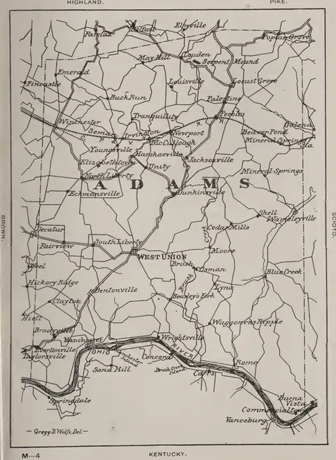 (opens in a new tab)
 Adams County 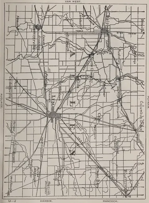 (opens in a new tab)
 Allen County 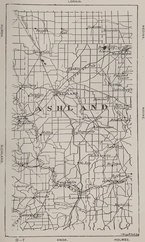 (opens in a new tab)
 Ashland County 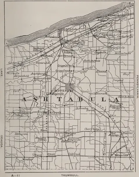 (opens in a new tab)
 Ashtabula County 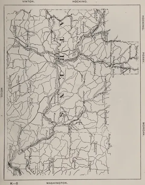 (opens in a new tab)
 Athens County 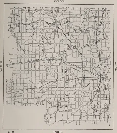 (opens in a new tab)
 Auglaize County 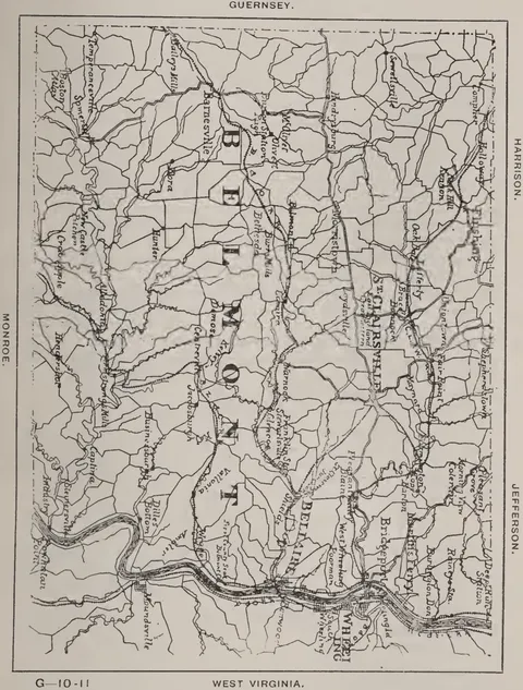 (opens in a new tab)
 Belmont County 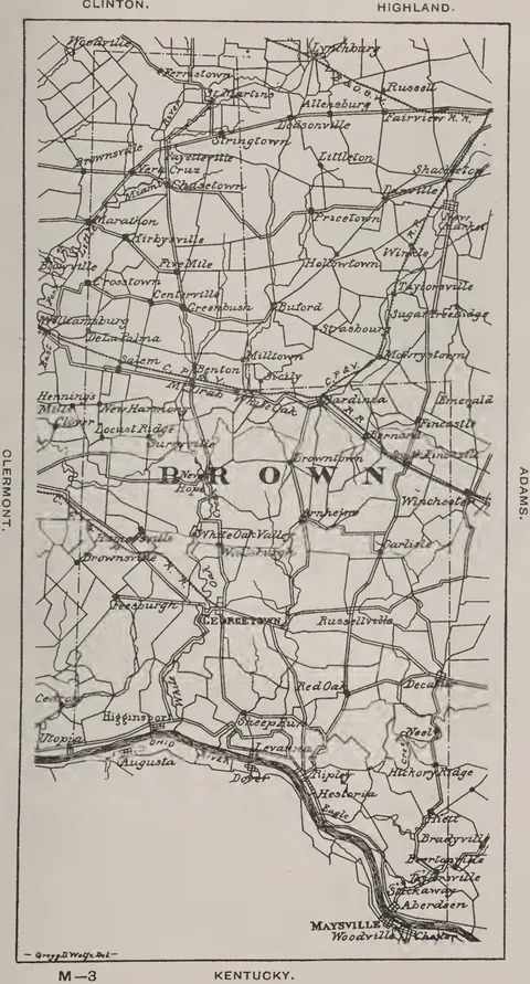 (opens in a new tab)
 Brown County 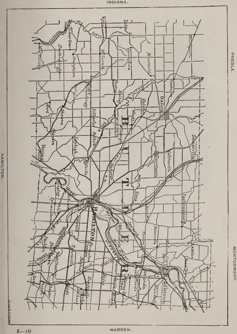 (opens in a new tab)
 Butler County 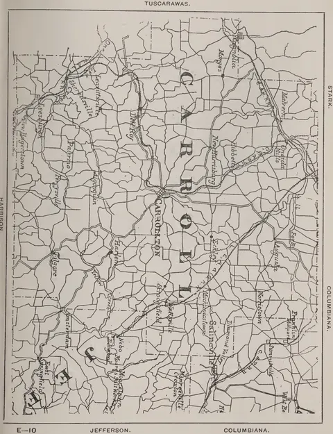 (opens in a new tab)
 Carroll County 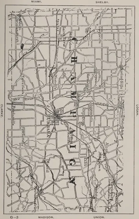 (opens in a new tab)
 Champaign County 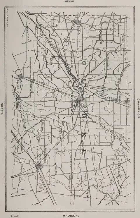 (opens in a new tab)
 Clarke County 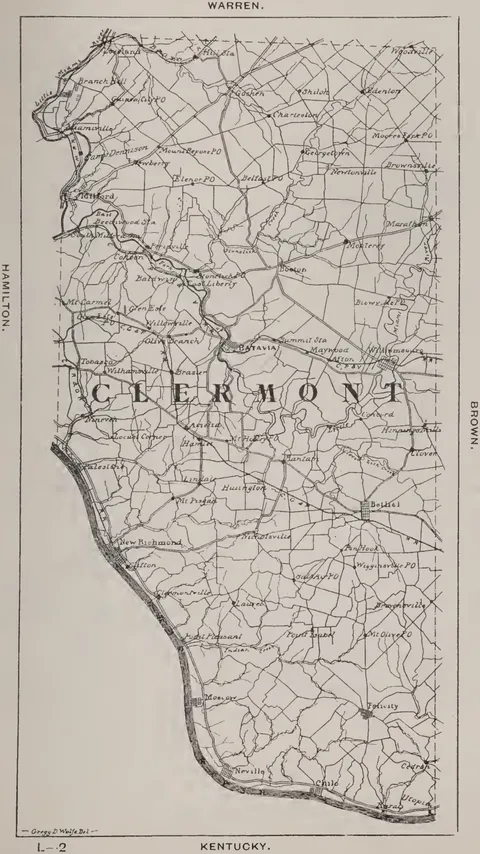 (opens in a new tab)
 Clermont County 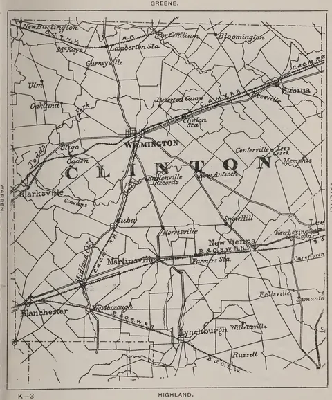 (opens in a new tab)
 Clinton County 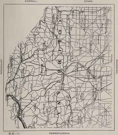 (opens in a new tab)
 Columbiana County 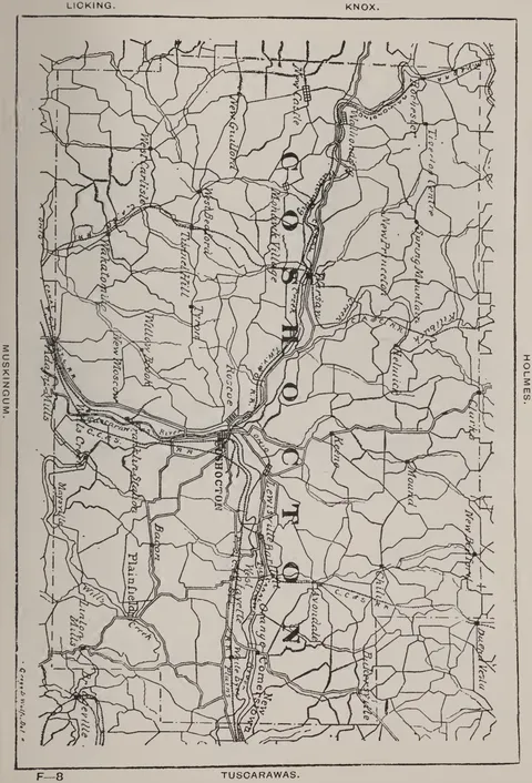 (opens in a new tab)
 Coshocton County 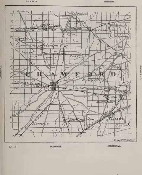 (opens in a new tab)
 Crawford County 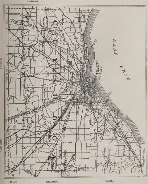 (opens in a new tab)
 Cuyahoga County 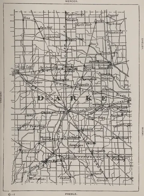 (opens in a new tab)
 Darke County 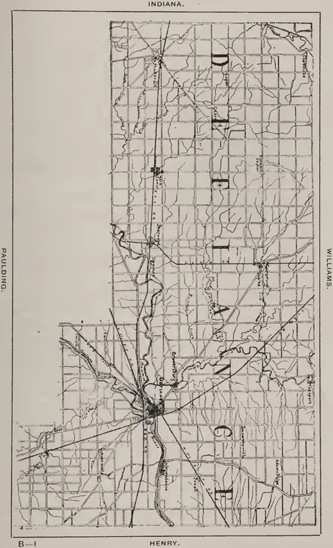 (opens in a new tab)
 Defiance County 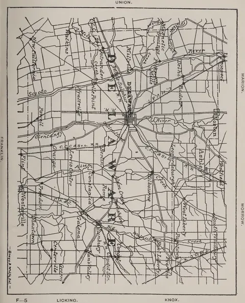 (opens in a new tab)
 Delaware County 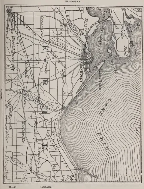 (opens in a new tab)
 Erie County 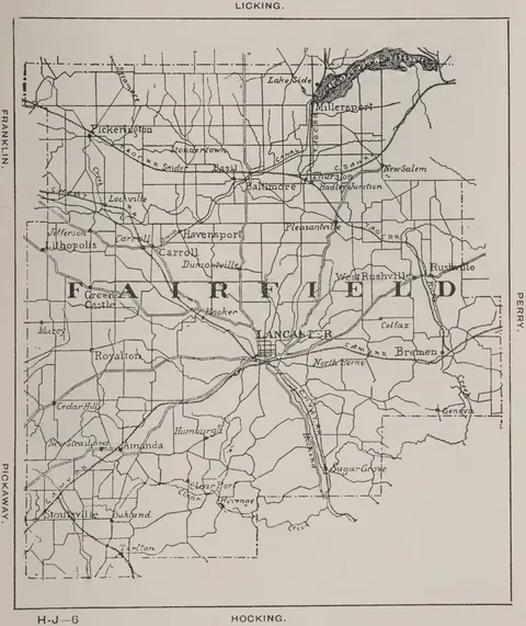 (opens in a new tab)
 Fairfield County 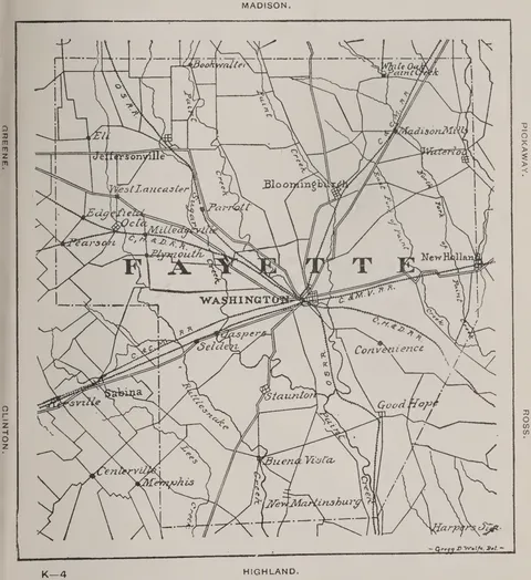 (opens in a new tab)
 Fayette County 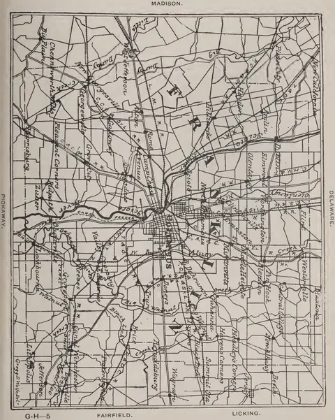 (opens in a new tab)
 Franklin County 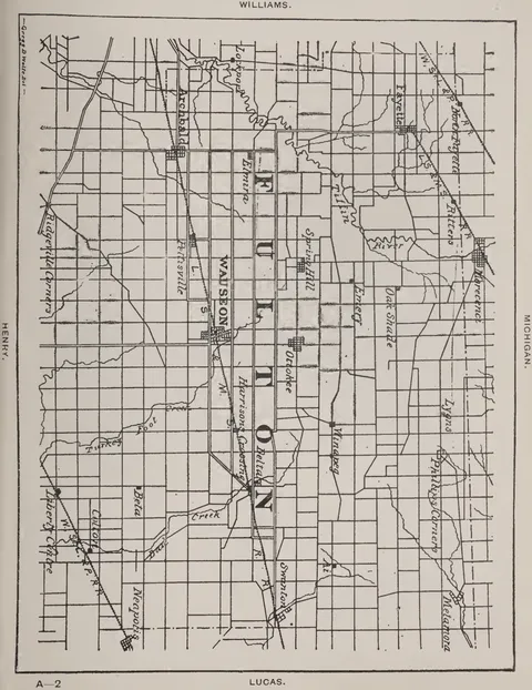 (opens in a new tab)
 Fulton County 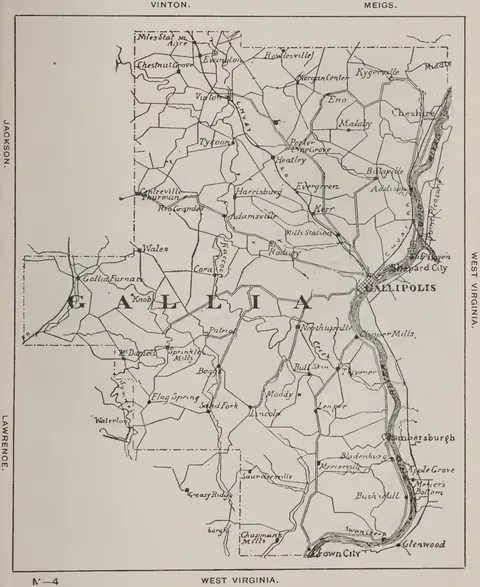 (opens in a new tab)
 Gallia County 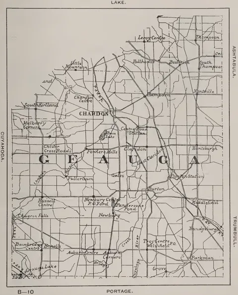 (opens in a new tab)
 Geauga County 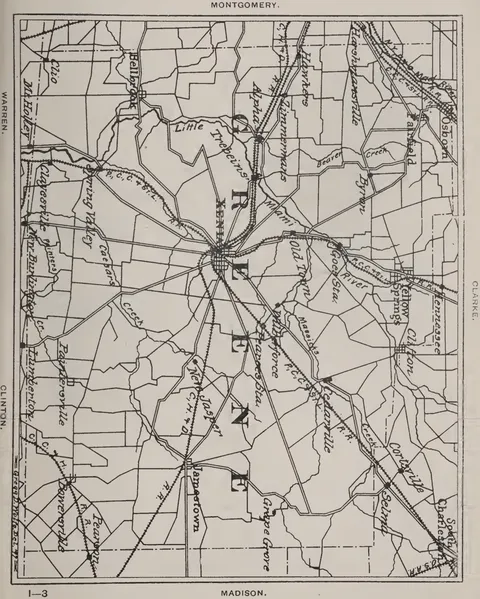 (opens in a new tab)
 Greene County 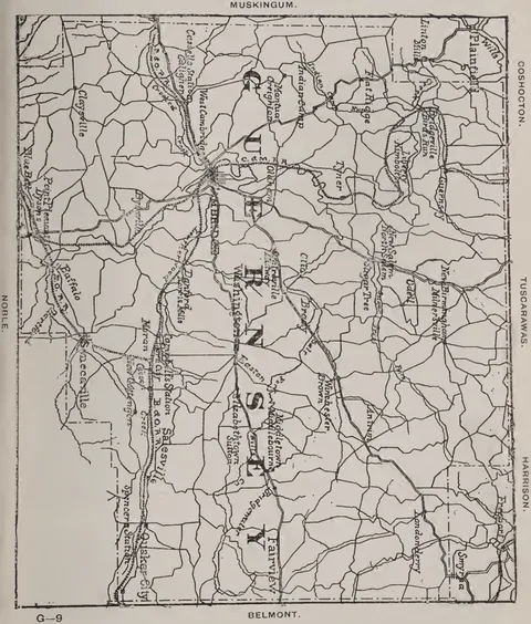 (opens in a new tab)
 Guernsey County 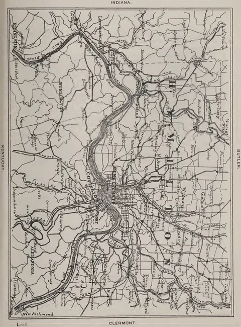 (opens in a new tab)
 Hamilton County 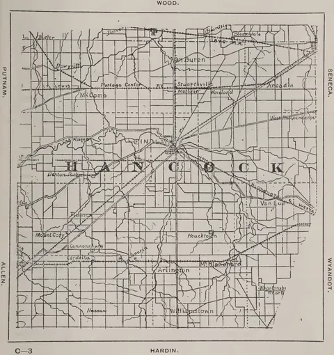 (opens in a new tab)
 Hancock County 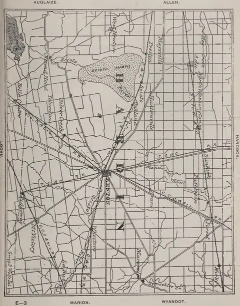 (opens in a new tab)
 Hardin County 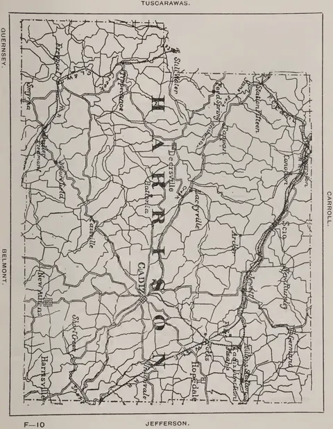 (opens in a new tab)
 Harrison County 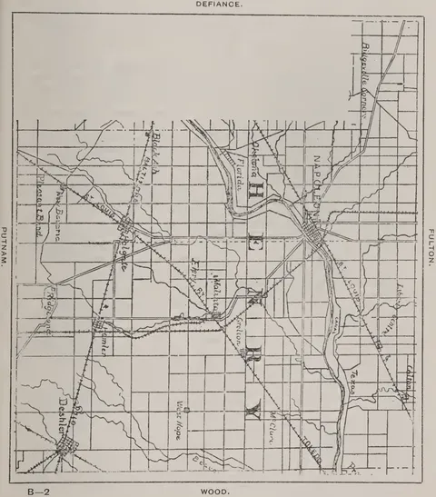 (opens in a new tab)
 Henry County 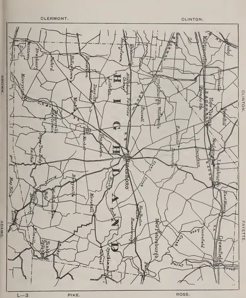 (opens in a new tab)
 Highland County 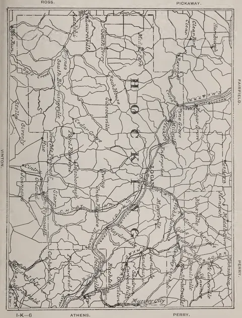 (opens in a new tab)
 Hocking County 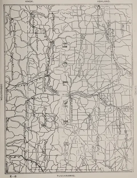 (opens in a new tab)
 Holmes County  (opens in a new tab)
 Huron County 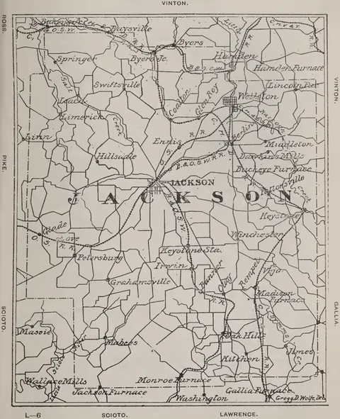 (opens in a new tab)
 Jackson County 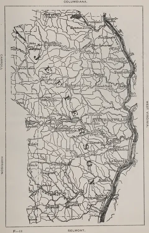 (opens in a new tab)
 Jefferson County 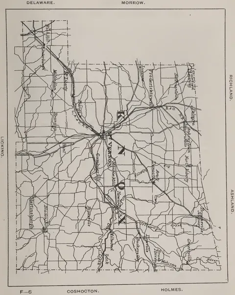 (opens in a new tab)
 Knox County 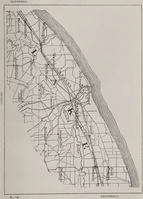 (opens in a new tab)
 Lake County 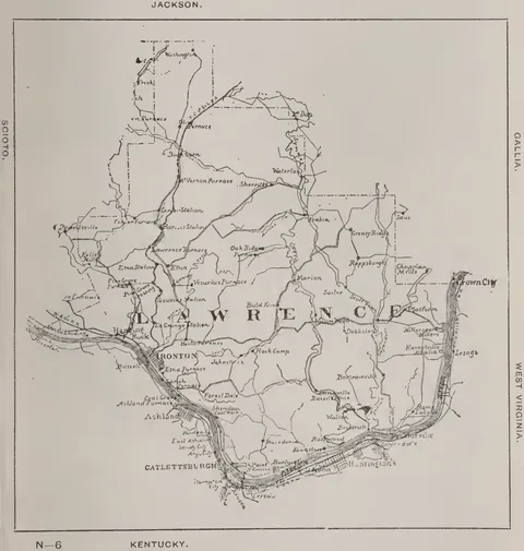 (opens in a new tab)
 Lawrence County 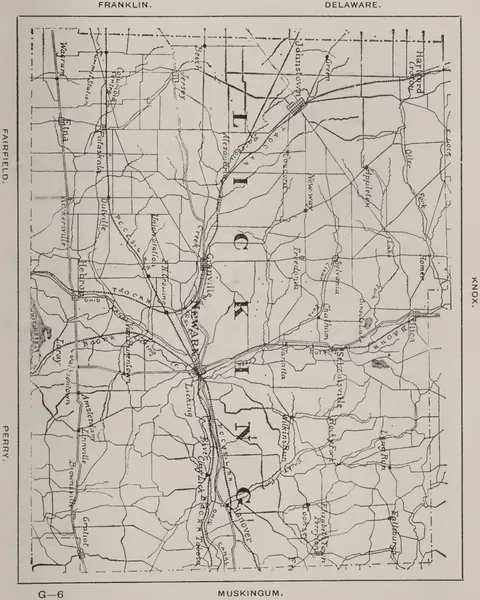 (opens in a new tab)
 Licking County 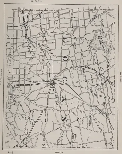 (opens in a new tab)
 Logan County 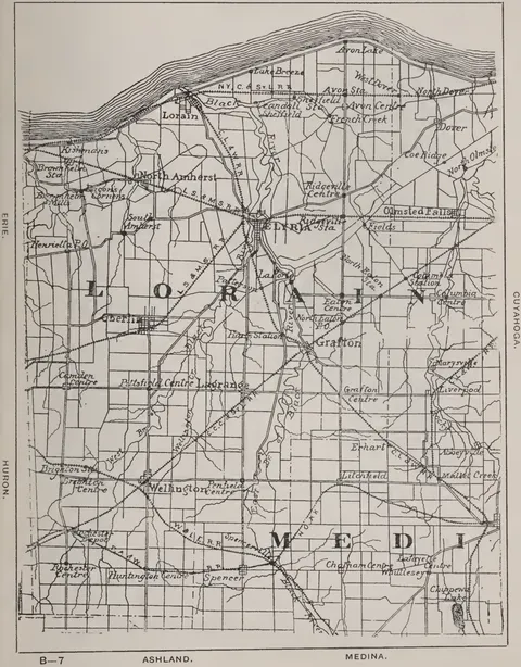 (opens in a new tab)
 Lorain County 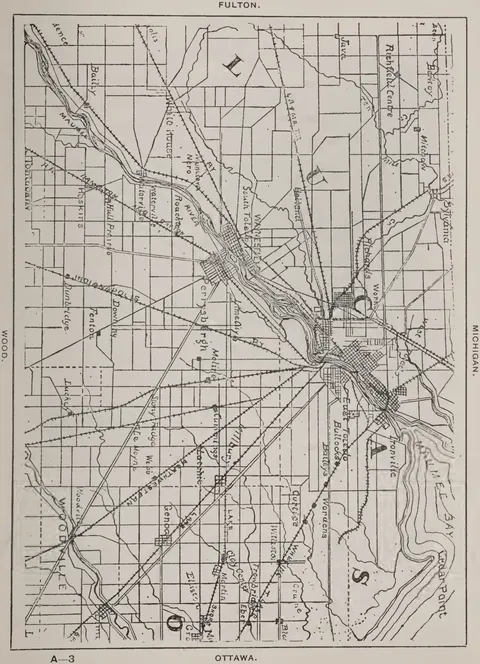 (opens in a new tab)
 Lucas County 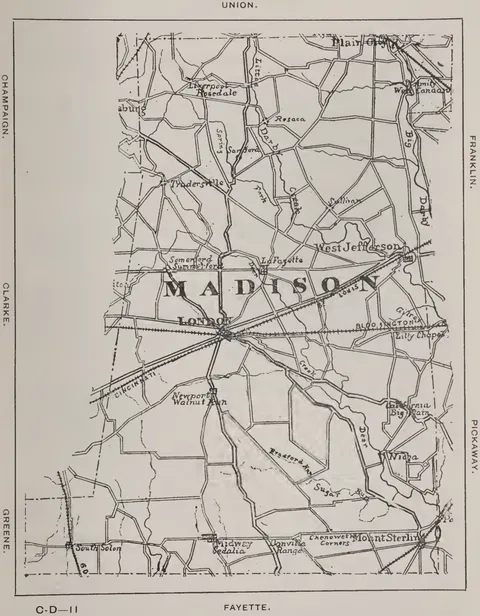 (opens in a new tab)
 Madison County 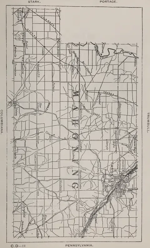 (opens in a new tab)
 Mahoning County 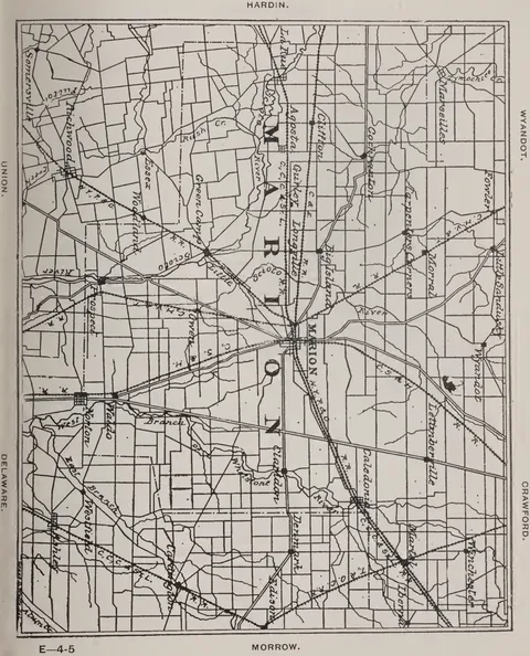 (opens in a new tab)
 Marion County 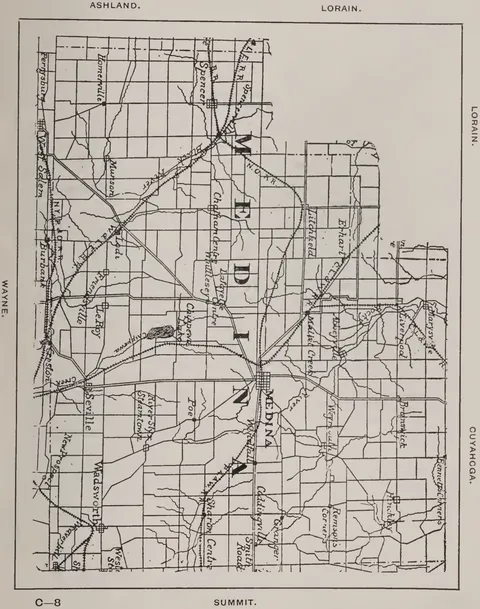 (opens in a new tab)
 Medina County  (opens in a new tab)
 Meigs County 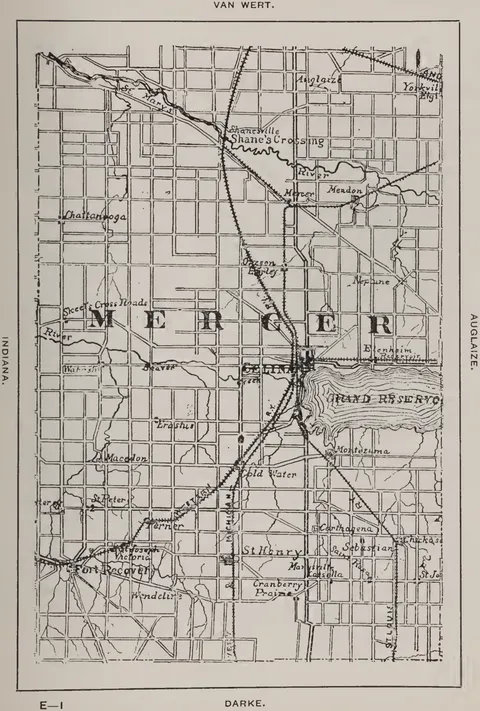 (opens in a new tab)
 Mercer County 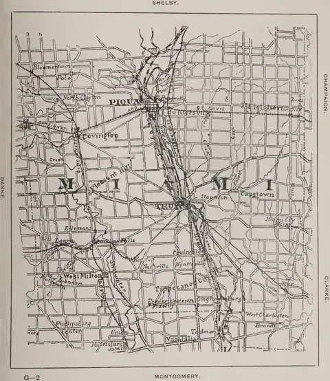 (opens in a new tab)
 Miami County 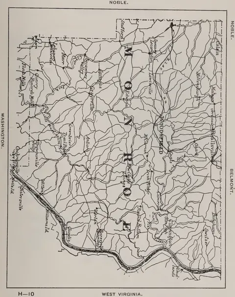 (opens in a new tab)
 Monroe County 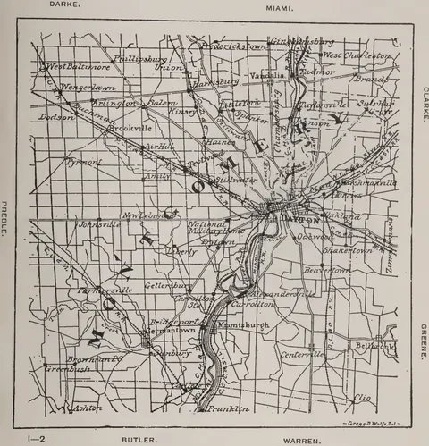 (opens in a new tab)
 Montgomery County 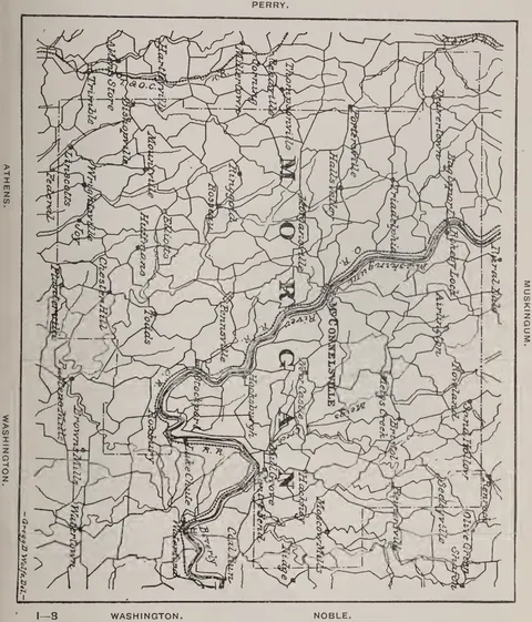 (opens in a new tab)
 Morgan County 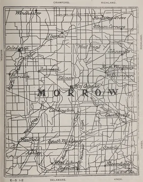 (opens in a new tab)
 Morrow County 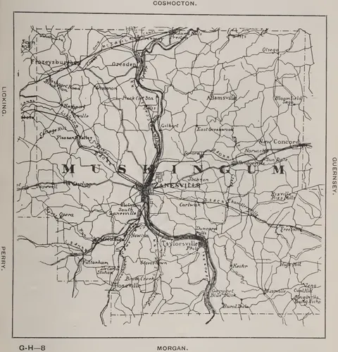 (opens in a new tab)
 Muskingum County 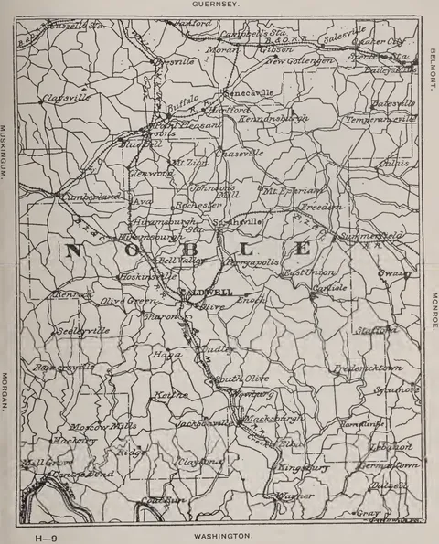 (opens in a new tab)
 Noble County 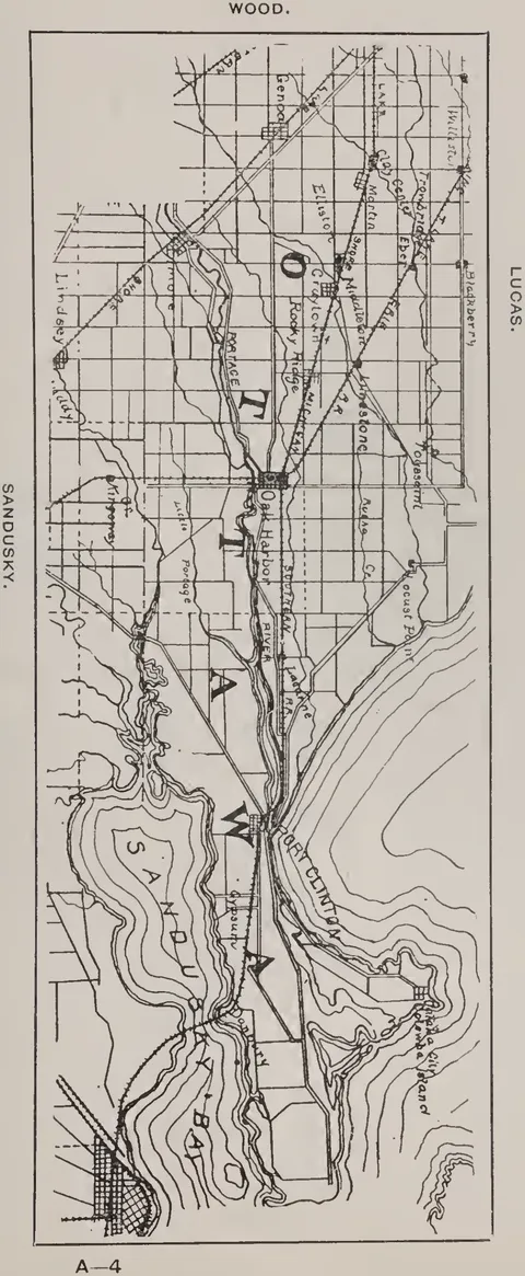 (opens in a new tab)
 Ottawa County 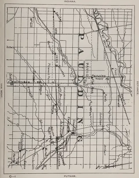 (opens in a new tab)
 Paulding County 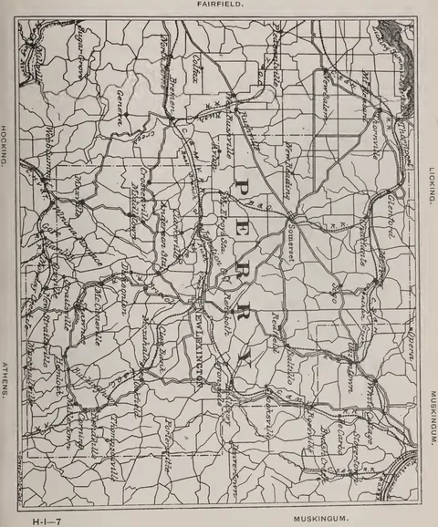 (opens in a new tab)
 Perry County 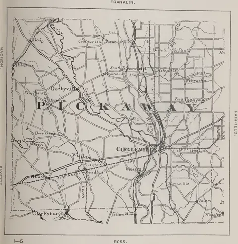 (opens in a new tab)
 Pickaway County 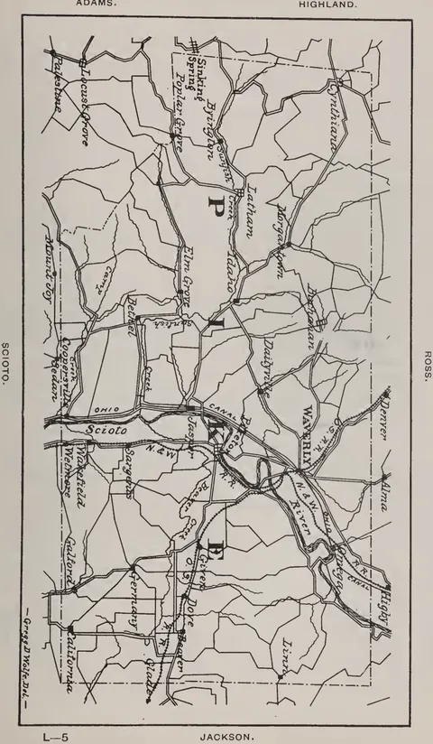 (opens in a new tab)
 Pike County 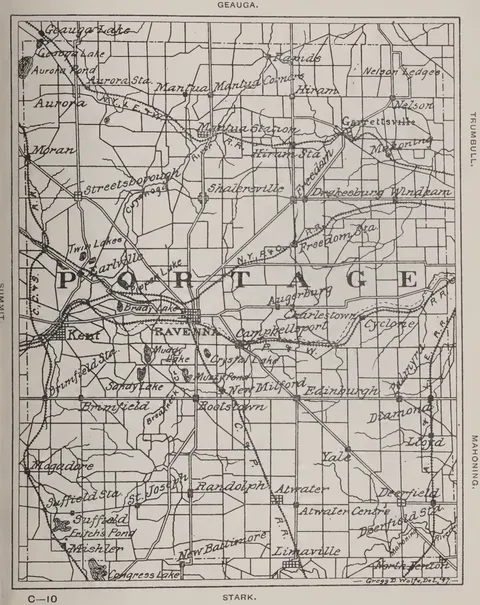 (opens in a new tab)
 Portage County 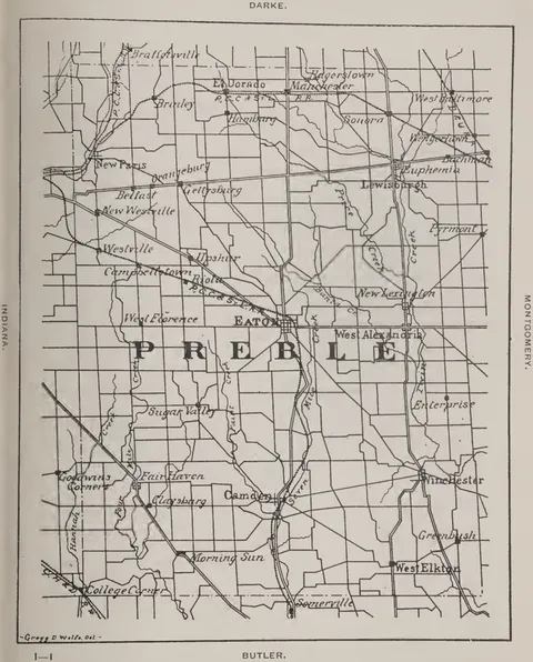 (opens in a new tab)
 Preble County 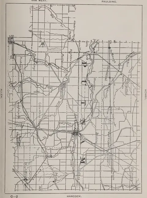 (opens in a new tab)
 Putnam County 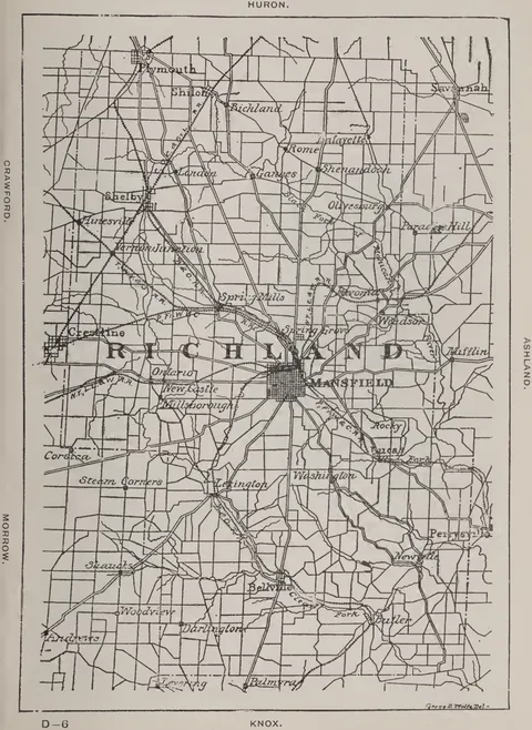 (opens in a new tab)
 Richland County 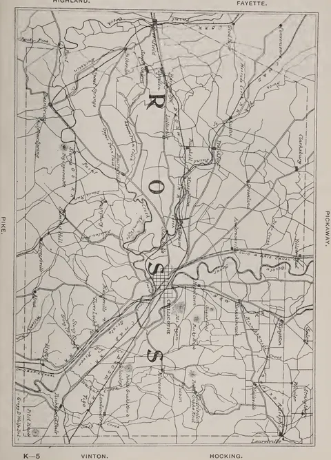 (opens in a new tab)
 Ross County 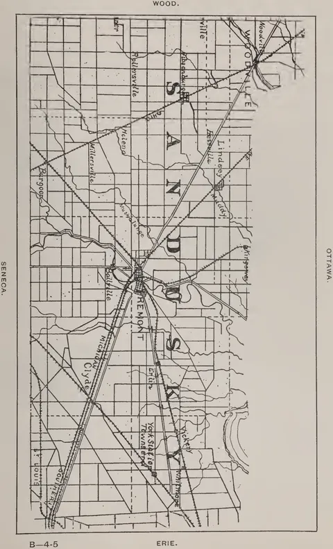 (opens in a new tab)
 Sandusky County 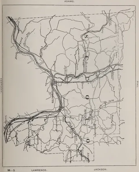 (opens in a new tab)
 Scioto County 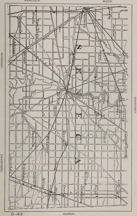 (opens in a new tab)
 Seneca County 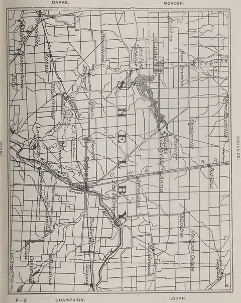 (opens in a new tab)
 Shelby County 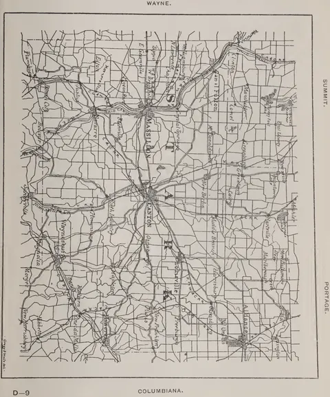 (opens in a new tab)
 Stark County 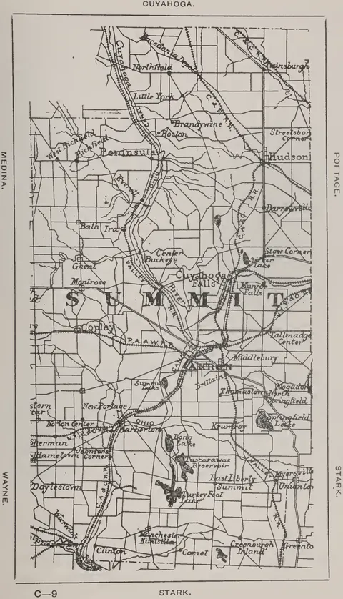 (opens in a new tab)
 Summit County 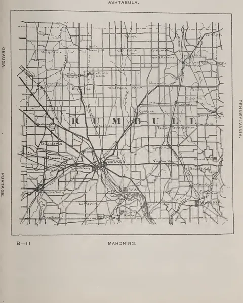 (opens in a new tab)
 Trumbull County 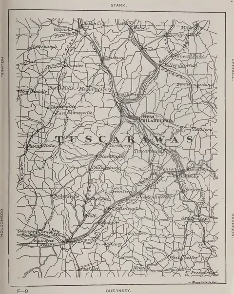 (opens in a new tab)
 Tuscarawas County 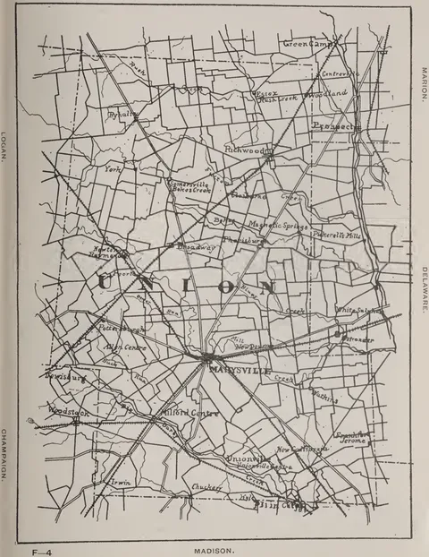 (opens in a new tab)
 Union County 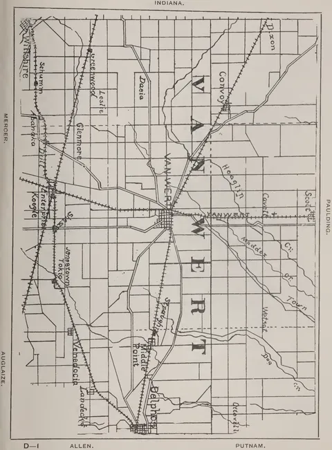 (opens in a new tab)
 Van Wert County 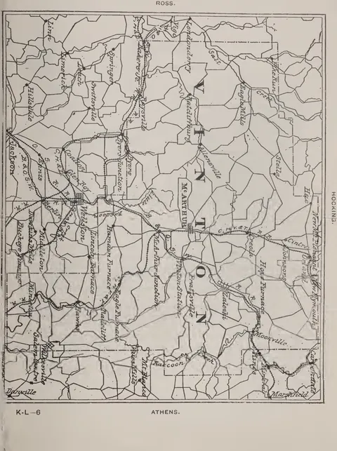 (opens in a new tab)
 Vinton County 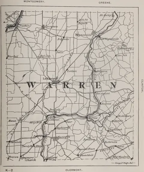 (opens in a new tab)
 Warren County 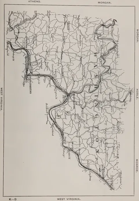 (opens in a new tab)
 Washington County 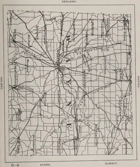 (opens in a new tab)
 Wayne County 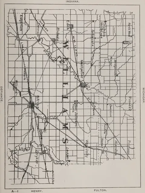 (opens in a new tab)
 Williams County 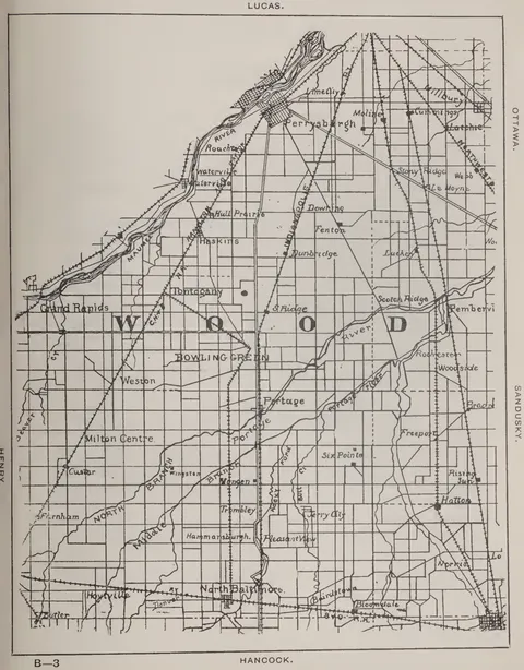 (opens in a new tab)
 Wood County 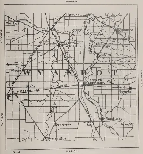 (opens in a new tab)
 Wyandot County 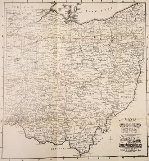 (opens in a new tab)
 Map of Ohio showing the main roads and pikes of the state
Mastheads 1
 (opens in a new tab)
 League of American Wheelmen emblem