The Cyclists' Road Guide of Canada
Edited by Fred Bryers1894131 chapters18 images

Contents
- Editor Fred Bryers explains that the Canadian Wheelmen's Association commissioned this road guide three years earlier and first published the collected routes in Cycling magazine, with distances checked to within half a mile. Notes that the map locates every place named and that the index covers only Ontario and Quebec, the other provinces having comparatively few routes.
- Route from Niagara Falls through St. Davids, Welland, St. Catharines, Grimsby, Hamilton and Oakville to Toronto, about 91.25 miles by the right-hand branch through St. Catharines or 69.75 miles by the left-hand branch via Queenston and Hamilton. Describes fair gravel and stone roads with hills between St. Catharines and Thorold.
- A 111.75-mile route via Dundas, Freelton, Guelph, Fergus and Mount Forest to Owen Sound. Stone road through Dundas is heavy after rain near a swamp at Freelton, then good gravel from Freelton to Guelph and fine gravel via Fergus to Mount Forest before the Garafraxa road into Owen Sound.
- Alternative 115.5-mile route from Toronto via Brampton, Orangeville, Shelburne, Dundalk and Flesherton to Owen Sound, with a branch (a) leaving Brampton for Georgetown and Rockwood into Guelph. Road is gravel and sand with interspersed hills, fine towards the Owen Sound end.
- A 212.5-mile route via Brampton, Georgetown, Berlin, Stratford, St. Mary's, London and Strathroy to Sarnia. Notes six miles saved by not entering Strathroy, and calls the road near London "beautiful" and "level as a billiard table" in fine weather.
- A 219-mile route through Brantford, Woodstock, Ingersoll, London, St. Thomas and Wallacetown to Windsor. Heavy sand between Wallacetown and Clearville gives way to a road so smooth it becomes "a regular race track for the last 45 miles."
- A 116.75-mile route along the Lake Huron shore through Kincardine and Goderich to the sand hills at Grand Bend, then inland over clay roads (impassable after rain) via Parkhill to Strathroy. Advises tourists to ask locals about the crooked road from Grand Bend.
- A 49.5-mile route via Paris, Glen Morris and Galt to Guelph, mostly excellent gravel on Dundas street and Governor's road with some sand and hills approaching Glen Morris and Galt.
- A 123-mile near-straight route through St. Thomas, London, Mount Forest and Wingham to Walkerton, described as the main road through several counties, mostly good gravel with only a few light hills.
- A 49.5-mile route via Norwich and Scotland to Simcoe and Port Dover, good gravel with a sandy, heavy stretch around Round Plains; notes a side trip south from Brown's hotel to the "romantic little spot" of Port Ryerse.
- A 53-mile route via New Dundee, Ayr and Brantford to Waterford and Simcoe, good gravel that is quite hilly about Ayr, with heavy sand leaving Brantford on the Mount Pleasant road before a fine gravel run to Simcoe.
- A 25-mile route east to Shakespeare and south through Tavistock to Woodstock, described as a beautiful gravel road with a few hills near Woodstock.
- A 50-mile route down the river's edge through Port Lambton and Wallaceburg to Chatham on fine level clay-and-sand road, finishing on the Baldoon clay road directly into Chatham.
- A 29-mile route through Mitchell, Seaforth, Brucefield and Bayfield to Goderich, with a high hill before Mitchell giving a view back to Stratford; the Bayfield-to-Goderich stretch via Brucefield is called the "Wheelman's Paradise," though riders are warned about coasting the hills.
- A 44-mile route via Thamesford, St. Mary's and McIntyre's Corners to Exeter on Thamesford and Nissouri gravel roads, with only a few, not-bad hills.
- A route via Thornhill, Newmarket, Barrie and Orillia to Gravenhurst, good gravel on Yonge street (better after rain) turning to rough macadam near Bradford before improving into Barrie; numerous but rideable hills along the way.
- A route via Lambeth, Delaware and Strathroy to Forest on North street and the London gravel road, with good gravel and no hills of consequence the whole way.
- A 96-mile route north-west through Fergus, Arthur, Walkerton and Paisley to Southampton, gravel nearly the whole way and very fine in places, with numerous hills toward the north that are not seriously hard.
- A 32-mile route through Milverton and Britton to Listowel, mostly clay with some gravel and a little corduroy, described as "essentially a dry weather road."
- A 53.5-mile route via Arthur and Drayton to Listowel, fair gravel with a few hills to Arthur, then mostly clay turning to gravel on to Listowel.
- A route via Lambeth, Wardsville and Thamesville to Chatham, first-class gravel to Wardsville, sandy and rough to Thamesville, then good clay into Chatham.
- A 28-mile route south to Port Stanley then east along the Lake Shore road through Copenhagen and Gravesend to Port Burwell, good gravel then sand, with fair riding and fine scenery.
- An 84-mile route north-east to Orangeville on fine gravel, then rough and hilly clay, sand and gravel from Orangeville to Duntroon before fair gravel into Collingwood, with fine scenery in dry weather.
- An 88-mile route east on the Durham road through Walkerton, Flesherton and Singhampton to Collingwood, good gravel with hills east of Walkerton and heavier ones east of Singhampton, generally downhill toward Lake Huron.
- A 37.5-mile route via Crosshill and Macton to Listowel, good gravel to Crosshill, clay to Macton and gravel into Listowel with one or two hills.
- A 28.25-mile route north then east through Carlow and Blyth to Wingham, all good gravel with a few small hills.
- A 43-mile route south-west through Fergus to Berlin, good gravel to Fergus then fair gravel with some rough, stony places, a number of small hills and beautiful scenery.
- A 26.5-mile route via Russelldale and the Thames road to Hay and on to Exeter, all good gravel.
- A 36-mile route through Berlin and Waterloo to Creekbank and Drayton, sandy road west from Hespeler then good gravel and clay, with some easily rideable hills.
- A 30-mile route via Mount Elgin to Tilsonburg and Vienna to Port Burwell, good gravel to Tilsonburg then considerable drifting sand, though frequent sidepaths and few hills.
- A 45.5-mile route through Parkhill and Thedford to Forest and Wyoming, fair sand and gravel that turns sandy and bad crossing the Aux Sables river, then fine gravel through Forest and clay-then-gravel on to Wyoming.
- A 55-mile route through Burford and Norwich to Brownsville and Aylmer, nearly all good gravel to Norwich, then poor sand near Springfield and heavy sand, clay and gravel to Aylmer with some parts unrideable.
- A 63-mile route through Dundas, West Flamboro and Berlin to New Hamburg and Stratford, hilly but good gravel and macadam with splendid scenery, becoming very fine gravel with a rolling grade from Berlin to Stratford.
- A 39.25-mile route via Ailsa Craig and Strathroy to Watford, fairly good gravel nearly the whole way.
- A 56-mile route north-west through Wingham, Lucknow and Amberley to Kincardine, fairly good gravel with a sandy stretch between Wingham and Bluevale and a rough, stony, somewhat hilly county-line section.
- A 16.5-mile route south then east via Gravesend to Port Burwell, good gravel followed by the sandy Lake road.
- A 58-mile route on the Talbot street gravel road through Bayham and Delhi to Simcoe and Jarvis, with heavy sand toward Atherton and blue clay to Jarvis said to be "excellent in dry weather."
- A 57.5-mile route through Palmerston, Listowel and Mitchell to St. Mary's, first-class gravel with few hills, jogging at Listowel and Monkton.
- A 28.5-mile route north then east through Carlow and Dungannon to Lucknow and Kinloss, fair gravel with no heavy hills; notes the Durham road onward to Walkerton or Kincardine.
- A 59-mile route via Charing Cross and Maidstone onto the famous Talbot gravel road into Windsor, described as only rideable in fine weather; a longer but better alternative via Buckhorn is also given.
- A 45-mile route west then south through Wroxeter and Brussels to Seaforth, fair gravel and stone that improves toward the end.
- A 66-mile loop through Windsor, Amherstburg and Kingsville to Leamington, rough sandy road to Pike's Creek, poor sand, clay and gravel with nice sidepaths along the river at Windsor, then mostly clay to Kingsville and good gravel to Leamington.
- A 41-mile route through Petrolia and Dawn Centre to Dresden and Wallaceburg, gravel to Petrolia then clay improving gradually to gravel, clay and sand near Wallaceburg.
- A 24-mile route on the "Plank Road" south-east then east on the 10th concession through Petrolia to Oil Springs, gravel to Petrolia and clay the rest, with no hills.
- A 38-mile route via Caledonia and Hagersville to Port Dover, stone road to Caledonia then stone, gravel and clay beyond; riders are told "do not on any account coast the mountain."
- A 109-mile route through Owen Sound and along the Georgian Bay shore to Collingwood, with fine views of the Blue Mountains, then largely clay but good riding through Stayner on to Barrie; noted as essentially a dry-weather route.
- A 27.5-mile route south-east on the plank road then direct east on the 4th line to Watford, good gravel with no hills.
- A 26-mile route via Christie's Hill and Chippawa Hill to Southampton and Port Elgin, good gravel with some hills for the first ten miles and fine scenery.
- A 37-mile route via Pine Orchard and Stouffville to Uxbridge and Port Perry, mostly gravel with a few hills, a little sand and some clay.
- A 62-mile route via Keswick and Beaverton to Orillia, nearly all good gravel with one sand hill and a little corduroy; notes Roche's Point and Jackson's Point as nearby summer resorts.
- A 55-mile route east on the Kingston road then north through Markham and Ballantrae to Sutton and Jackson's Point, fine gravel with two miles of poor sand near Ballantrae.
- A 172.75-mile route via the Woodbine race track, Whitby, Bowmanville, Colborne and Belleville to Kingston, warning of several steep, crooked hills between Toronto and Bowmanville that should not be coasted, with fine gravel and macadam into Kingston.
- A 185-mile route along the river through Gananoque, Brockville and Cornwall to Montreal, fine riding along the river to Dickinson's Landing then a heavy, low clay road from Cornwall to Summerstown before perfect gravel and macadam into Montreal.
- A 128.5-mile route via Pointe Claire, St. Anne's, Vaudreuil and Hawkesbury (at the head of the Long Sault rapids) to Ottawa, fine macadam near Montreal, clay roads only fair in dry weather, sandy and rough near Hawkesbury, with good roads and fine stretches from Wendover into Ottawa.
- A 39-mile route via Claremont and Zephyr to Sutton and Jackson's Point, nearly all fair gravel with some clay and sand, rather hilly in places.
- A route via Port Perry and Uxbridge to Wilfrid and on to Sutton, gravel and some clay on the Reach road with some hills and rough road between Uxbridge and Wilfrid.
- A 129-mile route through Cannington, Omemee, Peterboro' and Campbellford to Stirling and Belleville, first-class gravel with no hills to Manilla, then heavy hills and poorer roads near Peterboro' before improving toward Belleville.
- A 24-mile route north to Blackstock, crossing a bridge to Scugog Island, to Port Perry, fairly good gravel with a short stretch of sand and only one hill.
- A 55-mile route via Ridgetown, Wallacetown, Shedden and Fingal to St. Thomas, recommending the train from Ridgetown to Dutton to avoid the sand around Clearville; fine gravel and no hills, noted as the route favoured in the solid-tired ordinary era.
- A 49.5-mile route east on Talbot street to Aylmer then via Tilsonburg and Delhi to Simcoe, good gravel with a couple of hills, a poorly kept stretch recommended only in dry weather, and heavy sand between Delhi and Atherton.
- A route along the lake shore through Dunnville, Marshville and Humberstone to Fort Erie and Buffalo, clay the whole distance but fine in midsummer, turning to fine gravel from Humberstone onward.
- A 72-mile route via Jarvis, Attercliffe, Welland and Chippewa through Queen Victoria Park to Niagara Falls, mostly clay or clay-loam except the last four or five miles, with no hills of consequence and excellent midsummer riding.
- A 33-mile route via Stevensville and Chippewa through Niagara Falls Park and along the river through St. Davids and Queenston to Niagara, good gravel turning to gravel and clay-loam.
- A 36-mile route via Attercliffe and Wellandport onto the Canboro road, then along the Welland Canal to St. Catharines, clay and clay-loam with sand around Fonthill.
- A route over the mountain via the Port Dover stone road to Mt. Hope and Caledonia, then along the east bank of the Grand River to Cayuga and Dunnville, fair riding in fine weather but some hilly stretches.
- A 24-mile route via Canboro' and Smithville to Grimsby, one mile of heavy sand then good clay; the crooked road prompts a warning to make frequent inquiries, with a walk down the mountain into Grimsby.
- A 26.5-mile route along the new canal bank to St. Catharines and Thorold, then clay south to Humberstone and gravel to Port Colborne, with a heavy grade between St. Catharines and Thorold.
- A shorter 12-mile alternative to the canal-bank route, avoiding the numerous locks by taking St. Paul street to the top of the hill near the G.T.R. station, past Decew's Falls, then south to Welland.
- A 19.5-mile route via Danforth avenue and Unionville to Markham, pavement giving way to sand with good sidepaths, then gravel and clay, with no hills.
- A round trip via Carlton and the Weston road, good pavement then poor macadam with one hill; the return follows the west side of the river past Lambton, noted as "all down hill from Weston."
- A 23-mile route via Bathurst, St. Clair avenue and Fairbank to Carrville and King, asphalt then clay giving way to gravel; Richmond Hill and Oak Ridges are noted as nearby good-gravel side trips.
- A 47-mile route via Port Perry and Seagrave to Cannington and Beaverton, gravel turning hilly near Seagrave then the Cameron gravel road into Beaverton, all described as good wheeling.
- A 14-mile route via Kettleby, Pottageville and Lloydtown to Schomberg, fair clay loam and some sand with a few hills at Pottageville.
- A 43-mile route on the Verulam road through Bobcaygeon and across Chemong Lake to Peterboro', clay and gravel with a suggested steamer excursion from Bobcaygeon to Chemong Park.
- A 42-mile route through Orono and Bethany to Reaboro' and Lindsay, good gravel turning somewhat sandy then clay and gravel, with a few small hills.
- A 32.5-mile route on the Kingston road to Welcome then north through Mount Pleasant to Omemee, good gravel and clay road with few hills.
- A 34-mile route via Rossmount and South Monaghan to Springville and Peterboro', fair gravel with a few hills; notes Millbrook five miles west of South Monaghan.
- A 14-mile route north along the Otonabee river through Lakefield to Young's Point on good gravel road, with pleasant lake excursions noted from Young's Point.
- A 15-mile route via Baltimore to Harwood on Rice Lake, fair gravel turning sandy and poor, running parallel with the old railway, with a summer hotel at Harwood.
- A 13-mile route north and north-east to Gore's Landing, fair gravel with a mile or two of sand and no hills; a summer hotel is noted there.
- A 31-mile route on Division street north to Baltimore then north-east to Hastings, good gravel giving way to considerable sand, with no hills of consequence and rain said to improve the going.
- A 29-mile route north through Castleton and Morganston to Hastings, good gravel though rather uphill.
- A 24-mile route north-west and north through Hilton to Campbellford, gravel and clay giving way to good gravel with a little uphill.
- A 36-mile route south to Norham then east through Newcombe's Mills to Trenton, good gravel the whole distance and "down grade all the way."
- A 28-mile route east to Wooler then north-east to Stockdale and Foxboro' before Belleville, all good fair gravel; notes Trenton eight miles south of Frankford and an all-downhill run along the river.
- A 32-mile route following the telegraph line along the Bay of Quinte shore through Carrying Place to Wellington and Picton, good gravel and pretty scenery, said to be improved by a little rain.
- A short route east over Bridge Street hill to Glenora and Lake on the Mountain, following the telegraph line on good gravel.
- A 10-mile route on the East Lake road via Woodrow's Corners to Sandbanks, following the telegraph line then good gravel along the north side of East Lake.
- A 24-mile route on the Bay Shore road to Peterson's Ferry opposite Deseronto, good gravel and clay then, after the ferry crossing, a rough and stony road east to Napanee.
- A 12-mile route via the telegraph line to Cherry Valley then west along the south shore of East Lake to Salmon Point, good gravel; notes Millford nearby.
- A 35.5-mile lake-road route via Glenora, Young's Point, Adolphustown and Bath to Kingston, clay and gravel with some sand, fine in dry weather; a horse ferry connects Lake on the Mountain and Young's Point.
- A route north-east to Camden East then straight north to Tamworth, described as excellent gravel roads the whole distance.
- A route north-west through Harrowsmith to Camden East, good gravel that is rather hilly for a few miles before improving toward Camden East.
- A 14-mile route via Cataraqui and Elginburgh to Sydenham, good gravel but hilly with fine scenery; notes Inverary six miles north-east of Elginburgh.
- A 17-mile route past the G.T.R. station north-east to Battersea, only fair gravel with some hills; notes Inverary three miles west of Sunbury.
- A long route via Seeley's Bay, Oliver's Ferry, Perth and Richmond to Ottawa, passing the Royal Military College and Fort Henry, hilly and stony toward Perth then dirt road with clay and sand before macadam into Ottawa.
- A 23-mile route west and north-west to Smith's Falls then south-west to Lombardy and north to Oliver's Ferry, fair wheeling on a somewhat sandy stage road.
- A 22-mile route direct south to Perth on fair clay road then south-east over rough clay and gravel to Smith's Falls.
- A route south-west to Richmond on good macadamized road, then clay, sandy and stony via Franktown and Smith's Falls before Toledo and south to Brockville, mostly macadam with no hills of consequence.
- A 65-mile route by Bank street and Metcalf toward Kemptville, macadam for the first 20 miles then mostly clay with rough, sandy and stony parts, many footpaths and a number of hills.
- A 26-mile route on the Richmond road to Hintonburg then south through Manotick to North Gower, macadam to Merivale then clay and sand loam, somewhat rough beyond.
- A 14-mile route south-east on macadam to Hawthorn then clay and sand to Eastman Springs, rideable only in dry weather.
- A 44-mile route via Bell's Corners and Stittsville to Carleton Place, then round Mississippi Lake to Lanark, sand and clay loam that is somewhat stony in places.
- A 19-mile route via Britannia and South March to Dunrobin on a good dirt road, with Lake Constance about three miles north of South March.
- A 63-mile route via Richmond, North Gower and Burritt's Rapids to Merrickville and Maitland, sand and clay loam turning to clay loam and gravel with a number of hills, good only in dry weather.
- A 9-mile route across the Ottawa river to Hull then a river-line macadam road, slightly up-grade, all the way to Aylmer, Quebec.
- A 16-mile route through Hull past Eddy's factory to Long Hill on splendid macadam, then a sandy road across the Gatineau river to Templeton, with the return possible by ferry and the Montreal road.
- A 24-mile route through Hull to Chelsea on good macadam, then a good dirt road with several stiff hills on to North Wakefield.
- An 85-mile circuit via the Upper Lachine road to Beaconsfield (good macadam with fine views of Lake St. Louis), through St. Anne's past the rapid where Moore composed his song, then clay roads east to Sault au Recollet and Bout de L'Isle, completing a full circle of the island.
- A 15-mile route via Sherbrooke and Bleury streets to Sault au Recollet on good macadam, crossing two toll bridges (5 cents each) to reach Terrebonne.
- A 126-mile route via Chambly, Granby, Waterloo and Magog to Stanstead and Newport, Vermont, noting Morrill's Hill as the highest point in the Eastern Townships and sand near the U.S. boundary at Derby Line.
- An 80-mile route via Lawrenceville and Richmond to Coaticook, some very heavy sand but generally fair riding, with tourists particularly cautioned against coasting the quite hilly, rough stretches.
- A long descriptive account, performed by Louis Rubenstein of the Montreal Bicycle Club, of the North Shore route through Repentigny, Berthier, Three Rivers and Batiscan (crossed by a ferry worked on a "windlass" plan) to Quebec, over clay, sand and macadam with steep hills near the end.
- A 246-mile route through Kamouraska, Riviere du Loup, Cacouna, Trois Pistoles and Bic to Matane, the Bic-to-Matane stretch called splendid road rideable in six hours, and the Bic marine view called the prettiest in Canada.
- A 260-mile New Brunswick route on the Maine post road down the west side of the St. John River through Grand Falls, Woodstock and Fredericton to St. John, hard clay with good gravel stretches and very fine river scenery.
- A 296-mile route north-easterly to Moncton on hard gravel, then clay and sand to Amherst, heavy sand and good clay to Truro, and fine gravel on to Halifax.
- An 89-mile route along the Bay of Fundy shore to Digby then round Annapolis Basin, hard beach gravel the whole way making "a beautiful run"; steamers connect from St. John, N.B.
- An 84-mile route on the main post road (hard gravel) to Bridgetown, then a centre road via Berwick on good clay, finishing on the Bog road from Hantsport to Windsor; the direct road is noted as very heavy sand.
- A route via Port William and Canard to the Blomidon lookoff, first-class hard gravel turning slightly sandy, with views from the lookoff of Evangeline's home, Minas Basin and the old Acadian farms.
- A 3-mile fine gravel road east to Grand Pre, noted as the home of Evangeline where the old well and tree are still pointed out to tourists.
- The "Southern route" via Shelburne and Lunenburg to Halifax, good hard clay with some sand giving way to first-class gravel, the Atlantic ocean in view the whole distance though less convenient to railways than the Annapolis and Windsor route.
- A 46-mile route north-easterly on good gravel to Martin's Corners, then fair clay to Bedford and fine gravel into Halifax.
- A 23-mile route straight up Main street to Selkirk on a good clay road not passable after a shower, passing a historic church and graveyard, an Indian Industrial School at St. Paul's, and the stockaded Lower Fort Garry still used by the Hudson's Bay Company.
- A 92-mile route via Oak Lake, Virden and Elkhorn to Moosomin running almost parallel with the railway, clay soil with a slight mixture of sand that dries quickly after rain; Virden, built mostly of stone, is called the best midway stopping place.
- A 63-mile route on Portage avenue following the old Assiniboine Trail past Silver Heights (Sir Donald Smith's residence and a herd of buffalo) through St. Francois Xavier and High Bluff, heavy clay road good except after rain.
- A 65-mile clay road via St. Norbert, St. Agathe and Morris to Emerson, well travelled and excellent wheeling except after rain, running between the Red River and the C.P.R. track.
- An 87-mile trail nearly parallel to the railway via McGregor and Carberry to Brandon, with sand hills near Austin "practically unwheelable" before the road improves past Sewell into "the wheat city."
- A 130-mile trail via Dewdney and High River to MacLeod, fair level riding turning rather hilly but good and hard, with hospitable farmers, grand scenery and convenient railway bridges over the creeks crossed.
- A 28-mile route north-east and south-east on the Blackfoot trail to Langdon, rather hilly but a good road.
- A 9.25-mile route west on the North Morley trail to Twin Bridges, a little hilly at the start then level with good roads, fine scenery and trout fishing on the Bow River.
- Nine numbered club rules governing the century bar: amateur wheelmen must ride 100 miles in 14 hours (16 for ladies) unpaced, entirely on the wheel or on foot with no train-taking, and apply within 30 days, paying a $3 initiation fee for the club badge and bar plus 75 cents for each additional bar.
Images in this book 18 pictures from 117 pages
Maps 2
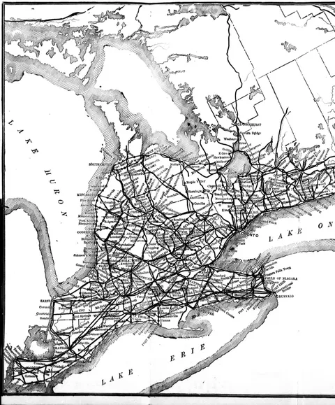 (opens in a new tab)
 Cyclists' Road Map of Ontario (west sheet) 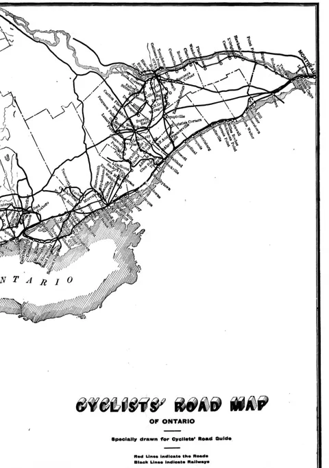 (opens in a new tab)
 Cyclists' Road Map of Ontario
16 advertisements
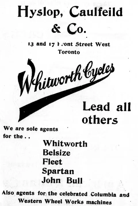 (opens in a new tab)
 Whitworth Cycles advertisement 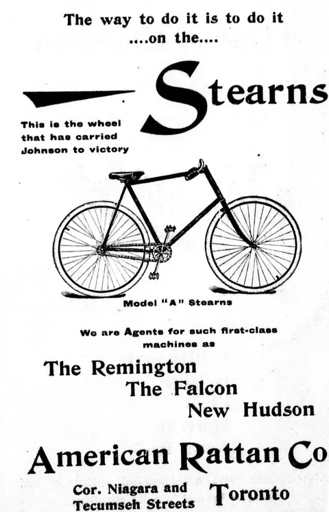 (opens in a new tab)
 Stearns Bicycle - Model A advertisement 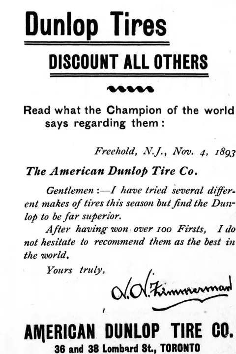 (opens in a new tab)
 Dunlop Tires advertisement 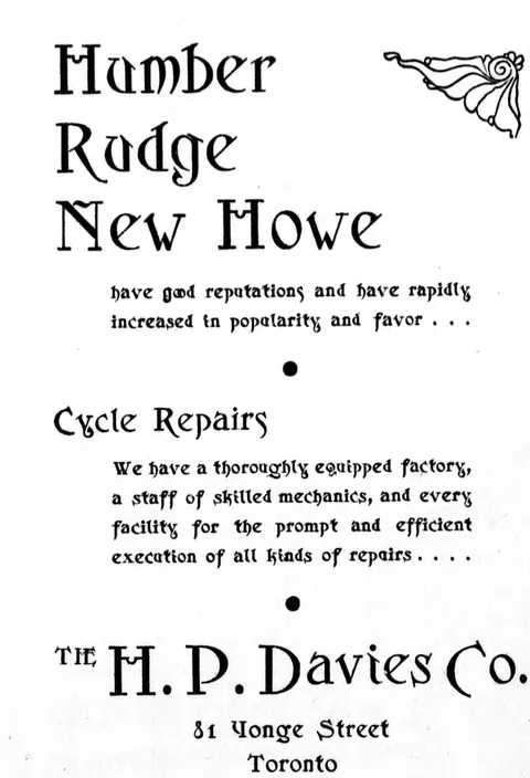 (opens in a new tab)
 Humber, Rudge, New Howe advertisement 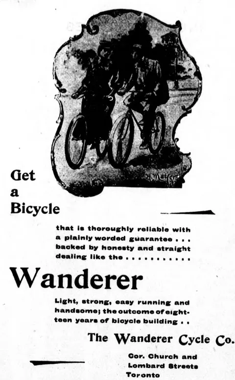 (opens in a new tab)
 Wanderer Bicycle advertisement  (opens in a new tab)
 We are not liars! advertisement  (opens in a new tab)
 We Manufacture advertisement 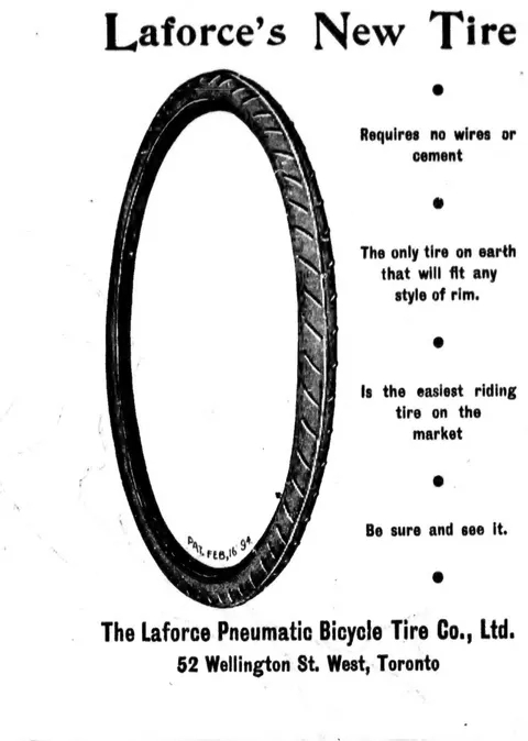 (opens in a new tab)
 Laforce's New Tire bicycle tire engraving 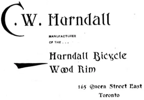 (opens in a new tab)
 C. W. Harndall, Harndall Bicycle Wood Rim  (opens in a new tab)
 Davis Bros., Diamond Merchants and Jewellers  (opens in a new tab)
 "Cycling"  (opens in a new tab)
 C. A. Deeks & Bro., Tailors and Importers 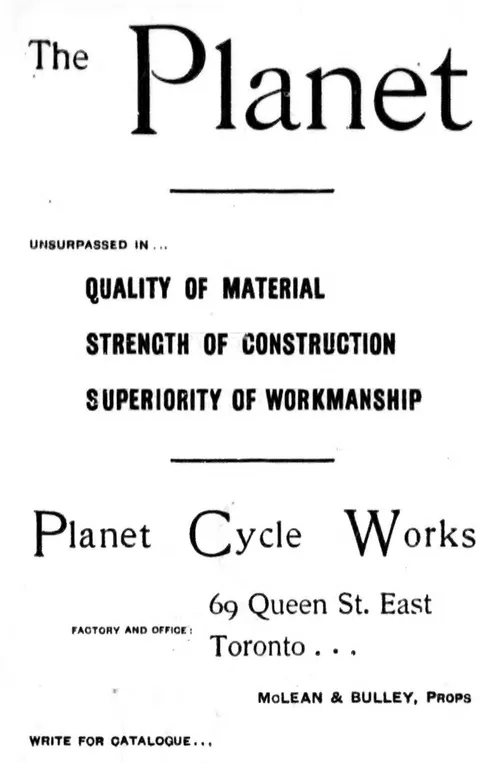 (opens in a new tab)
 Planet Cycle Works advertisement  (opens in a new tab)
 Brantford Cycles advertisement 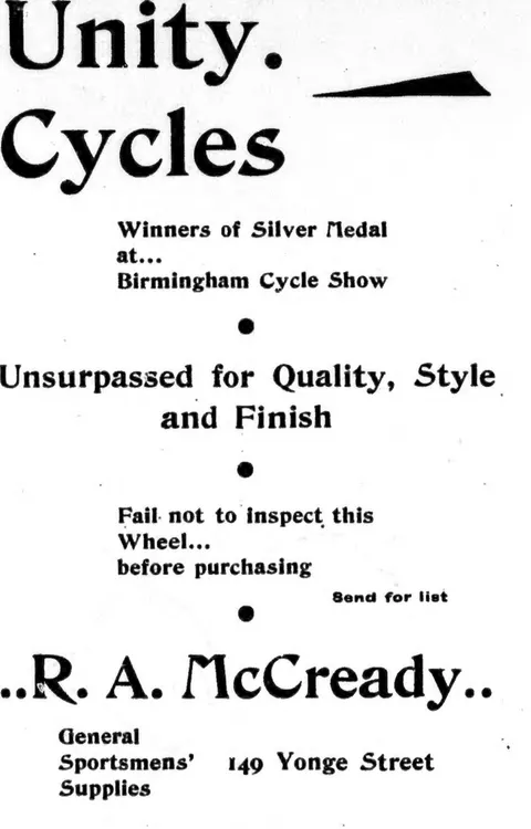 (opens in a new tab)
 Unity Cycles advertisement 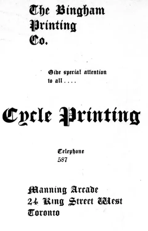 (opens in a new tab)
 Bingham Printing Co. advertisement