The Cyclist's Road Guide of Canada, with Map
Edited by Fred. Bryers1896145 chapters22 images
Contents
- Editor Fred Bryers explains that the first edition of 1894 sold out, so this second edition was revised and extended with new routes, junction points and the start and end of each route set in heavy type. Thanks J. M. Barnes of St. John, F. M. Macnaughton of Quebec, L. Blagdon of Fraserville, Colin McIntosh of Carleton Place, P. C. Dowdall of Almonte, Chas. Macnamara of Arnprior and T. H. Graham of Inglewood for their help.
- Alphabetical index running from Abbotsford and Aberfoyle to Zephyr, giving every place named in the guide with each page on which it appears; entries such as Guelph, Hamilton and Quebec carry six or more page references. Occupies nine leaves interleaved with full-page bicycle and tyre advertisements.
- Falls of Niagara (Parkside Inn) through Niagara Falls Town, Stamford, Thorold, St. Catharines (Grand Central), Beamsville, Grimsby, Stoney Creek, Hamilton at 51.5 miles (St. Nicholas), Burlington, Bronte, Oakville, Lorne Park and Port Credit to Toronto (Walker), 91.25 miles of good gravel and macadam. Branch (a) runs east to Queenston and Niagara-on-the-Lake (Long's); branch (b) leaves Oakville north by Trafalgar and Dundas street through Cooksville, Lambton Mills and Toronto Junction, 28 miles.
- Fort Erie north to the International Bridge, west to Stevensville, then north through Chippewa and Queen Victoria Park to the Falls of Niagara (Parkside Inn), Niagara Falls (American), Stamford and Queenston to Niagara (Long's), 33 miles. Good gravel to Stevensville, gravel and clay loam on to Chippewa.
- The guide's longest Ontario route: Hamilton (St. Nicholas) by Ancaster, Brantford (Belmont) at 23.5, Woodstock (Oxford) at 49.75, Ingersoll, London (Tecumseh), St. Thomas (Grand Central) at 97.25, Wallacetown at 115.25, Blenheim at 150, Leamington at 186 and Maidstone to Windsor (Crawford), 219 miles. Very heavy sand with many hills between Wallacetown and Clearville, after which the road becomes a regular race track for the last 45 miles.
- Running east then north from Blenheim (Sheldon) to Ridgetown (Arlington) at 10.5 miles, Dutton (McIntyre) at 22.5, Wallacetown (Ontario) at 35.5, Shedden and Fingal (Fulton) to St. Thomas (Grand Central). All fine gravel with no hills; taking the train from Ridgetown to Dutton escapes the sands around Clearville, and this was the route always chosen in the days of the solid-tired ordinary.
- Hamilton (St. Nicholas) by Dundas (Collins'), Greensville, Freelton (Duffy's), Puslinch, Morriston and Aberfoyle to Guelph (Wellington) at 32.25, then Marden (Burns'), Fergus, Mount Forest (Queen's) at 70.5, Durham (Middaugh) at 85.25 and Chatsworth (Somers') to Owen Sound (Patterson House), 111.75 miles. The stretch below Freelton crosses a swamp and is heavy after rain; the Garafraxa road runs straight into Owen Sound.
- Guelph (Wellington) north-west by Marden, Elora (Dalby), Teviotdale at 32 miles, Harriston (Royal) at 39.5, Mildmay, Walkerton (Hartley) at 61, Paisley at 77, Dumblane, Burgoyne and Port Elgin (American) to Southampton (Teahan's), 96 miles. Gravel all the way and mostly very fine, with numerous hills towards the north; Palmerston (Hess House) lies 4.5 miles west of Teviotdale.
- Guelph (Wellington) north-east through Eramosa, Everton and Ospringe to Brisbane at 16 miles, then Hillsburg, Reading, Orangeville (Paisley) at 29, Camilla, Shelburne (Royal) at 44.5, Horning's Mills, Maple Valley, Singhampton at 64, Duntroon (Black's) and Nottawa to Collingwood (Grand Central). Fine roads to Orangeville, then rough gravel and hilly clay and sand to Duntroon; Erin (Queen's) is 2 miles east of Brisbane.
- Hamilton (St. Nicholas) west by Dundas (Collins'), West Flamboro', Rockton, Galt, Preston (N. American) and Freeport to Berlin (Walper) at 35 miles, then Petersburg, Baden, New Hamburg (Commercial) and Shakespeare to Stratford (Albion), 63 miles. Hilly but good gravel and macadam with splendid scenery as far as Berlin, then very fine gravel with a rolling grade.
- Stratford (Albion) due west along the Hamilton and Goderich road through Sebringville, Mitchell (Hicks'), Dublin, Seaforth at 23.75 miles (Queen's), Clinton and Holmesville to Goderich (Albion), 44.75 miles. An alternative from Seaforth runs south by Egmondville, Brucefield and Bayfield, 29 miles; the Bayfield to Goderich stretch is known as the Wheelman's Paradise. Riders are warned not to coast blind hills.
- Goderich (Albion) north then east to Carlow (McDonagh's), Blythe and Belgrave, reaching Wingham (Brunswick) in 28.25 miles. All good gravel with a few small hills.
- Goderich (Albion) by the Lake Shore road for 2.5 miles, then east to Carlow (McDonagh's) and north-east through Dungannon and Kinlough to Kinloss, 28.5 miles of fair gravel with no heavy hills. From Kinloss the Durham road leads east to Walkerton or west to Kincardine.
- Stratford (Albion) north-west through Gadshill and Topping to Listowel (Queen's). Mostly clay with some gravel and essentially a dry-weather road; a little corduroy and a small hill or two do not damage the route.
- Listowel (Queen's) north-west by Molesworth, Morrisbank, Lochalsh, Amberley and Pine River to Kincardine (Royal). Fairly good gravel but sandy between Wingham and Bluevale, then rough, stony and somewhat hilly along the county line, with clay to Amberley and the Saugeen road north.
- Kincardine east by Riversdale and Greenock to Walkerton (Hartley) at 27 miles, then Hanover (Reid), Allan Park, Durham (Middaugh) at 43.75, Bunessan, Priceville (Commercial), Flesherton at 59, Maxwell, Singhampton at 75, Duntroon (Black's) and Nottawa to Collingwood (Grand Central). Mostly good gravel, with hills east of Walkerton and heavy ones east of Singhampton, the general grade falling towards Lake Huron.
- Stratford (Albion) east to Shakespeare, south to Tavistock (Commercial), then Strathallan (Lappen's) and direct south to Woodstock (Oxford), 25 miles. A beautiful gravel road with a few hills near Woodstock.
- Hamilton (St. Nicholas) by James street and the mountain brow through Ryckman's Corners, Mount Hope or Glanford (Dominion) and North Seneca to Caledonia (Leach's) at 13.5 miles, then Willow Grove, York, Hagersville (Lawson's), Garnet and Jarvis (Commercial) to Port Dover (Dominion), 38 miles. Stone roads to Caledonia and stone, gravel and clay beyond; on no account coast the mountain.
- Hamilton (St. Nicholas) up James street and over the Port Dover stone road through Ryckman's Corners, North Glanford, Mount Hope (Dominion) and North Seneca to Caledonia (Leach's) at 13.5 miles, then York, Mount Healey and Cayuga (Campbell) to Dunnville (Mansion), 39.5 miles. All clay from Caledonia along the east bank of the Grand River, fair in fine weather but quite hilly in parts.
- Dunnville (Mansion) east on the Robinson road through Attercliffe and Wellandport at 13 miles, then Fenwick, Ridgeville, Fonthill at 23.5, Allanburg, Thorold (Welland) and Merritton to St. Catharines (Grand Central), 36 miles. Clay and clay loam with sand around Fonthill, following the Welland Canal north from Allanburg.
- Port Dalhousie by the new canal bank to St. Catharines (Grand Central), then Merritton, Thorold (Welland), Allanburg, Port Robinson, Welland (Arlington) and Humberstone to Port Colborne (O'Neill's), 26.5 miles. Clay along the canal with a stone road to Thorold and gravel at the end; there is a heavy grade between St. Catharines and Thorold.
- A 12-mile alternative to the canal-bank route for riders who do not wish to see the locks: take St. Paul street west from St. Catharines to the top of the hill near the G.T.R. station, turn south-east past Decew's Falls, jog west half a mile and run direct south to Welland.
- Dunnville (Mansion) north and north-east to Canboro' at 4.5 miles, then by the Smithville road through Warner to Smithville (Royal) and north to Grimsby (Mansion), 24 miles. One mile of heavy sand and the balance good clay with no hills, but the road is very crooked and riders should ask their way often; walk down the mountain into Grimsby.
- Brantford (Belmont) by the Woodstock gravel road through Mount Vernon, Burford (Barnea), Harley and New Durham to Norwich (Brown's) at 23.25 miles, then Lynn's Corners, Newark, Mount Elgin at 34, Verchoyle, Culloden, Brownsville, Springfield and Glencolin to Aylmer (Brown), 55 miles. Good gravel to Brownsville, very poor sand to Springfield, then heavy sand, clay and gravel with some parts unrideable.
- Printed with the heading spelt Alymer. From Aylmer (Brown) south 4 miles, east 2.5 and south 2.5 over good gravel to Mount Salem and Gravesend, then along the Lake road on sand and gravel to Port Burwell, 16.5 miles.
- Fingal (Fulton) south 1.5 miles then east over good gravel to Port Stanley (Fraser), and east along the Lake Shore road by Dexter, Port Bruce, Copenhagen and Gravesend to Port Burwell, 28 miles. Gravel and sand, fair riding and fine scenery.
- Ingersoll (Atlantic) south by Salford, Mount Elgin and Ostrander to Tilsonburg (Queen's) at 14 miles, then Acacia, Eden, Staffordville and Vienna to Port Burwell, 30 miles. Good gravel to Tilsonburg, beyond which there is considerable drifting sand, but sidepaths are frequent and good and there are few hills.
- Ingersoll (Atlantic) north-west by the Thamesford gravel road (McCartney's), Kintore and Medina to St. Mary's (Windsor) at 22 miles, then McIntyre's Corners, Kirkton, Winchelsea and Elmville to Exeter (Commercial), 44 miles. All good gravel with only a few hills and none of them bad.
- Woodstock (Oxford) east on Dundas street and the Governor's road through Eastwood (Cornish's) to Paris, then by the west bank of the Grand River to Glen Morris and the east bank to Galt, Preston (N. American), Hespeler (Commercial) and Gourock, reaching Guelph (Wellington) in 49.5 miles. Excellent gravel to Paris with a little sand, rough sandy river-bank riding to Galt, then fair gravel.
- Woodstock (Oxford) east on Dundas street then south by Currie's Crossing, Holbrook, Burgessville and Lynn's Corners to Norwich (Brown's) at 16.5 miles, then Scotland, Round Plains and Simcoe (Battersby) to Port Dover (Dominion), 49.5 miles. Good gravel to Scotland, sandy and heavy to Round Plains, no hills of account; Port Ryerse, a romantic little spot, lies 2 miles east of Brown's hotel.
- Petersburg (Wuerschmidt) south-east by New Dundee, Roseville, Ayr (Hilborn) and Paris to Brantford (Belmont) at 29.5 miles, then Mohawk, Oakland, Waterford (Teeter's) at 45, Bloomsbury and Simcoe (Battersby) to Port Dover (Dominion), 61 miles. Good gravel but quite hilly about Ayr, then a little gravel and heavy sand to Waterford before a fine gravel road runs to Port Dover.
- St. Thomas (Grand Central) by North street and the London gravel road through Talbotville, Lambeth and Delaware, then north-west to Mount Brydges (Hodgins') and Strathroy (Queen's) at 29.5 miles, on by Adelaide and Keyser to Forest (Franklin). Good gravel all the way with no hills of consequence.
- St. Thomas (Grand Central) east on Talbot street by Yarmouth Centre and New Sarum to Aylmer (Brown) at 11 miles, then Springfield, Tilsonburg (Queen's) at 27, Courtland, Delhi and Atherton to Simcoe. Good gravel with a couple of hills to Aylmer; the poorly kept Tilsonburg section is recommended only in extremely dry weather, and there is heavy sand between Delhi and Atherton.
- Second route east from St. Thomas (Grand Central) by Talbot street to Aylmer (Brown) at 11 miles, then Bayham, Guysboro', Courtland, Delhi (Stoddard) at 38, Simcoe (Battersby) at 48 and Renton to Jarvis (Commercial). Fine gravel to Bayham, clay to Guysboro', heavy sand between Delhi and Atherton, then blue clay to Jarvis which is excellent in dry weather.
- Port Dover (Dominion) north-east by the Hamilton stage road to Jarvis (Commercial), then east on the Talbot road through Balmoral, Nelles' Corners, Decewsville, Canfield, Canboro', Attercliffe, Wellandport and Candasville to Welland (Fraser), and on by Crowland and Chippewa through Queen Victoria Park to the Falls of Niagara (Parkside Inn) and Niagara Falls (American), 92 miles. All clay or clay loam except the last few miles, but excellent riding in midsummer with no hills of consequence.
- Port Dover (Dominion) east along the Lake shore road by Nanticoke, South Cayuga and Rainham Centre to Dunnville (Mansion) at 33 miles, then the Forks road to Marshville, Humberstone, Ridgeway and Fort Erie, crossing to Buffalo (Tift), 77 miles. Clay the whole distance but fine in midsummer, with a fine gravel road east from Humberstone; Welland lies 8 miles north-east of Marshville.
- Harriston (Royal) south by Palmerston (Hess) and Gowanstown to Listowel (Queen's) at 15.5 miles, then Newry or Atwood, West Monkton and Bornholm to Mitchell (Hicks') at 37.5, and east to Sebringville and south by the Downie and Blanchard roads to St. Mary's (Windsor), 57 miles. The whole route is first-class gravel with few hills.
- A near-straight 123-mile line north from Port Stanley (Fraser) through St. Thomas (Grand Central), London (Tecumseh) at 28.5 miles, Masonville, Centralia, Exeter (Commercial), Wingham at 98.25, Glenannan, Teeswater (Commercial), Riversdale and Greenock to Walkerton (Hartley). It is the main road of the several counties it passes through, all good gravel with some very fine stretches and only a few light hills.
- Mitchell (Hicks) south-west to Russeldale, then by the Thames road west through Farquhar and Hay to Exeter (Commercial), 16.5 miles of good gravel.
- Walkerton (Hartley) west on the Durham road to the town line, then due south by Jamestown to Brussels (American) at 29 miles, and south-west by Walton's, Leadbury and Winthrop to Seaforth (Queen's), 45 miles. Fair gravel and stone which much improves towards the end.
- The Lake Huron shore route: Southampton (Teahan's) by the Saugeen road through Port Elgin (American) and Underwood to Kincardine (Royal) at 27.75 miles, then Pine River, Amberley, Kingsbridge and Port Albert to Goderich (Albion) at 58.75, on by Bayfield, Drysdale and Brewster to Grand Bend at 87.75, then inland by Parkhill (Franklin) and Springbank to Strathroy (Queen's), 116.75 miles. Exceptionally fine gravel to Grand Bend, where immense sand hills are met, then crooked clay roads impassable after rain.
- Port Elgin (American) by Burgoyne, Arkwright, Invermay and Kilsyth to Owen Sound (Paterson), then along the Georgian Bay shore through Woodford (Lemon's), Bayview (Hartford), Meaford (Paul), Thornbury (Revere), Clarksburg and Craigleith to Collingwood (Grand Central), and on by Nottawa (Black's), Stayner (Queen's), Sunnidale, Minesing and Midhurst to Barrie (Queen's). Good gravel to Owen Sound with only a couple of hills; the bay-shore run shows the Blue Mountains on one side and Georgian Bay on the other, and beyond Collingwood it is a dry-weather clay route.
- Leaving Owen Sound (Paterson) by Christie's Hill and running direct west through Jackson (Johnson's), Allenford (McCarroll's), Elsinore and Chippawa Hill, then south by Southampton (Teahan's) to Port Elgin (American), 26 miles. Good gravel with some hills for the first ten miles, then only one or two small ones, and fine scenery.
- London (Tecumseh) by Richmond street and the York street bridge to Lambeth, then south-west through Delaware (Delaware), Strathburn, Wardsville, Cashmere, Thamesville (Union), Kentbridge and Louisville to Chatham (Garner), 97.5 miles. First-class gravel to Wardsville, sandy and rough on to Thamesville, then good clay.
- Chatham (Garner) direct south over gravel to Charing Cross (Walker's), then by the Edgeware and Middle clay roads through East Tilbury, Belle River, Comber (Commercial) at 31 miles, Maidstone and Oldcastle to Windsor (Crawford), 59 miles. The most direct route between the two towns but only rideable in fine weather; a longer and much better road runs 5 miles south from Charing Cross to Buckhorn to pick up the famous Talbot gravel road.
- A 64-mile circular tour of Essex county from Belle River through Patillo, Pike's Creek, Tecumseh and Walkerville (Crown) to Windsor (Crawford) at 17 miles, then Sandwich (Stuart's), Chappel (Chappel's), Canard River and Gordon to Amherstburg (Lake View) at 35, and on by Vereker, Harrow and Kingsville (Exchange) to Leamington (Huffman). Rough and sandy from Belle River to Pike's Creek, fair gravel to Windsor, then poor sand, clay and gravel with some nice sidepaths on the river road.
- Toronto (Walker) west by College and Dundas streets through Toronto Junction (Occidental), Lambton Mills (Scott's) and Cooksville to Brampton (Queen's) at 25.75 miles, then Georgetown (Clark), Ballinafad, Guelph, Berlin (Walper), New Hamburg (Commercial) and Shakespeare to Stratford (Albion) at 104.5, on by St. Mary's, London (Tecumseh), Hyde Park, Poplar Hill and Amiens to Strathroy at 169.5, then Adelaide, Warwick and Reed's Corners to Sarnia (Vendome), 212.5 miles. From London to Sarnia the road is level as a billiard table and of fine gravel.
- Sarnia (Vendome) direct south along the river's edge through Corunna, Courtright (Bedard), Sombra (Whitely) at 18 miles and Port Lambton (International) to Wallaceburg (Hill's) at 33, then by the Baldoon clay road through Oldfield and Oungah into Chatham (Garner), 50 miles. Fine level clay and sand beside the river, clay beyond.
- Sarnia (Vendome) south-east on the Plank Road for 8.5 miles, then east on the tenth concession to Petrolia (Tecumseh) at 16 miles and south over a country road to Oil Springs (Cameron), 24 miles. Gravel to Petrolia and clay the balance, with no hills.
- Sarnia (Vendome) south-east on the plank road one mile then direct east over the fourth line through Mandamin, Wyoming (Commercial) and Wanstead to Watford (Dominion), 27.5 miles of good gravel with no hills.
- Clandeboye south and west by Maple Grove and Ailsa Craig to the London and Sarnia road at Amiens, then west and south to Strathroy at 27.25 miles and direct west by Napperton to Watford (Dominion), 39.25 miles of fairly good gravel nearly all the way.
- Ailsa Craig (Queen's) south one concession and direct west to Parkhill (Franklin), then north-west by Thedford, Forest (Franklin) and Kertch to Wyoming (Commercial), 45.5 miles. Fair sand and gravel, very bad at the Aux Sables river, fine gravel from Thedford to Forest and clay at Kertch.
- Wyoming (Commercial) south by Petrolia (Tecumseh), Oil Springs (Cameron) and Dawn Centre or Rutherford, then west to Dresden (Westcott) and along the north side of the River Sydenham to Wallaceburg. Gravel and good to Petrolia, clay to Dawn Centre, after which the roads improve and are built of gravel, clay and sand.
- Harriston east over fair gravel 8 miles, then north to Mount Forest, east 3 miles and north by Yeovil and Dromore to the Durham road, then good roads to Flesherton and straight north by Griersville to Meaford, 62.5 miles. The first half is rough and hard and the 5.5 miles north of Dromore very rough, but the scenery is beautiful throughout and the guide urges riders not to miss Eugenia Falls.
- Toronto (Walker) by College and Dundas streets through Carlton, Weston (Eagle), Thistleton, Woodbridge, Woodhill and Brampton (Queen's), then Inglewood (Dent's), Credit Forks and Cataract to Orangeville (Paisley) at 52.5 miles, on by Shelburne (Royal), Dundalk (Connor), Flesherton, Markdale and Chatsworth (Somers') to Owen Sound (Paterson) at 120, then Shallow Lake, Hepworth (Hermann) and Clavering to Wiarton (Arlington), 140 miles. Branch (a) turns west at Brampton through Georgetown (Clark), Acton (Agnew's) and Rockwood to Guelph (Wellington), 32 miles. Beautiful Credit Valley scenery and high, frequent hills north of Orangeville.
- Hamilton (St. Nicholas) by York street and the Lake Shore road to Bronte, then north to Milton (Queen's), east and north by Horner and Centreville to Brampton, and north through Edmonton, Victoria, Claude, Inglewood (Dent's), Credit Forks and Cataract to Orangeville (Paisley), 65.5 miles. Gravel and clay to Milton and clay the balance; all fair roads in good weather with few hills.
- Toronto (Walker) by College and Dundas streets and the Dundas road through Toronto Junction, Lambton Mills (Scott's), Summerville, Cooksville at 16.25 miles, Springfield, Trafalgar, Palermo and Boyne to Milton (Wallace) at 36.5, then Mansewood, Speyside, Acton (Agnew's) and Rockwood to Guelph (Wellington), 61.5 miles. Fair gravel with few hills as far as Palermo, then north over clay, gravel and rock road with some hills to Acton and fair gravel to Guelph.
- Toronto (Walker) west on College and Dundas streets to the Weston road, through Carlton, Weston (Eagle) and Thistleton to Woodbridge at 16 miles, then Woodhill, Tullamore, Sandhill, Victoria and Claude to Inglewood (Dent's), Credit Forks and Bellfountain at 45, and Erin (Queen's), Brisbane, Ospringe and Eramosa to Guelph (Wellington), 66.5 miles. Fair gravel to Weston and clay the balance, then through the Credit Valley to the Forks over clay, with good gravel improving as you go and some fine coasts and a few hills to climb.
- Toronto (Walker) west on College and Dundas streets then north-west by Weston (Eagle), Thistleton, Woodbridge, Kleinburg and Nobleton to Schomberg, and on through Alliston at 50.5 miles, Creemore, Stayner (Queen's), Duntroon (Black's) and Nottawa to Collingwood (Grand Central), 87 miles. Good gravel with some clay and hills to Schomberg, then nearly all clay, somewhat hilly and impassable in wet weather.
- Orangeville (Paisley) direct west on the town line through Waldemar at 10 miles to Arthur (Queen's) at 22, then Parker and Drayton (Royal) at 33, and on by Dorking and Tralee to Listowel. Fair gravel with a few hills to Arthur, mostly clay to Drayton, then gravel with a little clay.
- Orangeville (Paisley) south-west by Reading and Craigsholme to Fergus (Commercial), then Elora (Dalby), West Montrose, Winterbourne, Bloomingdale, Bridgeport and Berlin (Walper) to Waterloo (Zimmerman), 45 miles. Good gravel to Fergus, then only fair gravel, rough and stony in places, with a number of small hills and beautiful scenery.
- Waterloo (Zimmerman) north-west by Heidelburg, St. Clements, Crosshill, Linwood, Macton, Dorking and Tralee to Listowel, 37.5 miles. Good gravel to Crosshill, clay to Macton and gravel on to Listowel, with one or two hills.
- Hespeler (Commercial) west over sandy road then north by Freeport to Berlin (Walper) at 10 miles, Waterloo (Zimmerman), St. Jacobs and Elmira (O'Donnell) at 22, then Goldstone and Creekbank to Drayton (Royal), 36 miles. Good gravel then clay and gravel, with some hills but all easily rideable.
- Toronto (Walker) up Yonge street through Eglinton (Oulcott's), Newton Brook, Thornhill (Queen's), Richmond Hill (Dominion) and Bond's Lake to Aurora (Royal) at 24 miles, then Newmarket (Forsyth), Holland Landing (Sheppard's), Bradford (Hulse), Churchill and Painswick to Barrie (Queen's) at 55, and on by the Ridge road through Hawkestone (Orillia House), Orillia, Washago and Severn Bridge (Robinson's) to Gravenhurst (La Frena). Numerous but rideable hills; Oak Ridges between Bond Lake and Aurora is the height of land between Lakes Erie and Simcoe, and the Muskoka road is poor and sandy.
- A 20-mile round trip from Toronto (Walker) by College and Dundas streets and the Weston road through Carlton to Weston (Eagle), returning across the bridge at Weston down the west side of the river past Lambton Mills (Scott's) and The Humber (Nurse's) to the Lake Shore road. Fair macadam with one hill and good side paths.
- Toronto (Walker) by College and St. George streets to the asphalt Davenport road, then west to Bathurst, north to St. Clair avenue and north-west by Fairbank, Concord, Carrville and Maple into King. Clay from Fairbank and all gravel for the last stretch; Richmond Hill lies 4 miles east of Maple and Oak Ridges 4 miles east of King.
- Aurora (Royal) up Yonge street to the first cross road, then west three concessions and north to Kettleby, west to Lloydtown and north through Pottageville to Schomberg, 14 miles. Fair clay loam and some sand with a few hills at Pottageville.
- Toronto (Walker) by Queen street and the Kingston road through East Toronto (Warren's), Scarboro', Highland Creek (Kellar's), Dunbarton and Pickering (Gordon) to Whitby (Royal) at 20 miles, then Oshawa (Queen's), Bowmanville (Bennett), Newcastle at 48, Port Hope (Queen's) at 66.75, Cobourg (Dunham), Colborne, Brighton (Central) at 101.25, Trenton (Gilbert), Belleville (Anglo-American) at 123.75, Napanee (Paisley) and Cataraqui to Kingston (Brit. American), 172.75 miles. Good gravel and macadam, but several steep, crooked hills between Toronto and Bowmanville should not be coasted.
- Toronto (Walker) east on Queen street and the Kingston road nine miles through East Toronto (Warren's), Woburn, Malvern and Armadale, then north to Markham (Franklin), Ringwood (Button's), Ballantrae, Vivian and Mount Albert, on by Zephyr (Shepard's) and Ravenshoe Station to Sutton and Jackson's Point (Mansion). Good gravel on the Kingston road, poor road to Markham, fine gravel to Ballantrae, then two miles of poor sand before the road improves.
- Leaving Toronto (Walker) by Gerrard street and Jones avenue to Danforth avenue, then east past East Toronto (Warren's) through Ellesmere, Milliken, Hagerman's Corners and Unionville to Markham (Franklin), 19.5 miles. Pavement to Danforth avenue, then sand with good side paths, gravel, four miles of clay and good gravel at the end, with no hills.
- Printed with the heading spelt Orilla. Newmarket (Forsyth) east by Huron street then north through Sharon, Queensville, Keswick and Roche's Point at 13.5 miles and Belhaven to Sutton and Jackson's Point (Mansion) at 21.5, then Virginia to Beaverton (Hamilton) at 38, and by the Centre road through Gamebridge, Brechin (Oberend's), Uptergrove and Atherley (Gaudaur's) to Orillia, 62 miles. Nearly all good gravel with a couple of sandy hills, first-class gravel to Beaverton, then one sand hill and a little corduroy.
- Newmarket (Forsyth) east by Gorham street to Pine Orchard, then Lemonville, Ringwood (Button's) and Stouffville (Mansion) at 17.5 miles, on by the Stouffville gravel road through Goodwood to Uxbridge at 27.5 and south-east by Epsom to Port Perry (Oriental), 37 miles. Mostly gravel with a few hills, a little sand and some clay.
- Sutton (Mansion) east through Virginia, Pefferlaw and Wilfrid to Cannington (Queen's) at 18.5 miles, then Manilla, Oakwood and Lindsay (Bradburn) at 37.5, Reaboro' and Omemee to Peterboro' (Grand Central) at 62.5, on by Indian River, South Dummer and Norwood (Brennan) at 80.5, Hastings (Clarendon) and Campbellford (Windsor) at 97.5, then Burnbrae, Stirling and Foxboro' to Belleville (Anglo-American), 129 miles. First-class gravel with no hills to Manilla, then very heavy hills, poor clay and gravel to Norwood, and good gravel from Stirling.
- Pickering (Gordon's) north by the Brock road through Brougham to Claremont, then a jog west on the fourth concession for 15 miles, north to Zephyr and on to Sutton and Jackson's Point (Mansion), 39 miles. Nearly all fair gravel with some clay and sand, rather hilly in some parts.
- Whitby north by the Whitby and Port Perry gravel road through Manchester to Port Perry (Oriental) at 16 miles, then by Simcoe street north-east to the county line at Seagrave and north over hilly gravel to Cannington (Queen's), finishing north-west on the Cameron gravel road to Beaverton (Hamilton). All good wheeling.
- Bowmanville (Bennett) up Scugog street and straight north through Hampton (Beer's), Enniskillen and Burketon to Blackstock (Royal), then west to Lake Scugog and across the bridge to Scugog Island and Port Perry (Oriental), 24 miles. Fairly good gravel with a short stretch of sand and only one hill.
- Oshawa (Queen's) north by the Reach road through Columbus to Port Perry (Oriental) at 17 miles, then west to Uxbridge and north on the Brock road by Victoria Corners, Vallentyne and Wilfrid, turning west and north through Virginia to Sutton (Mansion), 52 miles. Gravel with some clay, but some hills and rough road between Uxbridge and Wilfrid; Sunderland with its two good hotels lies 4 miles south-east of Vallentyne.
- Taking the Verulam road north and east from Lindsay (Benson) through Dunsford to Bobcaygeon (Read) at 22 miles, then south along the county line to the bridge at Pigeon Lake and east to Ennismore, crossing Chemong Lake to Peterboro' (Grand Central), 43 miles. Clay and gravel, with a pleasant steamer excursion available from Bobcaygeon to Chemong Park.
- Newcastle north by Orono (N. American), Kirby, Pontypool and Ballyduff to Bethany (Hamilton's) at 25.5 miles, then Fleetwood and Reaboro' to Lindsay (Benson), 42 miles. Good gravel to Orono, somewhat sandy but rideable to Bethany, then clay and gravel and gravel to Lindsay, with a few small hills.
- Port Hope (Queen's) north by Welcome, Canton, Perrytown and Garden Hill to Millbrook (Queen's) at 16.25 miles, then Cavanville, Ida and Mount Pleasant, continuing north 3.5 miles and west 2.5 miles to Omemee (Bradburn), 32.5 miles. Good gravel and clay road with few hills.
- Port Hope (Queen's) north by Dale, Rossmount, Bewdley, Baillieboro', South Monaghan or Centreville, Fraserville and Springville to Peterboro' (Grand Central), 34 miles of fair gravel with a few hills. Millbrook lies 5 miles west of South Monaghan.
- Peterboro' (Oriental) north by George street along the west side of the Otonabee River to Lakefield (Munroe), then on to Young's Point (Kearney), 14 miles of good gravel road, with pleasant excursions to be had on the lakes from Young's Point.
- Cobourg (Dunham) north through Baltimore (Pickering's) to Harwood on Rice Lake, 15 miles. Fair gravel to Baltimore then sandy and poor, the road running parallel with the old railway; there is a summer hotel at Harwood.
- Cobourg (Dunham) north 4 miles, then a jog west and north by Cold Springs and Plainville, taking the right-hand fork north-east to Gore's Landing, 13 miles. Fair gravel with a mile or two of sand and no hills; there is a summer hotel at Gore's Landing.
- Cobourg (Dunham) by Division street north and north-east to Baltimore (Pickering's), then Fenella and Roseneath (Edington) to Hastings (Clarendon), 31 miles. Good gravel to Baltimore and considerable sand beyond, with no hills of consequence, and rain rather improves the going.
- Colborne (Bristol) north to Castleton, then east to Morganston and on by Warkworth (Leonard) and Brickley, east 2 miles and north to Hastings (Clarendon), 29 miles of good gravel, rather uphill.
- Brighton (Central) north-west and north by Hilton, Newcombe's Mills, Codrington, Mallory's Corners and Meyersburg to Campbellford (Windsor), 24 miles. Gravel and clay to Meyersburg then good gravel, a little uphill.
- Hastings (Clarendon) south by Brickley, Warkworth (Leonard), Norham, Mallory's Corners, Codrington, Newcombe's Mills, Wooler and Rosa to Trenton (Gilbert), 36 miles. Good gravel the whole distance and down grade all the way.
- Newcombe Mills east to Wooler, then north-east by Stockdale to Frankford (Clarke) at 13 miles, and on by Wallbridge and Foxboro' south to Belleville (Anglo-American), 28 miles of fair gravel. Trenton lies 8 miles south of Frankford, all downhill along the river on good gravel.
- Trenton (Gilbert) along the Bay of Quinte shore to Carrying Place, then by the lake shore through Consecon (Porter's), Hillier, Wellington (Garrett) and Bloomfield to Picton (Royal), 32 miles. Simply follow the telegraph line the whole way; good gravel roads and pretty scenery, and a little rain improves the surface. Brighton lies 10 miles west of Carrying Place.
- A 5-mile run from Picton by Main street east to Bridge Street Hill, across the bridge and left, then due east 1.5 miles to the hill and along the telegraph line to Glenora and the Lake on the Mountain (Glen House). Good gravel.
- Picton west by Main street to the East Lake road, then south-west along the telegraph line 3.5 miles to Woodrow's Corners and right over a good gravel road on the north side of East Lake to West Point (Lake Shore House), 11 miles.
- Picton east by Main street to the Bay Shore road and on to Peterson's Ferry opposite Deseronto (O'Connor), then east to Napanee (Paisley), 24 miles. Good gravel and clay to the ferry, then a rough and stony road into Napanee.
- Napanee (Paisley) north-east by Napanee Mills, Newburg (Hope's) and Camden East (McCarthy's), then straight north through Centreville to Tamworth, 22 miles of excellent gravel road the whole distance.
- Picton (Royal) west by Main street to the East Lake road, following the telegraph line to Cherry Valley at 5 miles, then west along the south shore of East Lake to Salmon Point, 12 miles of good gravel. Milford lies 4 miles east of Cherry Valley or 7 miles south of Picton.
- Picton (Royal) by the Lake road through Glenora and the Lake on the Mountain (Glen), Young's Point, Adolphustown, Conway, Sandhurst, Bath (Bay View), Mill Haven and Collin's Bay to Kingston (Br. American), 35.5 miles. Beautiful scenery all the way over clay and gravel with some sand, fine in dry weather; a ferry connects the Lake on the Mountain with Young's Point.
- Kingston (Br. American) by Ontario street and the long bridge, then the river road through Gananoque (International), Lansdowne, Mallorytown and Lyn to Brockville (Grand Central), on by Maitland, Prescott (Daniel's), Iroquois, Morrisburg (Windsor) and Dickinson's Landing (Ryan's) to Cornwall (Rossmore) at 107.5 miles, then Lancaster (McRae's), Coteau, Vaudreuil (Serre), St. Anne's, Pointe Claire and Lachine (Harvey) to Montreal (Queen's), 186 miles. Fair macadam to Gananoque and very fine riding with beautiful scenery from Brockville; the Ottawa is crossed to St. Anne's by the railway bridge, and Cornwall wheelmen are building cinder paths.
- Kingston (Br. American) north-east by Cataraqui, Glenville, Murvale and Harrowsmith, then west by Yarker to Camden East (McCarthy's), 27 miles. Good gravel, rather hilly for a few miles, with the road improving west of Harrowsmith.
- Kingston (Br. American) by Princess street north-west to Cataraqui, then north to Elginburgh and north-west to Sydenham, 14 miles of good gravel but hilly, with fine scenery. Inverary lies 6 miles north-east of Elginburgh over a good gravel road.
- Kingston (Br. American) by Montreal street to the outer G.T.R. station, then the main road north-east through Sunbury at 10.5 miles to Battersea, 17 miles. Only fair gravel with some hills; Inverary lies 3 miles west of Sunbury.
- Kingston (Br. American) over the long bridge past the Royal Military College and Fort Henry, following the Rideau by Barriefield, Kingston Mills, Joyceville, Washburn and Brewer's Mills to Seeley's Bay at 23.5 miles, then Lyndhurst, Delta, Philipsville, Portland and Oliver's Ferry (Coutt's) to Perth (Hicks) at 67, on by Franktown, Prospect and Dwyer Hill to Richmond (Reilly's) at 97, then Fallowfield (O'Meara's), Bell's Corners (Brown's), Britannia (Charles) and Hintonburg to Ottawa (Russell), 116 miles. Hilly and stony to Perth, dirt road with clay and sand to Richmond, then the Richmond macadam into Ottawa.
- Merrickville west and north-west by Montague to Smith's Falls (Wardrope), then south-west to Lombardy and north to Oliver's Ferry (Coutt's), 23 miles. Fair wheeling most of the way on a fair stage road that is somewhat sandy.
- Montreal (Queen's) by St. Antoine street and the Lachine road through Blue Bonnets, Lachine (Harvey), Dorval, Pointe Claire (Duchesnes), Ste. Anne's (Charlebois), Vaudreuil (Serre) and Hudson (Mrs. Amsbury) to Rigaud (Chevrier) at 45.5 miles, then Point Fortune (Seguin), Hawkesbury (McManus) and L'Orignal (St. Denis) at 73.5, on by Alfred, Plantagenet (Wilson) and Wendover (Rouleau) at 97.5, then Rockland (Langevin), Cumberland (Windsor) and St. Joseph (Lauzon) to Ottawa (Russell), 128.5 miles. Fine macadam to Ste. Anne's, clay roads only fair in dry weather to Rigaud, and sandy and rough at the head of the Long Sault rapids.
- Ottawa (Russell) by the Richmond macadam road through Hintonburg, Birchtown (Barnes) and Britannia (Charles) to Bell's Corners (Brown's), then west to Stittsville, north 2 miles and west to Carleton Place, and round Mississippi Lake to Lanark. Fair sand and gravel, somewhat stony in places, with a fine sand road from Carleton Place to Lanark.
- Arnprior (Richman's) by Pakenham (Sheehan's), Blakeney (Fenelon's) and Almonte, then west 1.5 miles and straight south over good clay with some gravel to Black's Corners, and west following the telegraph poles into Perth. Good sandy and gravel roads.
- Second route between the towns, taking the third line of Fitzroy from Arnprior (Richman's) through Antrim, Panmure and Powell, then south-west to Almonte (Davis). Mostly fair and fairly level.
- Arnprior (Richman's) east 4 miles then north-east by Galetta and Fitzroy Harbor to the Ferry Landing and across to Quyon, 14.5 miles. Nearly all clay to Fitzroy Harbor, then sandy along the river bank to the ferry.
- Ottawa (Russell) south-west by Birchtown (Barnes') and Britannia (Charles') to South March, then Carp (Dooley's) and south-west to Almonte (Davis), 31 miles. Good gravel to Britannia, rough and stony west to Carp, then fairly good gravel with some sandy patches.
- Ottawa (Russell) by Hintonburg, Birchtown (Barnes'), Britannia (Charles'), South March, Carp (Dooley's) and Kinburn to Arnprior (Richman's), then north-west through Braeside, Sand Point and Castleford to Renfrew (Plaunt). Stony to Carp, clay to Kinburn, sand and clay to Arnprior, then clay to Braeside and good gravel with three short steep hills.
- Ottawa (Russell) by the Richmond macadam road through Hintonburg, Birchtown (Barnes'), Britannia (Charles'), Bell's Corners (Brown's) and Fallowfield (O'Meara's) to Richmond (Reilly's) at 19 miles, then Prospect, Franktown (Loney's) and Numogate to Smith's Falls (Wardrope) at 46, on by Newbliss, Toledo, Frankville, Addison, Glen Buell and Lyn to Brockville (Grand Central), 77 miles. Clay, sandy and stony west of Richmond but mostly macadam and good wheeling, with no hills of consequence.
- Ottawa (Russell) by the Richmond gravel road through Britannia (Charles'), Bell's Corners (Brown's) and Fallowfield (O'Meara's) to Richmond (Reilly's), then south-east to North Gower (Ferguson's), south-west to Burritt's Rapids and west to Merrickville at 44.5 miles, then North Augusta and Algonquin to Maitland, 68 miles. Sand and clay loam to Merrickville, then clay loam and gravel with a number of hills, only good in dry weather.
- Ottawa (Russell) by the Richmond road to Hintonburg, then Merivale, Manotick (McCarney's) and Carsonby to North Gower (Ferguson's), 26 miles. Macadam to Merivale, then clay and sand loam and somewhat rough beyond.
- Ottawa (Russell) by Bank street south-east through Billings' Bridge and South Gloucester (O'Connor's) to Metcalfe (Commercial) at 20 miles, then Dawson and West Osgoode, following the road between the railway and the Rideau River to Kemptville (Burrill) at 40, and south-east by Christie's Corners and Spencerville to Prescott (Daniels), 65 miles. Macadam for 20 miles then mostly clay with rough, sandy and stony parts, many nice footpaths and a number of hills.
- Ottawa (Russell) south-east on the main road through Hawthorn (Graham's) and Ramsey's Corners to Eastman Springs (Dominion), 14 miles. Macadam to Hawthorn, then clay and sand only rideable in dry weather.
- Ottawa (Russell) by the Richmond gravel road past the sixth milestone, then west over clay through Hintonburg, Birchtown (Barnes'), Britannia (Charles') and South March, and north-west over good dirt road to Dunrobin, 19 miles. Lake Constance lies about 3 miles north of South March and half a mile east of the road.
- Ottawa (Russell) by Wellington to Bridge street, across to Hull and along the river past Bison's Hotel and Dechene's Crossing to Aylmer (Mrs. Ritchie's), 9 miles of fine macadam all the way, slightly up grade.
- Ottawa (Russell) into Hull by Bridge street, left past Eddy's factory and across Brigham's Creek to Ironsides and Long Hill, then right across the Gatineau River by Gatineau Point to Templeton, 16 miles. Splendid macadam to the foot of the hill, then a sandy road; returning, take the ferry to the south shore and wheel back by the Montreal road.
- Ottawa (Russell) across the river to Hull, then Ironsides and Chelsea (Moore's), Kirk's Ferry, Cascades and Piche to North Wakefield with its two hotels, 24 miles. Good macadam as far as Chelsea, then a good dirt road with several stiff hills.
- Lanark (Dobbie) direct south by Balderson to Perth (Hicks') over a fair stone road, then south-east by Port Elmsley over rough clay and gravel to Smith's Falls (Wardrope), 24 miles.
- An 85-mile circuit from Montreal (Queen's) by Sherbrooke street and the Upper Lachine road through Blue Bonnets, Lachine (Harvey's), Dorval, Valois, Pointe Claire (Duchesnes) and Beaconsfield to St. Anne's at 23.5 miles, then north by St. Genevieve and Bord a Plouffe to Sault au Recollet at 54.5, and east past the rapids to Bout des L'Isle before turning back through Longue Pointe and Hochelaga. All good macadam with a fine view of Lake St. Louis; Moore's song was composed on the border of the rapid at St. Anne's.
- Montreal (Queen's) by Sherbrooke and Bleury streets north to Back River and Sault au Recollet over good macadam, then across the toll bridge and east along the bank by St. Vincent de Paul to Terrebonne (Hotel Boulevarde), 15 miles. Two toll bridges are crossed at 5c. each.
- Montreal (Queen's) by Longueuil and the old military road to Chambly at 15 miles, then Marieville, Rougemont, St. Cesaire and Abbotsford to Granby (Windsor) at 53, on by Waterloo (Canada), Frost Village, South Stukely and Eastman to Magog (Park) at 97, then Ayer's Flats (Ayer's) and Stanstead at 117, Derby Line and Derby Centre to Newport, Vermont (Memphremagog), 126 miles. Fine macadam to Granby, corduroy and hilly country to Magog; Morrill's Hill is the highest point in the Eastern Townships and Derby Line the boundary with the United States. Follow the telegraph lines for the shortest main routes.
- Waterloo (Canada) by St. Anne de Stukley and Lawrenceville to Melbourne and Richmond at 33 miles, then Windsor Mills, Brampton Falls and Sherbrooke (Magog) at 57, on by Lennoxville, Waterville, Compton and Hillhurst to Coaticook, 80 miles. Fair and a little hilly to Lawrenceville, then some very heavy sand; tourists are particularly cautioned against coasting the hills, which contain places that would wreck most machines.
- The 194-mile north-shore route from Montreal (Queen's) through Hochelaga, Longue Pointe and Point aux Trembles to Bout de L'Isle, then by ferry to Repentigny and on through L'Epiphanie, Lavaltrie, Lanoraie, Berthier, Maskinonge, Louiseville, Yamachiche and Point du Lac to Three Rivers, then Champlain, Batiscan and its windlass ferry, St. Anne de la Parade, Grondines, Deschambault, Portneuf, St. Bazile, Pont Rouge and Belair to Quebec (Frontenac). Acres of sand around Lanoraie where walking is the only alternative, sawdust roads past Batiscan, macadam from St. Anne de la Parade and the finest piece of road from Deschambault to Portneuf; the journey was made by Louis Rubenstein of the Montreal Bicycle Club with J. H. Thomlinson.
- A 54-mile circuit from Quebec (Frontenac) by the island ferry from Champlain market wharf to Beaulieu, then St. Pierre, St. Laurent, St. Jean d'Orleans, St. Francois and St. Famille. Beaulieu has the island's only hotel, first-class in every respect, with good boarding houses elsewhere; the St. Laurent to St. Francois road is very good and the rest is not, and the direct road from Beaulieu to St. Laurent is covered by perennial mud for three miles.
- Take the Levis ferry from Quebec (Frontenac) to Levis (Kennebec), walk ten minutes up the heights and run south by St. Henri, St. Mary Beauce (Central House) and St. Joseph (Hotel St. Joseph) to Jackman, Maine (Newton House), 110 miles. Good macadam to St. Henri, a 3c. toll at the Etchemin river, then clay and sand that dries quickly; beyond St. Joseph the country gets wilder and sand and hills are met near the boundary, though it is rarely necessary to walk.
- Quebec (Frontenac) by the St. Charles bridge and Dorchester street east through Montmorency Falls (Bureau's), Auge Gardieu and Chateau Richer to St. Anne de Beaupre (Regina), then St. Tite des Caps, St. Cassien, St. Paul's Bay, Les Eboulements (Tremblay's), Point a Pic (Chamard), Murray Bay, St. Fidele and Port au Persil to Tadousac, 147 miles. The very best macadam to Chateau Richer then little-used clay with sand and stiff hills; Ste. Anne has the world-renowned miracle-working shrine, and beyond Murray Bay is terra incognita.
- The 243-mile south-shore run from Levis (Kennebec) by Beaumont, St. Michel and Berthier to Montmagny (Mrs. Cote's) at 34 miles, then L'Islet (Plourde's), St. Jean Port Joli (Fournier's) and River Ouelle to Kamouraska (Bellevere) at 95.5, on by St. Andre and Riviere du Loup (Commercial) to Cacouna (St. Lawrence Hall) at 122, then Isle Verte, Trois Pistoles, St. Fabien and Bic (Pineau's) to Rimouski at 182, and St. Flavie, Grand Metis, Little Metis (Astle) at 217 and Sandy Bay to Matane (Mrs. Moreau's). Three pretty steep hills between Isle Verte and Trois Pistoles; Bic to Matane by Grand and Little Metis is called the best stretch of road in the country, almost level with splendid marine views.
- Printed with Edmondston in the heading. Riviere du Loup (Commercial) by St. Francois (Fournier's) to St. Honore (Morin's) at 26 miles, then Fort Ingalls (Michoud's), Notre Dame du Lac (Lake House) at 47 and Ste. Rose (Dumond's) to Edmundston, N.B. (Royal), 82 miles. The connecting link between Quebec and St. John; roads are very fair, uphill but good to St. Honore then downhill for 20 miles, with very fine views along Lake Temiscouata and first-class roads to Edmundston.
- Chambord (American) by Metabechouan, St. Cyriac and Jonquieres to Chicoutimi (Martin's), 66 miles. Chambord Junction is on Lake St. John, 180 miles from Quebec by rail, and the run to the head of navigation on the Saguenay is an exceedingly satisfactory tour with good roads, magnificent scenery and first-class Maisons de Pension; a little sand is met at Metabechouan.
- Ferry across the head of the Baie de Chaleurs from Campbellton (McIntire's) to Cross Point, then east by Carleton, Maria, Cascapedia and St. Charles de Caplan to New Carlisle at 86 miles, on by Paspebiac, Newport at 122, Grand River and Perce (Flynn's) at 155 and Point St. Peter to Gaspe Basin (Baker's), 191 miles. Well travelled and generally in excellent condition, skirting the Baie de Chaleurs for its whole 200 miles, with magnificent sea and mountain scenery, first-rate hotels and maisons de pension and good fishing at almost every point.
- Edmundston (Hebert) down the St. John valley by Grand Falls (Commercial) at 35 miles, Andover (Perley's), Florenceville (McMullin), Woodstock (Wilbur) and Fredericton (Queen's) to St. John (Dufferin), 239 miles. At Andover a road crosses the river and follows the railroad, freest from hills, while the main post road on the opposite side is hillier and less settled; watering troughs are numerous, the hotels other than Florenceville are C.W.A. houses giving members special rates, and consuls are at Woodstock, Fredericton and St. John.
- St. John (Dufferin) by Hampton (Vendome), Sussex (Depot), Petitcodiac (Mansard), Moncton (American), Dorchester (Windsor) and Sackville (Brunswick) to Amherst (Amherst), 148 miles. Wheeling is very good and nearly all these hotels give special rates to C.W.A. members, with consuls at St. John, Sussex, Moncton and Amherst; the road onward to Halifax is little used since the railway was built.
- St. John (Dufferin) by steamer across the Bay of Fundy to Digby (New Royal) at 45 miles, then up the Annapolis valley by Clementsport, Annapolis (Queen), Bridgetown (Grand Central) and Lawrencetown (Elm House) at 90, on by Kentville (Porter House), Wolfville (Royal), Windsor (Thomas) and Bedford to Halifax (Queen), 201 miles. The crossing on the steamer Prince Rupert is delightful; the road is fair with long stretches of good gravel to Lawrencetown, too sandy for a bicycle on to Kentville, then good wheeling past Wolfville college and Grand Pre and along the Bedford basin.
- Yarmouth (Grand) by Hebron, Maitland, Meteghan (Germain's) and Weymouth (Black's) to Digby (New Royal), 72 miles of good road all the way. The route is in sight of the Bay of Fundy and St. Mary's Bay until within a few miles of Digby, and the people between Meteghan and Maitland are mostly French.
- The Southern route by the main post road: Yarmouth through Lower Argyle (Acadian), Barrington (Coffin's), Clyde River, Shelburne and Lockeport (Sea View) to Liverpool (Trilby) at 125 miles, then Mill Village (Phelan's), Bridgewater (Fairview), Lunenburg (King's), Mahone Bay, Chester (Lovett), Hubbard's Cove (Shatford's) and St. Margaret's Bay to Halifax (Queen), 234 miles. Good hard clay with some sand to Lunenburg and first-class gravel beyond; hardly as good a route as by Annapolis and Windsor and further from the railways, but the Atlantic is in full view the whole distance.
- Divisional heading opening the western section of the guide, which carries nine routes covering Manitoba and the North-West Territories from Winnipeg, Brandon and Portage la Prairie to Selkirk, Emerson, Moosomin and the Calgary trails.
- Winnipeg (Leland) straight north by Main street through Kildonan, Parkdale and Lower Fort Garry to West Selkirk (Donohoue's), 23 miles. One road that no one could miss, a good clay road but not passable after a shower; the run passes the historic church and graveyard where the first settlers are buried, the Indian Industrial School at St. Paul's, the Hudson Bay Co.'s stockaded fort, a lunatic asylum and the largest government fish hatcheries in the Dominion.
- Brandon (Grand View) west by Kemnay, Alexander (Commercial) and Griswold to Oak Lake (Leland) at 34 miles, then Routledge, Virden (Balmoral) at 52, Hargrave, Elkhorn (Cavanagh) at 70 and Fleming to Moosomin (Queen's), 92 miles. The road lies almost parallel with the railway track and is well travelled; the soil is clay with a slight mixture of sand and gets into wheeling shape soon after even a heavy rain, and stone-built Virden is by all odds the best midway stopping place.
- Winnipeg (Leland) west by Portage avenue along the old Assiniboine Trail through St. James, Deer Lodge (Chadwick's), Silver Heights, St. Charles, Headingly (Royal Arms), St. Francois Xavier and Pigeon Lake to Baie St. Paul at 30 miles, then Poplar Point and High Bluff to Portage la Prairie (Albion), 63 miles. A heavy clay road, always good except after rain; Silver Heights is Sir Donald A. Smith's Manitoba residence, with the last herd of buffalo in the province, and High Bluff to Portage is considered the finest piece of road on the trip.
- Winnipeg (Leland) south from the Leland House by Main street across the Assiniboine and down River avenue and Pembina street, following the electric car track, then St. Norbert, St. Agathe (Oliver's Stopping Place) and Morris (Commercial) at 40 miles, on by St. Jean Baptiste (Parenteau's) and Letellier (Parent's) to Emerson (Russell), 65 miles. Clay all the way and well travelled, excellent wheeling except after rain; Pembina, N.D., is about three miles beyond Emerson over a good road.
- Portage la Prairie (Albion) west on Saskatchewan avenue by Burnside and Bagot to McGregor (Stanley House) at 26 miles, then Austin (Duncan's), Sidney (Sidney House) and Melbourne to Carberry (Western House) at 58, and Sewell, Douglas (New Douglas) and Chater to Brandon (Grand View), 87 miles. One trail running almost parallel with the railway, but the sand hills between McGregor and Austin are practically unwheelable and the tourist is advised to board the C.P.R. at Portage and stay on until Carberry.
- Calgary (Royal) south on the MacLeod trail by Fish Creek, Pine Creek and Dewdney (Queen's) to High River (High River) at 40 miles, then Mosquito Creek to MacLeod (MacLeod), 110 miles. Fair level riding to Dewdney then rather hilly but good and hard; the farmers are hospitable, the scenery grand, and the many little creeks crossed have convenient railway bridges.
- Calgary (Royal) north-east and south-east by the Blackfoot trail to Langdon, 28 miles. Rather hilly but a good road.
- Calgary (Royal) west on the North Morley trail to Twin Bridges, 9.25 miles. A little hilly at the start but level further on and all good roads, with fine scenery and trout fishing on the Bow River.
Images in this book 22 pictures from 143 pages
Maps 2
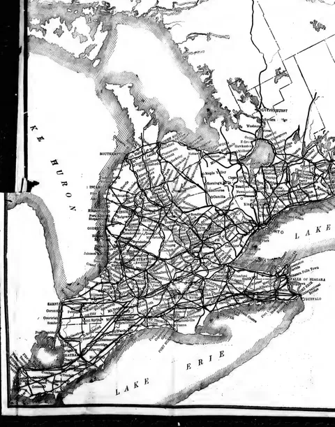 (opens in a new tab)
 Cyclists' Road Map of Ontario (west half) 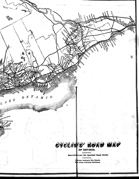 (opens in a new tab)
 Cyclists' Road Map of Ontario (east half)
20 advertisements
 (opens in a new tab)
 Griffiths Special  (opens in a new tab)
 Res-Flex Tires 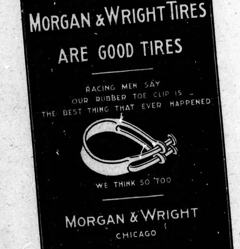 (opens in a new tab)
 Morgan & Wright Tires 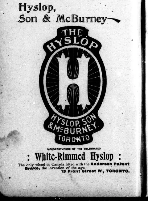 (opens in a new tab)
 White-Rimmed Hyslop 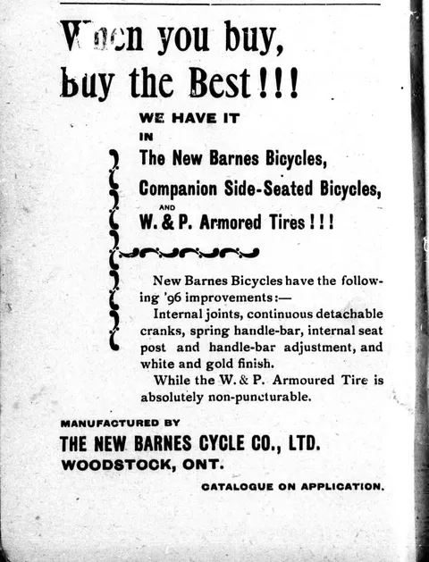 (opens in a new tab)
 New Barnes Bicycles 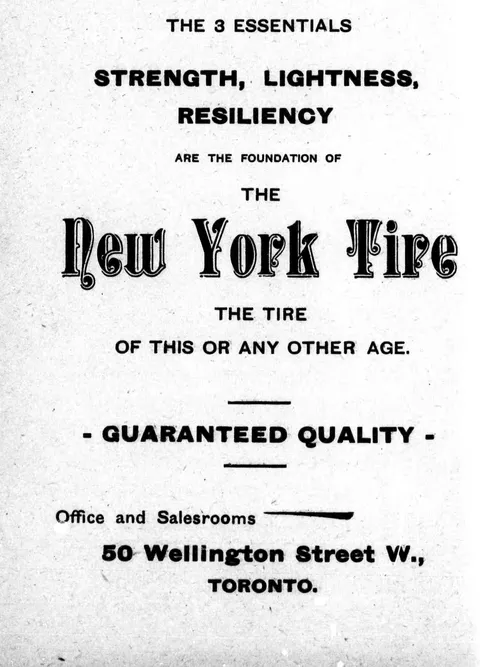 (opens in a new tab)
 New York Tire 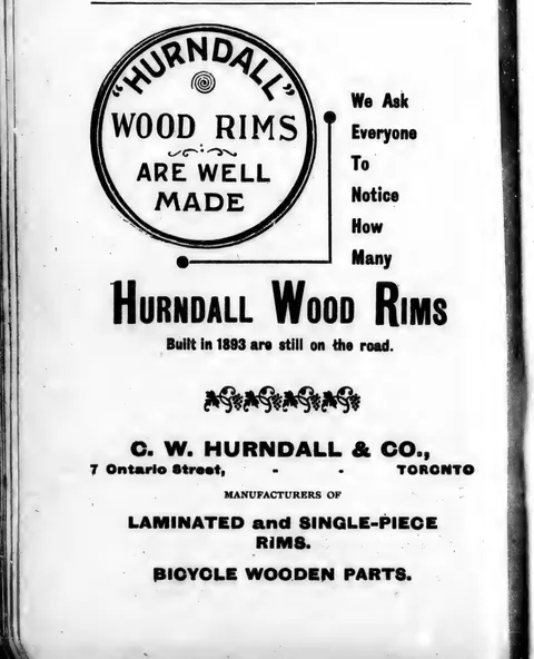 (opens in a new tab)
 Hurndall Wood Rims 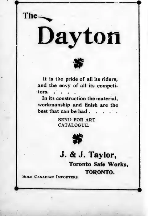 (opens in a new tab)
 The Dayton 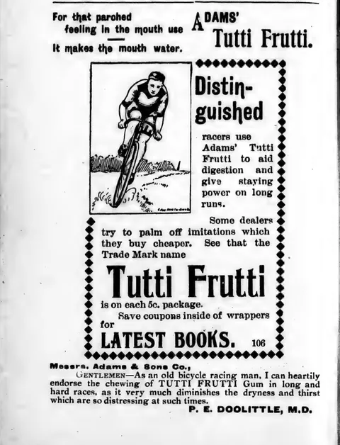 (opens in a new tab)
 Tutti Frutti 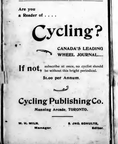 (opens in a new tab)
 Are you a Reader of Cycling?  (opens in a new tab)
 The Planet  (opens in a new tab)
 Wanderer Cycle  (opens in a new tab)
 L.B.D. Bicycle  (opens in a new tab)
 The Common Sense  (opens in a new tab)
 Massey-Harris Wheel 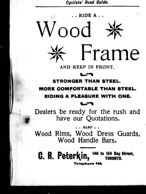 (opens in a new tab)
 Wood Frame 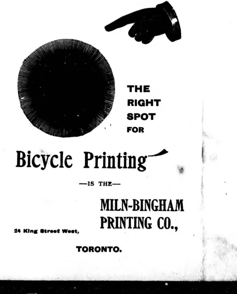 (opens in a new tab)
 Bicycle Printing 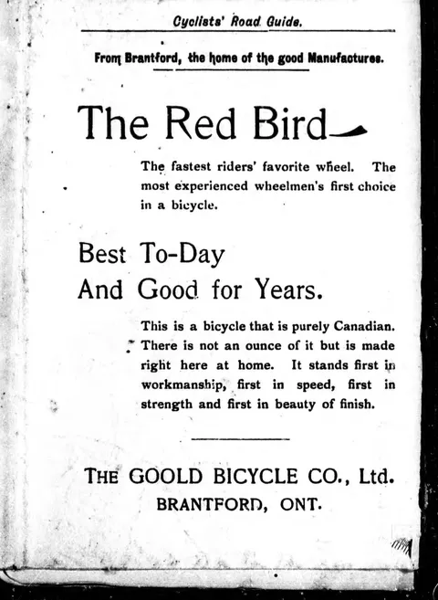 (opens in a new tab)
 The Red Bird  (opens in a new tab)
 The Planet - (opens in a new tab)
The Red Bird